
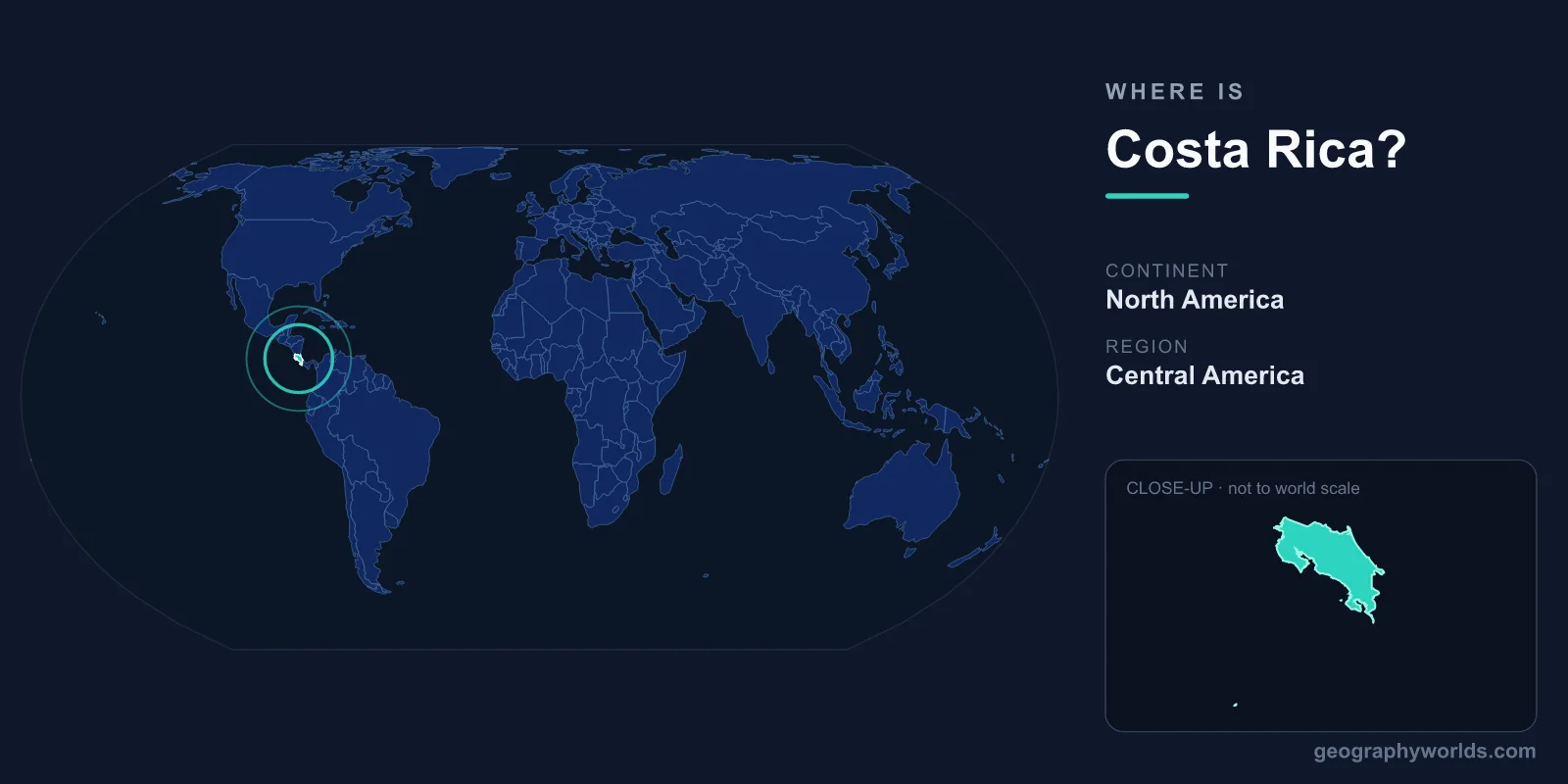
Costa Rica is located in Central America, on the narrow isthmus connecting North and South America, bordered by Nicaragua to the north and Panama to the southeast, with the Pacific Ocean to the west and the Caribbean Sea to the east. This small but ecologically rich nation covers roughly 51,100 km² and sits entirely within the tropics, in the Northern and Western Hemispheres. Its capital and largest city, San José, lies in the cool Central Valley highlands near the heart of the country.
Where Exactly Is Costa Rica on the Map?
Costa Rica occupies the southern stretch of Central America, a region that is part of the North American continent even though it bridges toward South America. The country runs roughly between 8° and 11° north of the equator and between 82° and 86° west longitude, placing it firmly in the tropical zone. Because the land narrows to a slender isthmus here, no point in Costa Rica is more than about 120 kilometers from the sea, and a traveler can drive from the Pacific surf to the Caribbean coast in a single day.
The country's compact size is often surprising to visitors. At 51,100 km², Costa Rica is comparable in area to the U.S. state of West Virginia or to the nations of Slovakia and Bosnia and Herzegovina. Despite that modest footprint, it packs in an extraordinary range of landscapes, from cloud forests and active volcanoes to mangrove swamps and palm-lined beaches.
Bordering Countries and Coastlines
Costa Rica shares land borders with just two countries, and both have shaped its history and trade:
- Nicaragua lies to the north, with the boundary running partly along the San Juan River and across the lowlands near Lake Nicaragua.
- Panama sits to the southeast, separating Costa Rica from the famous canal and the rest of the South American gateway.
What truly defines Costa Rica's geography, though, is its water. It boasts two distinct coastlines: a long, indented Pacific shore of roughly 1,000 kilometers studded with gulfs and peninsulas such as Nicoya and Osa, and a shorter, straighter Caribbean coast of about 200 kilometers. These two oceans create dramatically different climates and cultures on either side of the country.
Mountains, Volcanoes, and the Central Valley
A spine of volcanic mountain ranges runs the length of Costa Rica from northwest to southeast, dividing the Pacific and Caribbean slopes. The highest of these is Cerro Chirripó, which rises to 3,820 meters and is the tallest peak in the country. Several volcanoes remain active or recently active, including the iconic cone of Arenal Volcano, along with Poás and Irazú, both of which feature crater lakes and are accessible to visitors.
Cradled within these highlands is the Central Valley (Valle Central), a fertile plateau roughly 1,000 to 1,500 meters above sea level. This is the demographic and economic core of the nation, home to San José and the surrounding cities of Alajuela, Heredia, and Cartago. The valley's high elevation gives it a mild, spring-like climate year-round, which is why the majority of Costa Ricans live there rather than on the hotter coasts.
A Biodiversity Hotspot in a Tiny Space
Costa Rica's tropical location and varied terrain make it one of the most biologically diverse places on Earth. Although it represents only about 0.03 percent of the planet's land surface, it is estimated to hold close to 5 percent of the world's known species. Roughly a quarter of the country is protected within national parks and reserves, including renowned sites such as Tortuguero, Corcovado, and Monteverde Cloud Forest.
This natural wealth stems directly from geography. Sitting between two oceans and two continents, with elevations from sea level to nearly 4,000 meters, Costa Rica contains a dozen distinct life zones. Warm Caribbean rainforests, dry Pacific tropical forests, misty highland cloud forests, and coastal wetlands all exist within a few hours' travel of one another.
People, Language, and Government
Costa Rica is home to roughly 5 million people, most of whom speak Spanish, the official language. The dominant religion is Christianity, with a strong Roman Catholic heritage that shapes festivals and family life. The country is a stable presidential republic and is notable for having abolished its standing army in 1948, redirecting those resources toward education and health. The national currency is the Costa Rican colón (CRC). For a deeper look at the nation's history and travel highlights, see our costa-rica country guide.
Frequently Asked Questions
What continent is Costa Rica in?
Costa Rica is part of North America, within the Central America region. Although it lies on the isthmus leading toward South America, it is geographically classified as a North American country.
What are the two oceans bordering Costa Rica?
Costa Rica has coastlines on the Pacific Ocean to the west and the Caribbean Sea (part of the Atlantic Ocean) to the east, making it one of the few countries with shores on two seas in such a small area.
What is the capital of Costa Rica?
The capital is San José, located in the high-altitude Central Valley near the middle of the country. It is the largest city and the political, cultural, and economic center of the nation.
Is Costa Rica a big country?
No, Costa Rica is relatively small, covering about 51,100 km². That is roughly the size of West Virginia or Slovakia, yet it ranks among the world's most biodiverse nations.