
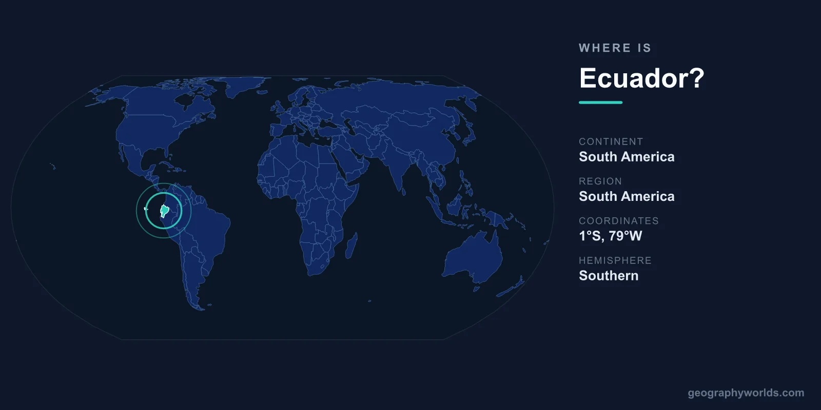
Ecuador is located in northwestern South America, straddling the equator on the continent's Pacific coast between Colombia to the north and Peru to the south and east. The country also includes the Galápagos Islands, a volcanic archipelago lying roughly 1,000 km out in the Pacific Ocean. Its capital, Quito, sits high in the Andes, and the nation covers about 256,369 km² — close to the size of the United Kingdom.
Where Exactly Is Ecuador on the Map?
Ecuador occupies the northwestern shoulder of South America, facing the Pacific Ocean to the west. Its name comes directly from its defining feature: the equator, the 0° line of latitude that runs right through the country just north of Quito. This places Ecuador in both the Northern and Southern Hemispheres at once, and firmly within the Western Hemisphere.
In terms of coordinates, mainland Ecuador stretches roughly between 1°N and 5°S latitude, and between about 75°W and 81°W longitude. The Galápagos Islands lie far to the west, near 90°W. Because the country sits on the equator, daylight stays remarkably constant year-round — roughly twelve hours of sun and twelve of darkness in every season.
Which Countries Border Ecuador?
Ecuador shares land borders with just two neighbours, both of them much larger nations:
- Colombia — to the north, along a border running through Andean highlands and dense rainforest.
- Peru — to the south and east, marking Ecuador's longest land boundary. A long-running border dispute between the two countries was finally settled by treaty in 1998.
To the west, Ecuador's coastline meets the Pacific Ocean for around 2,200 km, giving the country important access to fishing grounds, ports, and maritime trade. This compact positioning — squeezed between two giants and the sea — has long shaped Ecuador's trade routes and its role in regional politics.
The Three Mainland Regions and the Galápagos
Despite its modest size, Ecuador is one of the most geographically varied countries on Earth, divided into four distinct natural zones:
- La Costa (the Coast): the low-lying Pacific lowlands in the west, home to Guayaquil — the country's largest city and main port — plus banana plantations and shrimp farms.
- La Sierra (the Highlands): the central spine of the Andes, where two parallel mountain ranges cradle Quito and a string of snow-capped volcanoes, including Cotopaxi and Chimborazo.
- El Oriente (the Amazon): the eastern rainforest, part of the vast Amazon Basin, rich in biodiversity and oil reserves.
- La Región Insular (the Galápagos): the volcanic islands far offshore, made famous by Charles Darwin and his work on evolution.
A remarkable geographic curiosity is that the summit of Mount Chimborazo, because of the equatorial bulge of the Earth, is the point on the planet's surface farthest from the Earth's centre — even though Everest is taller above sea level.
Quito: A Capital in the Clouds
Ecuador's capital, Quito, sits at an elevation of about 2,850 metres in a long Andean valley, making it the second-highest official capital city in the world after La Paz, Bolivia. Founded on the ruins of an Inca city, its well-preserved colonial centre was among the first sites named a UNESCO World Heritage Site in 1978.
Just north of the city lies the Mitad del Mundo ("Middle of the World") monument, marking the equatorial line where visitors famously stand with one foot in each hemisphere. The economic heart of the country, however, beats on the coast in Guayaquil, the busy port that handles much of Ecuador's exports.
People, Language, and Currency
Ecuador is home to roughly 18 million people. Spanish is the official and most widely spoken language, though Indigenous languages such as Kichwa (Quechua) are also recognised and spoken in highland communities. The dominant religion is Roman Catholic Christianity, which shapes many of the country's festivals and traditions.
Unusually, Ecuador does not print its own everyday banknotes: it adopted the United States Dollar (USD) as its official currency in 2000, after an economic crisis, replacing the former sucre. The country is governed as a presidential republic. To explore more about its landscapes, cities, and culture, see our ecuador country guide.
Frequently Asked Questions
What continent is Ecuador in?
Ecuador is in South America, occupying the northwestern part of the continent along the Pacific coast, between Colombia and Peru.
Is Ecuador actually on the equator?
Yes. The equator passes through northern Ecuador just outside Quito, which is exactly how the country got its name — Ecuador is Spanish for "equator."
Are the Galápagos Islands part of Ecuador?
Yes. The Galápagos Islands are an Ecuadorian province located about 1,000 km off the mainland in the Pacific Ocean, despite their great distance from the coast.
What is the capital of Ecuador?
The capital is Quito, a high-altitude Andean city at about 2,850 metres. The largest city, however, is the coastal port of Guayaquil.