
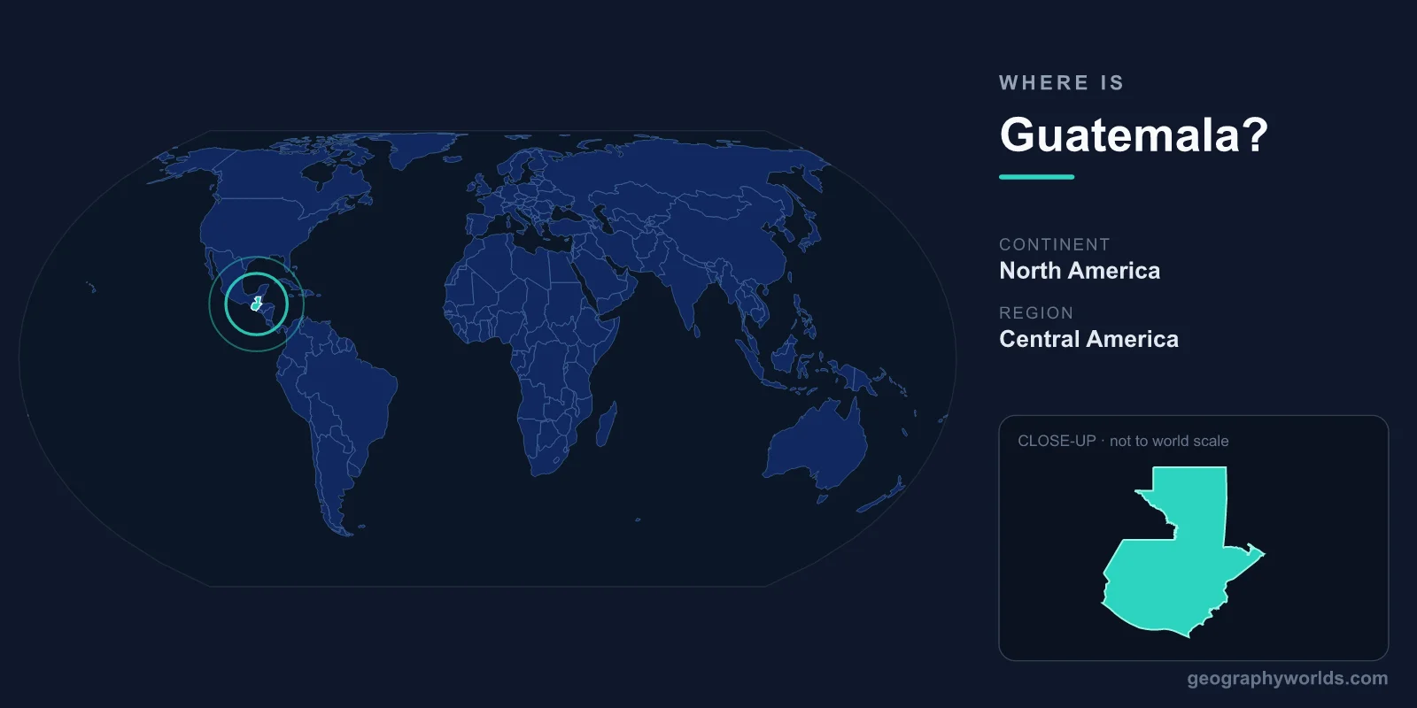
Guatemala is located in Central America, the northernmost country of the Central American isthmus, bordered by Mexico to the north and west, Belize to the northeast, and Honduras and El Salvador to the southeast. It has coastlines on both the Pacific Ocean to the south and the Caribbean Sea to the east, and sits on the continent of North America. The capital, Guatemala City, is the largest urban center in Central America, and the country covers an area of about 108,889 km².
Where Exactly Is Guatemala on the Map?
Guatemala lies between roughly 13.7° and 17.8° north latitude and 88.2° and 92.2° west longitude, placing it firmly in the Northern and Western Hemispheres and entirely within the tropics. Because it sits just north of the equator, the country has no true winter and summer in the temperate sense; instead, it experiences a dry season and a rainy season, locally called verano and invierno.
On a world map, you will find Guatemala at the point where the wide landmass of Mexico narrows into the slender bridge of land connecting North and South America. It is the third-largest country in Central America by area, after Nicaragua and Honduras, yet it has the largest population in the region, with roughly 18 million people. This combination of modest size and dense population makes it one of the most concentrated and culturally vibrant corners of the Americas.
Countries That Border Guatemala
Guatemala shares land borders with four neighboring countries, each shaping its trade, migration, and history:
- Mexico — the longest border, stretching along the north and west, linking Guatemala to the Mexican states of Chiapas, Tabasco, Campeche, and Quintana Roo.
- Belize — to the northeast; the boundary has been the subject of a long-standing territorial dispute now before the International Court of Justice.
- Honduras — to the east and southeast, sharing the Caribbean lowlands.
- El Salvador — to the southeast, Guatemala's smallest neighbor by border length.
In addition to its land neighbors, Guatemala's two coastlines give it maritime access in two different ocean basins, a strategic advantage for shipping that few countries its size enjoy. The short but busy Caribbean coast around Puerto Barrios handles much of the country's export traffic.
Two Oceans and a Volcanic Spine
Few countries pack as much geographic drama into their borders as Guatemala. A chain of volcanoes runs across the southern highlands, part of the Pacific Ring of Fire, and includes some of Central America's most active peaks such as Fuego, Pacaya, and Santa María. The country's highest point, Volcán Tajumulco, rises to about 4,220 meters, making it the tallest peak in all of Central America.
Between the volcanic highlands and the coasts, the terrain shifts dramatically. To the north lies the Petén, a vast, low, forested limestone plain that is home to ancient Maya cities. To the south, a narrow Pacific coastal plain supports plantations of sugar, coffee, and bananas. Lakes such as Atitlán, ringed by volcanoes, and Izabal, the country's largest, add to the varied landscape. This range of elevations creates many distinct microclimates within short distances.
Climate, Land, and Natural Setting
Guatemala's tropical location is moderated almost entirely by altitude. The coastal lowlands are hot and humid year-round, while the central highlands, where Guatemala City and Antigua sit at over 1,500 meters, enjoy a mild, spring-like climate that earned the region its nickname as a "land of eternal spring." Temperatures in the highlands rarely swing far from comfortable, which is one reason most of the population has historically settled there rather than on the hotter coasts.
The rainy season generally runs from May to October, feeding the rivers, cloud forests, and dense jungle that make the country exceptionally biodiverse. Guatemala lies within a recognized biodiversity hotspot, hosting tropical rainforest, cloud forest, mangrove, and dry forest ecosystems. Its position at the meeting point of North and Central American flora and fauna gives it an unusually rich variety of birds, including the resplendent quetzal, the national bird that also lends its name to the currency, the Guatemalan quetzal (GTQ).
A Crossroads of Maya and Colonial History
Guatemala's location made it a heartland of Maya civilization for over two thousand years. The ruins of Tikal, deep in the Petén jungle, were once one of the most powerful city-states of the Classic Maya period and remain the country's most famous landmark. Spanish is the official language today, a legacy of colonial rule, but more than twenty Maya languages are still spoken, reflecting a living indigenous heritage found nowhere else in such concentration. To learn more, see our guatemala country guide.
Frequently Asked Questions
What continent is Guatemala on?
Guatemala is part of the continent of North America. More specifically, it lies in the Central American region, the isthmus that connects North America to South America.
Is Guatemala in North or South America?
Guatemala is in North America. Although it is often grouped culturally with Latin America, geographically it sits on the North American continent, north of the South American landmass.
What countries border Guatemala?
Guatemala borders four countries: Mexico to the north and west, Belize to the northeast, and Honduras and El Salvador to the southeast. It also has Pacific and Caribbean coastlines.
What is the capital of Guatemala?
The capital is Guatemala City, located in the central highlands. It is the largest city in Central America and the political, cultural, and economic center of the country.