
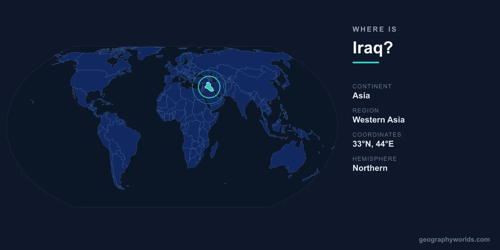
Iraq is located in Western Asia, in the heart of the Middle East, occupying the historic land of Mesopotamia between the Tigris and Euphrates rivers. Its capital, Baghdad, lies near the center of the country, and Iraq covers roughly 438,317 square kilometres. Bordered by six nations and with a narrow outlet to the Persian Gulf, Iraq sits at one of the most strategically and historically significant crossroads on Earth.
Where Iraq Sits on the Map
Iraq lies entirely within the Northern and Eastern Hemispheres, between roughly 29 and 37 degrees north latitude and 38 to 49 degrees east longitude. It belongs to the continent of Asia and, more specifically, to the region commonly called the Middle East or Western Asia. The country is largely landlocked, with only a short stretch of coastline — about 58 kilometres — touching the Persian Gulf in the far southeast near the port city of Basra.
Geographers describe Iraq as occupying the eastern end of the Arab world and the western edge of the broader region that links the Mediterranean to the Iranian Plateau. To get a sense of its scale, Iraq is comparable in area to Germany or Japan, or roughly the size of the U.S. state of California. Despite this moderate footprint, it is home to around 43 million people.
Mesopotamia and the Two Rivers
Iraq's identity is inseparable from the two great rivers that define it. The Tigris and the Euphrates both rise in the highlands of Turkey, cut diagonally across the country from northwest to southeast, and eventually join near the town of Al-Qurnah to form the Shatt al-Arab waterway before emptying into the Persian Gulf. The land between and around these rivers is the ancient region of Mesopotamia — Greek for "between the rivers" — often called the cradle of civilization.
It was here, more than five thousand years ago, that the Sumerians built the world's first cities, developed cuneiform writing, and constructed monumental temples such as the Ziggurat of Ur. Later empires, including Babylon and Assyria, rose on these same fertile plains, and centuries afterward the Abbasid Caliphate made Baghdad one of the largest cities on Earth. This riverine geography still shapes modern Iraq, concentrating agriculture, population, and major cities along the water.
Bordering Countries and Neighbours
Iraq shares land borders with six countries, a fact that underlines its position as a regional hub for trade, migration, and cultural exchange. Its neighbours are:
- Turkey to the north, source of both the Tigris and Euphrates.
- Iran to the east, sharing Iraq's longest border along the Zagros Mountains.
- Kuwait to the southeast, near the Persian Gulf coast.
- Saudi Arabia to the south, across desert terrain.
- Jordan to the west, linking Iraq toward the Levant.
- Syria to the northwest, along the upper Euphrates valley.
This central placement has made Iraq a meeting point of peoples and trade routes for millennia, from the caravan roads of antiquity to modern overland connections between the Gulf, Anatolia, and the Mediterranean.
Landscapes and Terrain
Iraq's geography is more varied than its desert reputation suggests. Broadly, the country divides into four zones. The fertile alluvial plain of central and southern Iraq, watered by the Tigris and Euphrates, supports most of the population and farmland. In the far south lie extensive marshlands, the historic home of the Marsh Arabs and a UNESCO-recognised wetland ecosystem.
To the west and southwest stretch arid deserts that merge with the Arabian and Syrian plateaus. In the north and northeast, the land rises into the rugged mountains of Iraqi Kurdistan, part of the Zagros range, where peaks exceed 3,000 metres and winters bring snow. This northern highland region enjoys a cooler, wetter climate, in sharp contrast to the scorching summers of the southern plains, where temperatures can climb well above 45 degrees Celsius.
People, Capital, and Culture
Baghdad, sitting on the Tigris near the country's center, is Iraq's capital and largest city, long a center of learning and commerce in the Islamic world. The two official languages are Arabic and Kurdish, reflecting the country's main ethnic communities, and Islam — practiced by both Shia and Sunni Muslims — is the dominant religion. Iraq is governed as a federal parliamentary republic, and its currency is the Iraqi Dinar (IQD). For a deeper look at the country's history, regions, and travel highlights, see our iraq country guide.
Frequently Asked Questions
What continent is Iraq on?
Iraq is located on the continent of Asia, in the region known as Western Asia or the Middle East. It sits in both the Northern and Eastern Hemispheres.
Is Iraq in the Middle East?
Yes. Iraq is a core Middle Eastern country, often considered to mark the eastern boundary of the Arab world and the western edge of the lands bordering the Iranian Plateau.
Does Iraq have a coastline?
Iraq is almost entirely landlocked but has a short coastline of about 58 kilometres on the Persian Gulf in the far southeast, near the city of Basra and the Shatt al-Arab waterway.
What is the capital of Iraq and where is it located?
The capital is Baghdad, located near the center of the country on the banks of the Tigris River. It serves as Iraq's political, administrative, and cultural heart.