
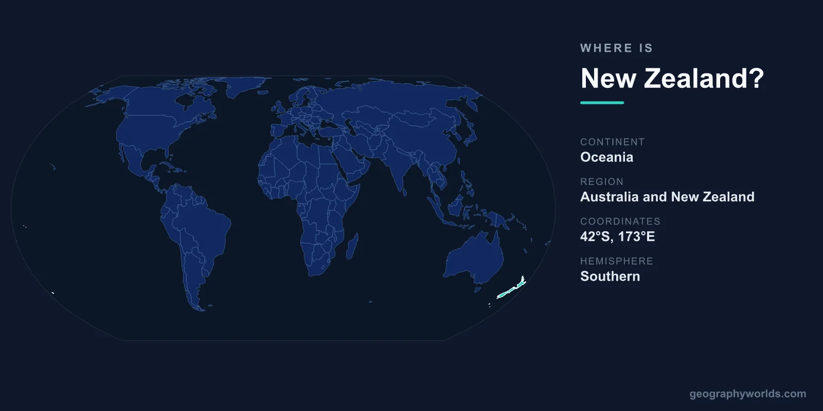
New Zealand is an island country in the southwestern Pacific Ocean, lying roughly 2,000 km southeast of Australia across the Tasman Sea, in the Oceania region of the world. It consists of two large landmasses, the North Island and the South Island, plus hundreds of smaller islands, and sits deep in the Southern Hemisphere between about 34 and 47 degrees south latitude. Its capital is Wellington, and the country spans a total area of 268,021 km².
Where Exactly Is New Zealand on the Map?
New Zealand occupies a remote corner of the South Pacific, far from any continental landmass. The nearest sizeable neighbour is Australia, separated by the Tasman Sea, a crossing of around 2,000 km at its narrowest. To the north lie the Pacific island nations of New Caledonia, Fiji, and Tonga, while to the south there is nothing but open ocean stretching toward Antarctica.
Geographers place New Zealand in the sub-region of Polynesia within Oceania, and the country lies in both the Southern and Eastern Hemispheres, close to the 180-degree meridian. That position near the International Date Line makes it one of the first inhabited places on Earth to greet each new day. Lying so far south also gives it a temperate maritime climate, with the South Island reaching latitudes comparable to southern Europe, so that summer falls in December and January and winter in June and July.
The Two Main Islands
New Zealand's territory is dominated by two long, narrow islands separated by the Cook Strait, which is only about 22 km wide at its closest point.
- North Island: Home to most of the population and to the capital, Wellington, as well as the largest city, Auckland. It features volcanic plateaus, the geothermal fields around Rotorua, and the country's largest lake, Lake Taupo, which fills an ancient volcanic caldera.
- South Island: Larger in area but less populous, dominated by the Southern Alps, a mountain range running almost its entire length and crowned by Aoraki / Mount Cook, the highest peak at roughly 3,724 metres.
Beyond these, New Zealand administers numerous outlying islands, including Stewart Island to the south and the Chatham Islands far to the east. Christchurch is the largest city on the South Island, while Queenstown draws visitors as an adventure-tourism hub.
An Isolated Island Nation
Because New Zealand is surrounded entirely by ocean, it shares no land borders with any other country. This isolation, the result of breaking away from the ancient supercontinent Gondwana around 80 million years ago, shaped one of the most distinctive natural worlds on Earth. With no native land mammals apart from bats, birds such as the flightless kiwi and the now-extinct moa evolved to fill ecological roles taken elsewhere by mammals.
Its location also sits squarely on the Pacific Ring of Fire, where the Pacific and Australian tectonic plates collide. This produces frequent earthquakes, active volcanoes, geysers, and hot springs, and continues to push the Southern Alps higher even as erosion wears them down.
Geography and Landscapes
For a country roughly the size of the United Kingdom or Japan, New Zealand packs in an extraordinary range of scenery. Its coastline stretches some 15,000 km, indented by deep fjords in the southwest, most famously Milford Sound and the wider Fiordland region. Glaciers such as Fox and Franz Josef descend close to sea level, an unusual feature for temperate latitudes.
The interior ranges from the rolling pasture of the Canterbury Plains to dense temperate rainforest, volcanic cones, and alpine peaks. Roughly 5 million people live here, most of them concentrated in the North Island's cities, leaving large stretches of the South Island sparsely populated. You can learn far more about its regions, history, and culture in the new zealand country guide.
How to Find New Zealand on a Globe
To locate New Zealand quickly, find Australia in the southern Pacific, then move your eye southeast across the Tasman Sea. The two slender islands angled from northeast to southwest are New Zealand. On a standard world map it appears at the far lower-right edge, often cropped or split by the map's border because it lies so close to the 180-degree meridian.
Frequently Asked Questions
What continent is New Zealand part of?
New Zealand is part of Oceania, in the Polynesian sub-region. Some geologists also describe it as the highest emergent part of Zealandia, a largely submerged continental landmass beneath the South Pacific.
How far is New Zealand from Australia?
The Tasman Sea between the two countries is about 2,000 km wide at its narrowest, roughly a three-hour flight from eastern Australian cities such as Sydney to Auckland.
Is New Zealand near any other countries?
Its closest neighbours after Australia are the Pacific island nations to the north, including New Caledonia, Fiji, Tonga, and Vanuatu, though all lie hundreds of kilometres away across open ocean.
What hemisphere is New Zealand in?
New Zealand lies in the Southern and Eastern Hemispheres, which means its seasons are reversed compared with Europe and North America, with summer in December and winter in July.