
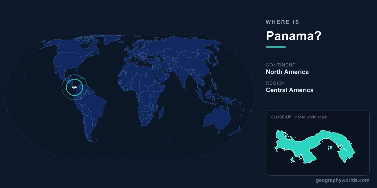
Panama is located in Central America, the southernmost country on the isthmus that links North and South America, bordered by Costa Rica to the west and Colombia to the east. It lies between roughly 7° and 10° North latitude and 77° to 83° West longitude, placing it firmly in the Northern and Western Hemispheres. The capital, Panama City, sits on the Pacific coast near the famous canal that bisects the country.
Where Exactly Is Panama on the Map?
Panama forms the slender land bridge between the two American continents, and geographers classify it as part of the North American landmass within the Central America region. Despite this classification, Panama is the gateway to South America, with Colombia lying directly to its southeast. The country stretches roughly 650 kilometres from west to east in a curving S-shape, yet at its narrowest the isthmus is only about 50 kilometres wide.
One of Panama's most surprising geographic quirks comes from this orientation: because the isthmus bends, the Pacific Ocean actually lies to the south and east while the Caribbean Sea lies to the north and west. A ship transiting the Panama Canal from the Atlantic to the Pacific travels in a generally southeastward direction, which routinely confuses first-time visitors.
Land Area and Neighbouring Countries
Panama covers a total area of about 75,417 km², making it comparable in size to the Republic of Ireland or the U.S. state of South Carolina. It shares land borders with just two nations:
- Costa Rica to the west, along a border running through highland forests and the Talamanca mountain range.
- Colombia to the southeast, separated by the dense, roadless rainforest and swamp of the Darién Gap.
The Darién Gap is one of the most significant features of Panama's location. It is the only break in the entire 30,000-kilometre Pan-American Highway, an impenetrable stretch of jungle that has never been bridged by road, leaving Central and South America physically disconnected by land for vehicles.
Coastlines and the Two Oceans
Panama is one of relatively few countries with coastlines on two separate oceans. To the north it faces the Caribbean Sea, an arm of the Atlantic Ocean, and to the south it borders the Pacific Ocean. Together these give Panama roughly 2,500 kilometres of coastline studded with islands, including the San Blas archipelago in the Caribbean and the Pearl Islands and Coiba in the Pacific.
This dual-ocean position is precisely what made Panama strategically priceless. The Panama Canal, opened in 1914 and expanded in 2016, slices through the country to connect the two oceans, sparing ships the long and dangerous voyage around South America's Cape Horn. Around 14,000 vessels pass through the canal each year, and it remains one of the most important shipping lanes on Earth.
Terrain, Climate and Time Zone
Panama's interior is dominated by a mountainous spine running roughly parallel to its coasts. The highest point is Volcán Barú, an inactive volcano in the west rising to about 3,475 metres, from whose summit it is occasionally possible to see both oceans on a clear day. Between the mountains and the sea lie tropical lowlands, mangrove coasts, and the deep rainforests that cover much of the country.
Sitting just a few degrees north of the Equator, Panama has a tropical climate with consistently warm temperatures year-round, divided into a dry season (roughly December to April) and a wet season (May to November). The country observes Eastern Standard Time (UTC−5) and does not use daylight saving time, so it aligns with the U.S. East Coast for part of the year.
People, Language and Currency
Panama is home to approximately four million people, the majority of whom live in or around Panama City. Spanish is the official language, and Roman Catholicism is the predominant faith, though the country is notably diverse, with Afro-Caribbean, Indigenous, mestizo, and immigrant communities all shaping its culture. Panama operates as a presidential republic. Uniquely, it uses two currencies side by side: the Panamanian balboa and the U.S. dollar, which circulate at a one-to-one fixed rate. For a deeper look at the nation's regions, history, and travel highlights, see our panama country guide.
Frequently Asked Questions
Is Panama in North or South America?
Panama is part of Central America, which is geographically considered a region of the North American continent. However, it directly borders Colombia in South America, making it the literal connecting point between the two continents.
What countries border Panama?
Panama shares land borders with two countries: Costa Rica to the west and Colombia to the southeast. Its only oceanic neighbours are reached across the Caribbean Sea and the Pacific Ocean.
What is the capital of Panama?
The capital is Panama City, located on the Pacific coast at the southern entrance to the Panama Canal. It is the country's largest city and its political, financial, and cultural centre.
Why is the Panama Canal so important?
Because Panama is a narrow isthmus between the Atlantic and Pacific oceans, the canal allows ships to cross between the two without sailing around South America. This shortcut saves thousands of kilometres and makes Panama one of the world's most critical maritime crossroads.