
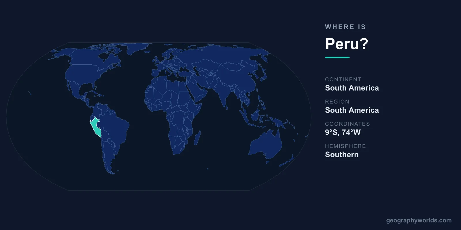
Peru is located on the western coast of South America, bordering the Pacific Ocean, with the Andes Mountains running down its spine and the Amazon rainforest spreading across its eastern interior. Its capital, Lima, sits on the central coast, and the country lies entirely within the Southern and Western Hemispheres, just below the equator. Covering about 1,285,216 km², Peru is the third-largest country in South America after Brazil and Argentina.
Where Exactly Is Peru on the Map?
Peru occupies the west-central part of South America, stretching roughly between 0° and 18° south latitude and 68° to 81° west longitude. To find it on a globe, locate the Pacific coast of the continent and look just south of the equator: Ecuador and Colombia sit to the north, Brazil and Bolivia to the east, and Chile to the south. The Pacific Ocean forms its entire western boundary, giving Peru a coastline of more than 2,400 kilometers.
The country is large by any measure. At roughly 1,285,216 km², Peru is about twice the size of France, or comparable to the U.S. states of Texas and California combined. Despite sitting in the tropics, it spans time zone UTC−5, the same as the eastern United States. For a fuller picture of the country's regions, history, and travel highlights, see our peru country guide.
Peru's Three Distinct Regions
Few countries pack as much geographic variety into their borders. Peru is traditionally divided into three parallel north-to-south zones:
- The Costa (coast) – a narrow, mostly desert strip along the Pacific where Lima and most major cities sit. Despite the dryness, this is the country's economic heartland and home to its busiest ports and fishing fleets.
- The Sierra (highlands) – the towering Andes, home to peaks above 6,000 meters, including Huascarán at 6,768 meters, the highest point in Peru. This region holds historic cities such as Cusco and the famed Inca citadel of Machu Picchu.
- The Selva (jungle) – the vast Amazon basin in the east, which makes up well over half of Peru's total land area and feeds the headwaters of the Amazon River, yet holds only a small share of the population.
This layered terrain means a traveler can move from sea-level desert to glaciated mountain passes to humid rainforest within a single day's journey, crossing some of the most dramatic elevation changes on Earth.
Countries That Border Peru
Peru shares land borders with five nations, placing it at a natural crossroads of the continent:
- Ecuador – to the northwest
- Colombia – to the northeast
- Brazil – to the east, across the Amazon
- Bolivia – to the southeast, sharing Lake Titicaca
- Chile – to the south, along the edge of the Atacama Desert
Lake Titicaca, straddling the Peru–Bolivia border high in the Andes, is the largest lake in South America by volume and one of the highest navigable lakes in the world at about 3,810 meters above sea level. To the west, Peru has no land neighbor at all, only the open Pacific and the cold Humboldt Current that defines its coastal climate.
Climate and Position Near the Equator
Although Peru lies in the tropics, its climate is anything but uniformly hot. The cold Humboldt Current sweeping up the Pacific coast keeps Lima cool and famously cloudy for much of the year, while the high Andes can be freezing year-round and the Amazon stays warm and humid. Because Peru is south of the equator, its seasons are reversed compared with the Northern Hemisphere: the warmest, driest highland weather, ideal for visiting Machu Picchu, generally falls between May and September.
This combination of equatorial latitude, extreme altitude, and the chilly offshore current packs an extraordinary range of ecosystems into one nation, supporting everything from penguins along the coast to jaguars in the rainforest.
People, Capital, and Currency
Peru is home to roughly 34 million people, most of whom live along the coast and in the capital, Lima, a metropolitan area of more than 10 million. Spanish is the most widely spoken language, but Peru also recognizes the Indigenous Andean languages Quechua and Aymara as official. Roman Catholic Christianity is the dominant religion and shapes many national festivals. The country is a presidential republic, and its currency is the Peruvian sol (PEN).
Key Facts at a Glance
- Continent: South America (western coast)
- Capital: Lima
- Area: approximately 1,285,216 km²
- Population: around 34 million
- Bordering countries: Ecuador, Colombia, Brazil, Bolivia, Chile
- Official languages: Spanish, Quechua, Aymara
- Currency: Peruvian sol (PEN)
Frequently Asked Questions
What continent is Peru in?
Peru is in South America, on the continent's western, Pacific-facing coast, just south of the equator.
Is Peru in North or South America?
Peru is in South America. It lies in the western part of the continent and shares borders with Ecuador, Colombia, Brazil, Bolivia, and Chile.
What is the capital of Peru and where is it located?
The capital is Lima, located on Peru's central Pacific coast. It is one of the largest cities in South America and serves as the country's political and economic center.
Is Peru in the Andes or the Amazon?
Both. The Andes Mountains run down the center of Peru, while the Amazon rainforest covers more than half of its territory in the east, with a coastal desert lying to the west.