
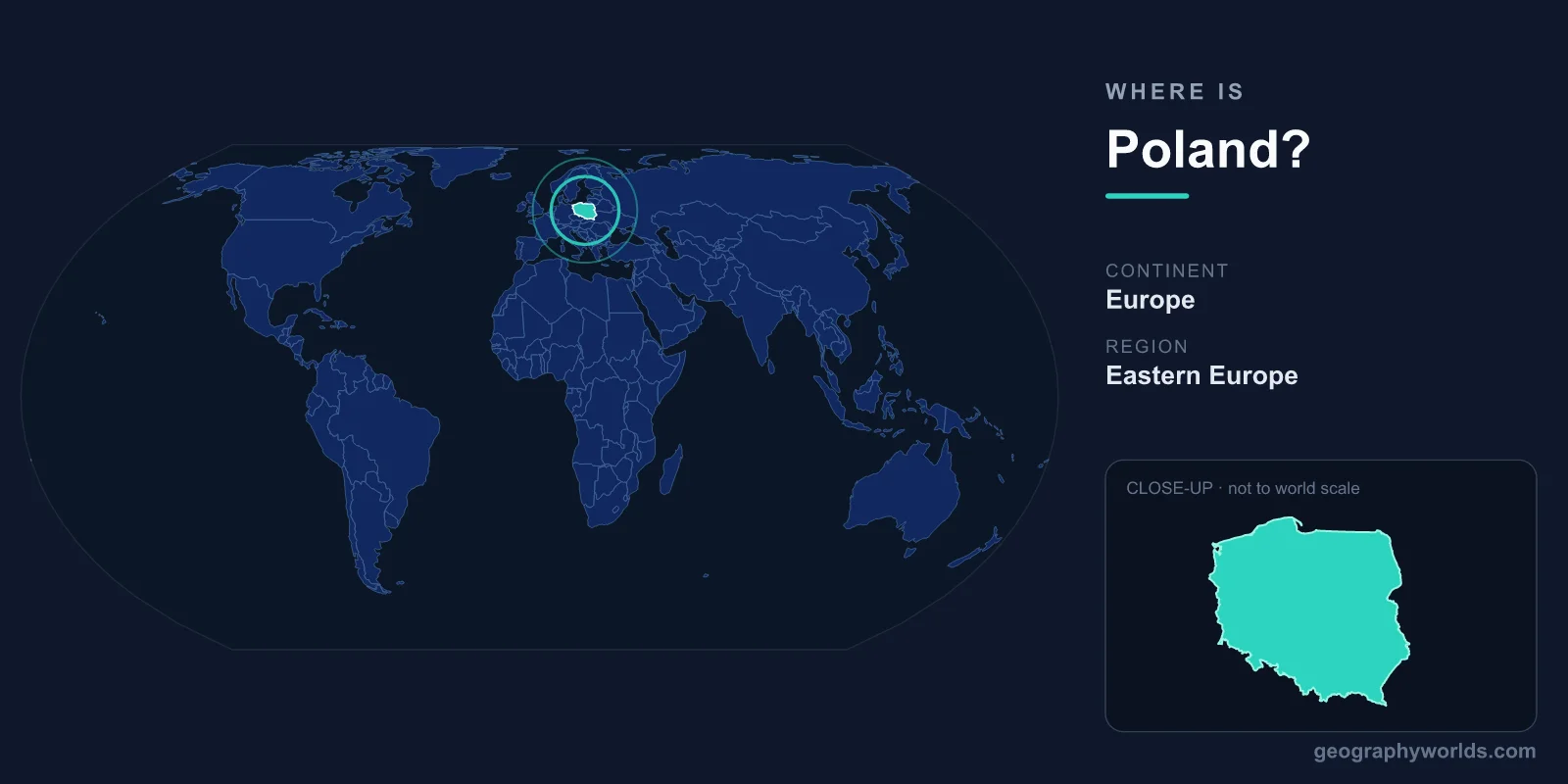
Poland is located in Central Europe, lying along the southern coast of the Baltic Sea and stretching across the North European Plain. Its capital is Warsaw, and it covers about 312,696 km², bordered by seven neighbouring countries. Positioned in the Northern and Eastern Hemispheres, Poland sits roughly between latitudes 49°N and 55°N, making it a natural bridge between Western and Eastern Europe.
Where Poland Sits on the Map
Poland occupies a central swathe of the European continent, with the Baltic Sea forming its northern edge and a long, mostly flat interior sweeping inland. The country is part of the Central European region and is widely regarded as the gateway between the established economies of the west and the emerging markets to the east. Warsaw, the capital, lies near the centre of the country on the Vistula River, while other major cities such as Kraków, Łódź, Wrocław, Poznań, and the Baltic port of Gdańsk are spread across its regions.
At roughly 312,696 km², Poland is comparable in size to Germany or to the US state of New Mexico, and it ranks as the ninth-largest country in Europe. Its compact, fairly square shape means travel between major cities is straightforward, and no point in the country is extremely far from a border.
Which Countries Border Poland?
Poland shares land borders with seven countries, a fact that has shaped its history as a crossroads of trade, culture, and conflict for centuries:
- Germany — to the west, along the Oder and Lusatian Neisse rivers
- Czech Republic — to the south-west, across the Sudetes mountains
- Slovakia — to the south, along the Tatra and Carpathian ranges
- Ukraine — to the south-east
- Belarus — to the east
- Lithuania — to the north-east
- Russia — to the north, via the Kaliningrad exclave on the Baltic coast
To the north, beyond the land borders, the Baltic Sea connects Poland by water to Scandinavia, the Baltic states, and the wider North Atlantic shipping routes.
Landscapes Across the Country
Most of Poland lies on the broad North European Plain, giving the country its characteristic low-lying, gently rolling terrain that is ideal for farming. This flatness is broken in the south, where the land rises into the Sudetes and the Carpathian Mountains. The highest point, Rysy in the Tatra range, reaches 2,499 metres along the Slovak frontier.
The north features a 770-kilometre Baltic coastline of sandy beaches, dunes, and lagoons, while the Masurian Lake District in the north-east is dotted with thousands of glacial lakes. Two major rivers, the Vistula and the Oder, drain the country northward into the Baltic. Poland also protects fragments of the ancient Białowieża Forest, home to Europe's largest population of wild European bison.
Warsaw and the Major Cities
Warsaw is Poland's capital and largest city, located on the Vistula River in the east-central part of the country, with a population of around 1.8 million. It is the political, financial, and cultural heart of the nation, and its Old Town, painstakingly rebuilt after the destruction of World War II, is a UNESCO World Heritage Site. The other major cities reflect how the population is spread across the country's regions.
Kraków, the historic royal capital in the south, sits beneath Wawel Castle on the upper Vistula and remains a centre of culture and tourism. Łódź lies just south-west of Warsaw, while Wrocław anchors the south-west near the Czech border and Poznań stands along the historic route linking Berlin and Warsaw. On the coast, the Tri-City of Gdańsk, Gdynia, and Sopot forms the country's main maritime gateway. This even distribution of large cities underlines Poland's role as one of the most populous nations in Central Europe.
People, Climate, and Time Zone
Poland is home to roughly 38 million people, with Polish as the official language and Roman Catholicism the predominant religion. The country uses the Polish złoty (PLN) rather than the euro, and operates as a parliamentary republic. It follows Central European Time (CET, UTC+1), shifting to CEST in summer, the same zone as Berlin, Paris, and Rome.
Poland's central location gives it a transitional climate, blending milder maritime weather from the west with colder continental conditions from the east. This produces warm summers and cold, often snowy winters, particularly in the mountainous south. To learn more about its regions and history, see our poland country guide.
Frequently Asked Questions
What continent is Poland on?
Poland is on the continent of Europe, specifically in the Central European region, sitting in the Northern and Eastern Hemispheres.
Is Poland in Eastern or Western Europe?
Geographically, Poland lies in Central Europe. It is often grouped with Eastern Europe for historical and political reasons, but on the map it occupies the heart of the continent, acting as a bridge between west and east.
Does Poland border the sea?
Yes. Poland's entire northern edge faces the Baltic Sea, giving it a coastline of around 770 kilometres and important ports such as Gdańsk, Gdynia, and Szczecin.
How many countries does Poland border?
Poland borders seven countries: Germany to the west; the Czech Republic and Slovakia to the south; Ukraine, Belarus, and Lithuania to the east and north-east; and Russia via the Kaliningrad exclave on the Baltic coast.