
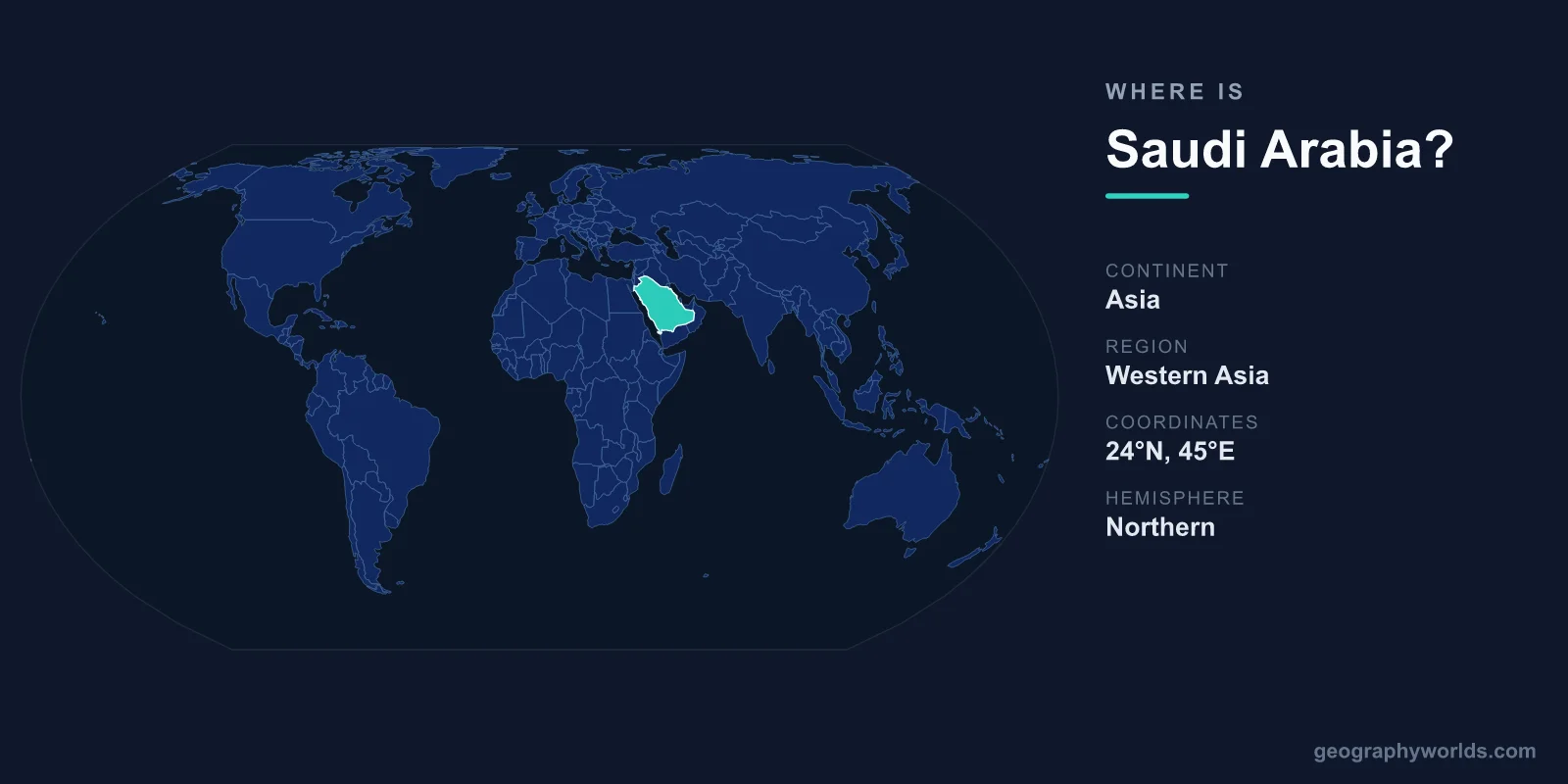
Saudi Arabia is located in the Middle East, occupying about four-fifths of the Arabian Peninsula in southwestern Asia, between the Red Sea to the west and the Persian Gulf to the east. Its capital is Riyadh, and the country spans roughly 2,149,690 km², making it the largest nation in the Middle East and the dominant landmass of the Arabian Peninsula.
Where Exactly Is Saudi Arabia on the Map?
Saudi Arabia sits firmly in the Northern and Eastern Hemispheres. Lying roughly between 16°N and 32°N latitude, much of the country falls within the arid belt that wraps around the globe near the Tropic of Cancer. If you locate the Arabian Peninsula — the large wedge of land south of Turkey and Iraq and east of Egypt — Saudi Arabia takes up nearly all of it.
The country has two long coastlines that frame it on either side. To the west, the Red Sea separates Saudi Arabia from Egypt, Sudan, and the Horn of Africa. To the east, the Persian Gulf faces Iran and links the kingdom to the wider Indian Ocean trade routes. Riyadh, the capital, lies inland on the central Najd plateau, while the holy cities of Mecca and Medina sit in the western Hejaz region near the Red Sea coast.
Which Countries Border Saudi Arabia?
Saudi Arabia shares land borders with seven countries, more than any other nation on the Arabian Peninsula. This central position has long made it a crossroads for trade, pilgrimage, and the movement of peoples across the region.
- Jordan — to the northwest
- Iraq — to the north
- Kuwait — to the northeast
- Qatar — to the east, on the Gulf coast
- United Arab Emirates — to the east and southeast
- Oman — to the southeast
- Yemen — to the south
Two of these neighbours — Qatar and the United Arab Emirates — connect via the Persian Gulf coast, while Bahrain, an island nation, is joined to the Saudi mainland by the King Fahd Causeway across the Gulf.
What Is the Landscape Like?
Despite its vast size, Saudi Arabia is overwhelmingly desert. The terrain includes some of the world's most striking arid landscapes, and the country has no permanent rivers or lakes of significance.
- Rub' al Khali (the Empty Quarter): in the south, one of the largest continuous sand deserts on Earth.
- An Nafud Desert: a smaller sand sea in the north known for its reddish dunes.
- Najd plateau: the central highlands where Riyadh is located.
- Asir Mountains: a green, comparatively cooler highland region in the southwest, rising over 3,000 metres and receiving seasonal monsoon rain.
This range of environments means that while most of the country experiences extreme heat and very little rainfall, the southwestern highlands can be surprisingly mild and fertile.
How Big Is Saudi Arabia and Where Do People Live?
At roughly 2.15 million square kilometres, Saudi Arabia is the largest country in the Middle East and one of the largest in Asia. It is bigger than all of Western Europe combined and comparable in size to the entire eastern United States. Yet because so much of its interior is uninhabitable desert, the population of around 36 million is concentrated in a relatively small number of cities.
The largest population centres include Riyadh in the central plateau, the Red Sea port city of Jeddah, the holy cities of Mecca and Medina in the west, and the oil-rich Eastern Province around Dammam and Dhahran on the Persian Gulf. Travelling between these hubs often means crossing hundreds of kilometres of open desert along modern highways, with vast empty stretches in between.
Why Saudi Arabia's Location Matters
Saudi Arabia's position gives it enormous strategic weight. It controls a long stretch of the Red Sea, which feeds into the Suez Canal — one of the busiest shipping arteries in the world — and it borders the Persian Gulf, the route through which much of the planet's oil is shipped. The kingdom is also home to Mecca, the holiest city in Islam, drawing millions of pilgrims for the annual Hajj from across the globe.
With a population of around 36 million, Arabic as its official language, and the Saudi Riyal (SAR) as its currency, Saudi Arabia is the heart of the Arab world both geographically and culturally. To explore its regions, cities, and travel highlights in more depth, see our saudi arabia country guide.
Frequently Asked Questions
What continent is Saudi Arabia on?
Saudi Arabia is in Asia, specifically the southwestern region known as the Middle East. It forms the bulk of the Arabian Peninsula and is the largest country in that region by land area.
Is Saudi Arabia in Africa or the Middle East?
Saudi Arabia is in the Middle East, on the Asian continent. It is separated from the African continent by the Red Sea, so while it lies close to northeastern Africa, it is not part of it.
What is the capital of Saudi Arabia and where is it?
The capital is Riyadh, located inland in the central Najd plateau region. It is the country's political and administrative centre and one of the fastest-growing cities in the Middle East.
What seas surround Saudi Arabia?
The Red Sea lies along the western coast and the Persian Gulf along the eastern coast. Both connect to the Indian Ocean and rank among the most important shipping and energy routes in the world.