
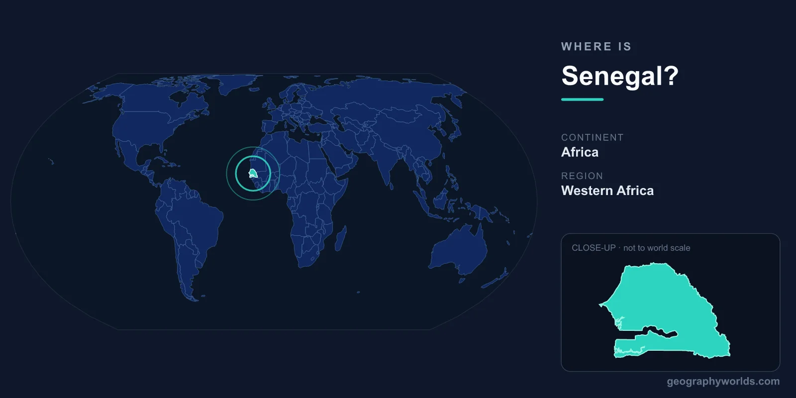
Senegal sits on the far western edge of mainland Africa, in the West Africa region, where the continent juts out into the Atlantic Ocean at its closest point to the Americas. Its capital, Dakar, occupies the tip of the Cap-Vert peninsula — the westernmost point of continental Africa. Senegal covers about 196,722 km² and lies entirely within the Northern and Western Hemispheres, just north of the equator.
Where Exactly Is Senegal on the Map?
Senegal lies roughly between 12° and 17° north latitude and 11° and 18° west longitude. That places it in the tropics, in the transitional belt between the arid Sahara to the north and the wetter savannas to the south. To find it on a globe, look at the western bulge of Africa and trace the coastline to the point furthest from the African interior — that is the Cap-Vert peninsula, with Dakar at its tip.
This westward position is more than a curiosity. Dakar is the closest major mainland-African port to North and South America, which made the city a strategic stop for shipping, aviation and transatlantic cables for over a century. Senegal also shares the same time zone as London (Greenwich Mean Time, with no daylight saving), making it convenient for trade and communication with Europe.
Which Countries Border Senegal?
Senegal shares land borders with five countries and a long Atlantic coastline to the west. One of its neighbours, The Gambia, is almost entirely surrounded by Senegalese territory — a narrow country following the Gambia River that nearly splits Senegal in two. Its neighbours are:
- Mauritania — to the north, across the Senegal River.
- Mali — to the east.
- Guinea — to the southeast.
- Guinea-Bissau — to the south.
- The Gambia — an enclave-like nation cutting into Senegal from the Atlantic coast.
The region south of The Gambia, called Casamance, is geographically separated from the rest of Senegal by Gambian territory, giving the country an unusual, almost pinched shape. This arrangement dates back to colonial-era border drawing between French and British powers.
The Landscape: Coast, Sahel and River Valleys
Senegal is largely a low-lying, flat country. Much of its terrain is rolling plains rising to foothills only in the southeast, near the border with Guinea, where the country reaches its highest point — an unnamed feature near Nepen Diakha of roughly 581 metres. The rest of the land sits close to sea level.
The country is shaped by three major rivers: the Senegal River along the northern border, the Gambia River, and the Casamance River in the south. The northern interior blends into the Sahel — a semi-arid zone of grasslands and scattered trees — while the south is greener and more forested, supporting agriculture such as peanuts (a key export), millet and rice. Along the Atlantic, sandy beaches, lagoons and the bird-rich Saloum Delta define the coast. Dakar's Cap-Vert peninsula is volcanic in origin, the only such formation along this stretch of coastline.
People, Capital and Everyday Geography
Senegal is home to roughly 17–18 million people, with a large share living in and around Dakar, one of West Africa's most important port and cultural cities. French is the official language, a legacy of colonial rule, while Wolof is the most widely spoken everyday language. Islam, predominantly Sunni, is the faith of the large majority of the population and shapes daily life, festivals and architecture.
Senegal is a presidential republic and uses the West African CFA franc (XOF), a currency shared with several neighbouring states. Just off the Dakar coast lies Gorée Island, a UNESCO World Heritage Site tied to the history of the transatlantic slave trade. For travellers and students wanting a deeper picture of the country's regions, climate and culture, see our senegal country guide.
Frequently Asked Questions
What continent is Senegal in?
Senegal is in Africa, specifically the West Africa region. It occupies the westernmost part of the African mainland, fronting the Atlantic Ocean.
What is the capital of Senegal?
The capital is Dakar, located on the Cap-Vert peninsula — the westernmost point of continental Africa. It is the country's largest city and main port.
Is Senegal near the equator?
Senegal lies north of the equator, between about 12° and 17° north latitude. It is well within the tropics but does not touch the equator itself, which runs farther south through countries like Gabon and Kenya.
How big is Senegal?
Senegal covers roughly 196,722 km², making it comparable in size to South Korea or to the U.S. state of South Dakota. Most of the terrain is flat, low-lying plain.