
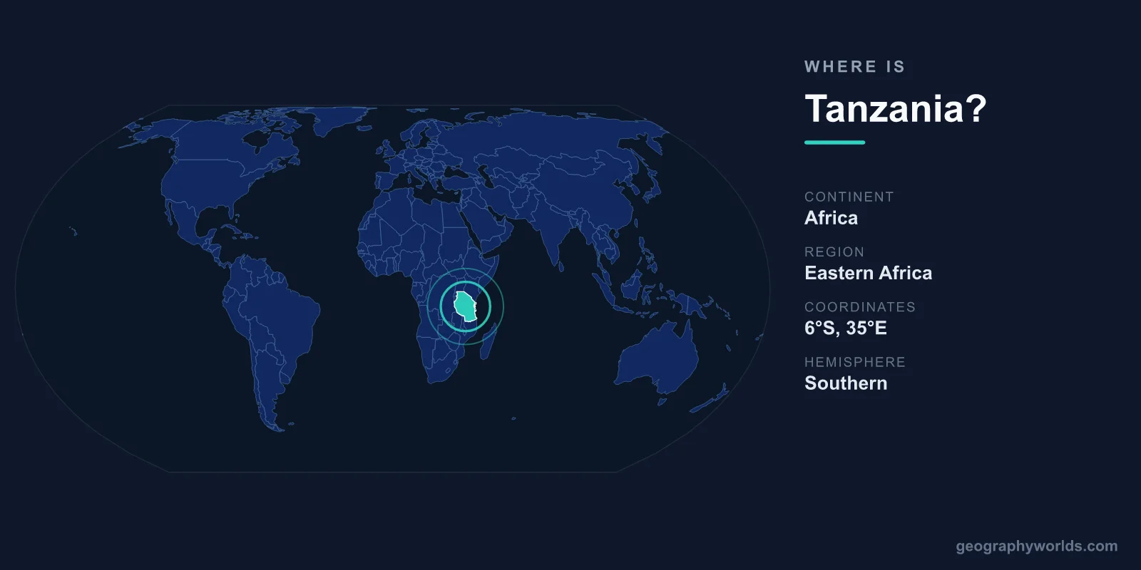
Tanzania is located in East Africa, on the eastern coast of the African continent, where it borders the Indian Ocean to the east and sits just south of the equator. It lies in both the Southern and Eastern Hemispheres, roughly between latitudes 1° and 12° South and longitudes 29° and 41° East. The official capital is Dodoma, while Dar es Salaam remains the largest city and commercial heart of the nation. Covering about 945,087 km², Tanzania is the largest country in East Africa.
Where Exactly Is Tanzania on the Map?
Tanzania occupies a strategic position on Africa's Indian Ocean seaboard, just below the horn of the continent. If you trace the equator across a world map, Tanzania begins a short distance south of it and extends down toward the southern tropics. Its eastern edge is defined by roughly 1,400 kilometres of coastline along the Indian Ocean, including the offshore islands of the Zanzibar Archipelago (Unguja, Pemba, and Mafia).
To orient yourself: Tanzania sits south of Kenya and Uganda, east of the African Great Lakes, and north of Mozambique and Zambia. Three of the continent's largest lakes form natural sections of its boundaries — Lake Victoria in the north, Lake Tanganyika in the west, and Lake Nyasa (Lake Malawi) in the southwest. This places the country firmly within the African Great Lakes region as well as East Africa.
Which Countries Border Tanzania?
Tanzania shares land borders with eight countries, more than almost any other nation in the region, making it a genuine crossroads of trade, language, and migration:
- Kenya and Uganda to the north
- Rwanda, Burundi, and the Democratic Republic of the Congo to the west (across or near Lake Tanganyika)
- Zambia and Malawi to the southwest
- Mozambique to the south, along the Ruvuma River
This central location has long made Tanzania an important transit corridor. Ports such as Dar es Salaam handle goods bound for landlocked neighbours like Zambia, Burundi, Rwanda, and the eastern DRC, while historic Swahili coast trade routes once linked the interior to merchants from Arabia, Persia, and India.
Tanzania's Landscape and Natural Landmarks
Tanzania's geography is dramatically varied. Rising in the northeast near the Kenyan border is Mount Kilimanjaro, at about 5,895 metres the highest point in Africa and the tallest free-standing mountain in the world. Nearby stands Mount Meru, another towering volcanic peak.
Much of the country sits on a high central plateau, flanked by the eastern and western arms of the Great Rift Valley. This rifting created the deep lake basins and volcanic highlands that define the north. The Serengeti plains, the Ngorongoro Crater, and the wetlands of the Selous (Nyerere) region host some of the largest wildlife populations on Earth, while the coastal lowlands are warm, humid, and dotted with mangroves and coral reefs.
Because the country stretches across so many elevations and latitudes, it contains multiple climate zones — from tropical, sticky heat along the coast to cool, temperate conditions on the mountain slopes and semi-arid stretches across the central interior.
Capital, Population, and People
Dodoma, located in the centre of the country, became the official capital and is the seat of the National Assembly. Dar es Salaam, on the coast, remains the largest urban centre, principal port, and economic engine. Tanzania's population is approximately 65 million, making it one of the most populous nations in Africa.
The country is strikingly diverse, with well over 100 ethnic groups. Swahili (Kiswahili) serves as the national language and a unifying force across communities, while English is widely used in business, higher education, and administration. Religious life is split fairly evenly between Christianity and Islam, with Islam especially prominent along the coast and on Zanzibar. The national currency is the Tanzanian Shilling (TZS). For a deeper look at the country's regions, history, and culture, see our tanzania country guide.
Frequently Asked Questions
What continent is Tanzania in?
Tanzania is in Africa, specifically in the East African region on the continent's Indian Ocean coast. It lies in both the Southern and Eastern Hemispheres, just south of the equator.
Is Tanzania near the equator?
Yes. The northern edge of Tanzania sits only about one degree south of the equator. This near-equatorial position gives the country its tropical climate and relatively consistent day length throughout the year, though high-altitude areas like Kilimanjaro stay cool or snow-capped.
What is the capital of Tanzania?
Dodoma is the official capital, chosen for its central location. Dar es Salaam, on the Indian Ocean coast, is the largest city and the main commercial and port hub.
Does Tanzania have a coastline?
Yes. Tanzania has roughly 1,400 kilometres of coastline along the Indian Ocean to the east, plus the islands of the Zanzibar Archipelago — Unguja, Pemba, and Mafia — which are known for their beaches, coral reefs, and Swahili heritage.