
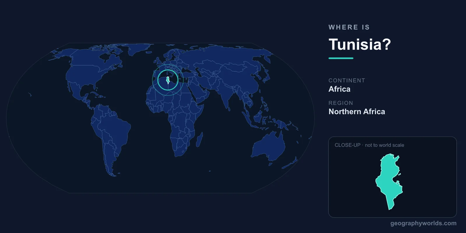
Tunisia is located in North Africa, on the southern shore of the Mediterranean Sea, where it forms the northernmost point of the entire African continent. It sits between Algeria to the west and Libya to the southeast, with its capital, Tunis, perched on the northern coast near the ancient site of Carthage. Covering 163,610 km², Tunisia occupies a strategic position at the meeting point of the western and eastern Mediterranean.
Where Exactly Is Tunisia on the Map?
Tunisia lies in both the Northern and Eastern Hemispheres, roughly between 30 and 37 degrees north latitude and 7 to 12 degrees east longitude. Its northern tip, Cape Angela near the town of Bizerte, is the closest point of mainland Africa to Europe. From there, the Italian island of Sicily lies only about 140 kilometers across the Strait of Sicily, and the narrow Sicilian Channel has long served as a bridge between Africa and Europe.
The country has a roughly wedge shape, broad along its Mediterranean coastline in the north and tapering southward into the Sahara Desert. This places Tunisia firmly within the region known as the Maghreb, the western part of the Arab world that also includes Algeria, Morocco, Libya, and Mauritania. Its central Mediterranean location has made it a crossroads of Phoenician, Roman, Arab, Ottoman, and French influences over more than three thousand years.
Which Countries Border Tunisia?
Tunisia shares land borders with only two countries, while its third and longest frontier is the sea:
- Algeria to the west and southwest, sharing roughly 1,000 kilometers of border that runs through mountains and desert.
- Libya to the southeast, with a border of around 460 kilometers stretching into the Sahara.
- The Mediterranean Sea to the north and east, giving Tunisia about 1,150 kilometers of coastline.
Because it has fewer land neighbors than its larger Maghreb counterparts, Tunisia has historically been outward-facing, with its economy, trade, and culture oriented toward the Mediterranean rather than the African interior.
The Landscape: From Coast to Sahara
Despite its modest size, comparable to that of Iceland or the U.S. state of Georgia, Tunisia contains a striking range of landscapes compressed into a short north-to-south span. The far north is green and fertile, watered by the Medjerda, the country's only major perennial river, and crossed by the eastern end of the Atlas Mountains, known locally as the Dorsale. The highest peak, Jebel ech Chambi, rises to about 1,544 meters.
Moving southward, the climate dries out dramatically. The central region features semi-arid steppes and olive-growing plains around Sfax and Sousse. Beyond them lie the chotts, vast salt flats such as Chott el Jerid, that shimmer in the heat. The southern third of the country merges into the Sahara, with sand dunes, oasis towns like Tozeur and Douz, and the troglodyte dwellings of Matmata that famously featured in the Star Wars films.
Why Tunisia's Location Matters
Tunisia's position at the narrowest part of the Mediterranean gave it enormous historical importance. The ancient city of Carthage, founded near modern Tunis, became a great maritime power that rivalled Rome itself. Later, the Romans built the magnificent Amphitheatre of El Jem, one of the largest in the world, whose ruins still stand today as a UNESCO World Heritage Site.
In the modern era, this same geography keeps Tunisia connected to Europe. Ferries link its ports to Italy and France, and millions of European tourists visit its beaches each year. The country is home to roughly 12 million people, the vast majority of whom live along the better-watered northern and coastal zones. Most Tunisians speak Arabic, with French widely used in business and education, and Islam is the predominant religion. To explore the country's history, cities, and culture in more depth, see our tunisia country guide.
Frequently Asked Questions
What continent is Tunisia in?
Tunisia is in Africa, specifically in North Africa within the region known as the Maghreb. It marks the northernmost point of the African mainland and faces Europe across the Mediterranean Sea.
Is Tunisia in the Middle East or Africa?
Geographically Tunisia is in Africa. Culturally and politically it is often grouped with the Arab world and the broader Middle East and North Africa (MENA) region because of its Arabic language and shared history, but on a map it sits on the African continent.
What is the capital of Tunisia and where is it?
The capital is Tunis, located on Tunisia's northern Mediterranean coast at the head of the Gulf of Tunis. It is the country's largest city and its political, economic, and cultural center, sitting close to the ruins of ancient Carthage.
How far is Tunisia from Europe?
Tunisia is very close to Europe. Its northern tip lies only about 140 kilometers from the Italian island of Sicily across the Strait of Sicily, making it one of the closest African countries to the European mainland.