
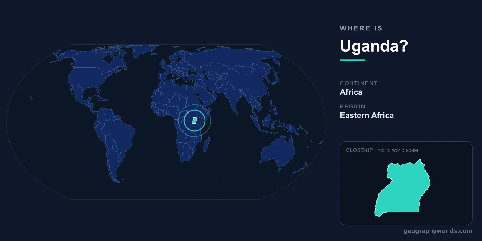
Uganda is a landlocked country in East Africa, lying directly on the equator just west of Kenya, with its capital at Kampala and a total area of 241,038 km². Often called the "Pearl of Africa," Uganda sits at the heart of the African Great Lakes region, where the world's longest river is born and where rainforest, savanna and snow-capped mountains all share a single border.
Where Exactly Is Uganda on the Map?
Uganda lies in the East Africa region of the African continent, roughly between latitudes 4°N and 1°S and longitudes 29°E and 35°E. Because the equator runs straight through the southern part of the country, Uganda spans both the Northern and Southern Hemispheres, while sitting entirely within the Eastern Hemisphere. This equatorial position gives much of the country a warm, consistent climate moderated by its relatively high elevation.
To picture it quickly: Uganda is tucked between the vast Democratic Republic of the Congo to the west and Kenya to the east, with the great body of Lake Victoria forming much of its southeastern edge. Despite being landlocked, it is far from cut off, sharing the second-largest freshwater lake in the world with two neighbours.
Countries That Border Uganda
Uganda shares land borders with five countries, placing it at a busy regional crossroads for trade, transport and cultural exchange:
- Kenya – to the east, Uganda's main gateway to the Indian Ocean port of Mombasa.
- South Sudan – to the north.
- Democratic Republic of the Congo – to the west, across the Rwenzori Mountains and Lake Albert.
- Rwanda – to the southwest.
- Tanzania – to the south, with whom Uganda shares Lake Victoria.
Being landlocked, Uganda depends on these neighbours for access to the sea. Goods typically travel overland to Kenya's coast or, increasingly, southward through Tanzania, making good relations with bordering states a constant priority for the nation's economy.
How Big Is Uganda?
Uganda covers 241,038 km², a figure that includes large areas of open water. That makes it comparable in size to the United Kingdom or the U.S. state of Oregon. Of that total, a striking share is water: Lake Victoria, Lake Kyoga, Lake Albert, Lake Edward and Lake George together account for tens of thousands of square kilometres, which is why Uganda is sometimes described as one of Africa's most water-rich nations.
Home to roughly 48 million people, Uganda is also one of the more densely populated and fastest-growing countries in East Africa, with a notably young population concentrated around the fertile crescent near Lake Victoria and the capital, Kampala.
Landscapes and Natural Landmarks
For a country of moderate size, Uganda packs in an extraordinary range of scenery. Much of the land is a high plateau averaging around 1,100 metres above sea level, which tempers the equatorial heat. From this plateau rise dramatic features that define Uganda's geography:
- The Rwenzori Mountains – the "Mountains of the Moon" on the Congo border, whose highest peak, Margherita, exceeds 5,000 metres and carries permanent glaciers despite sitting almost on the equator.
- Lake Victoria – the largest tropical lake on Earth and the chief reservoir feeding the Nile.
- The source of the Nile – at Jinja, where the White Nile begins its long journey north to the Mediterranean.
- Bwindi Impenetrable Forest – a dense montane rainforest in the southwest, famous as a refuge for roughly half the world's remaining mountain gorillas.
This blend of savanna, wetland, rainforest and alpine terrain is exactly what earned Uganda its "Pearl of Africa" nickname, a phrase popularised by Winston Churchill after his travels there in the early 1900s.
People, Language and Everyday Life
Uganda's official languages are English and Swahili, though dozens of local languages such as Luganda are widely spoken in daily life. The majority of the population identifies as Christian, with a significant Muslim minority, and these faiths shape festivals, music and community life across the country. Uganda is governed as a presidential republic, and its currency is the Ugandan shilling (UGX). To learn more about its history, regions and culture, see our uganda country guide.
Frequently Asked Questions
What continent is Uganda in?
Uganda is located on the continent of Africa, specifically in the East Africa region, where it straddles the equator.
Is Uganda landlocked?
Yes. Uganda has no coastline. It relies on overland routes through Kenya and Tanzania to reach Indian Ocean ports, though it borders several of Africa's largest lakes.
What is the capital of Uganda?
The capital and largest city is Kampala, which sits on the northern shore of Lake Victoria and serves as the country's political, commercial and cultural centre.
Which countries border Uganda?
Uganda shares borders with five countries: Kenya, South Sudan, the Democratic Republic of the Congo, Rwanda and Tanzania.