
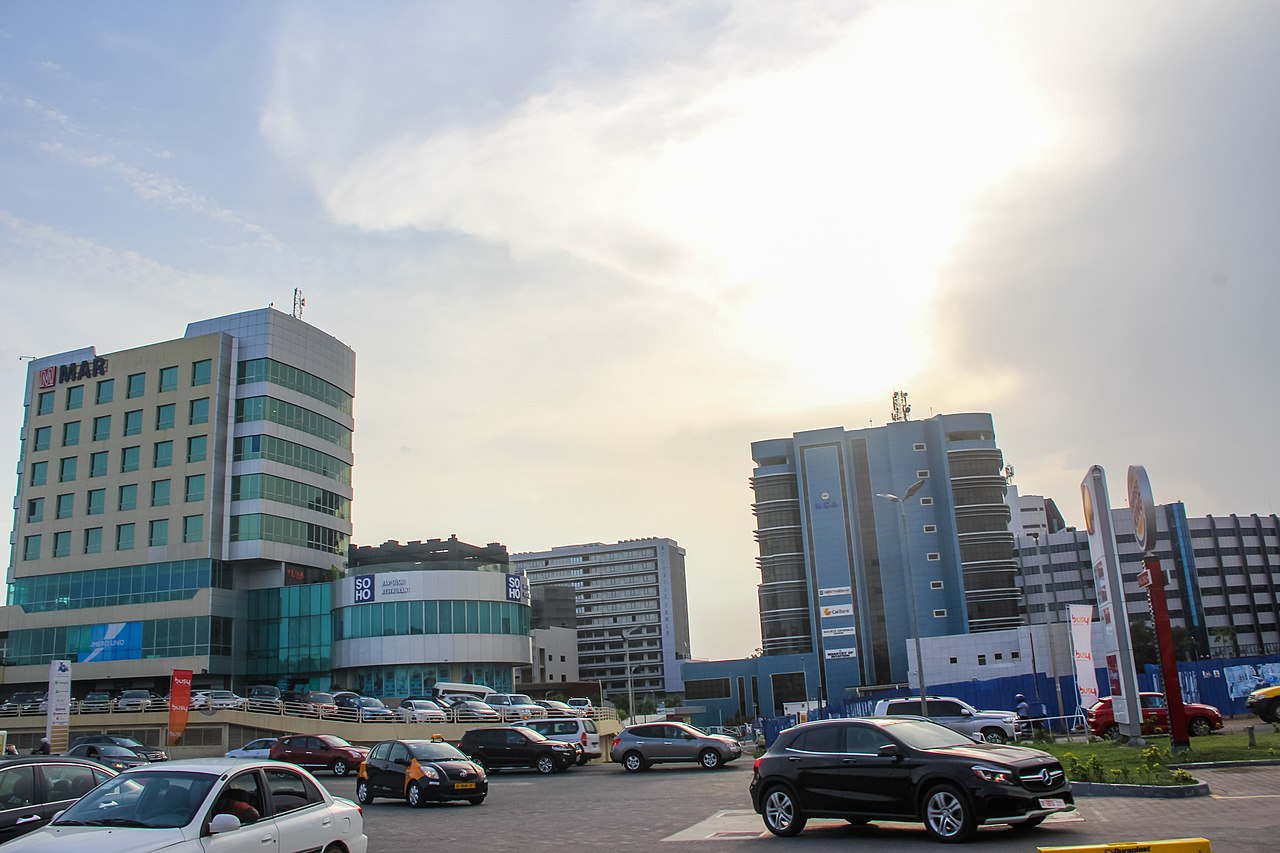
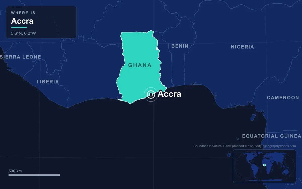
Depending on where you draw the line, Accra has 284,124 people or 5.46 million. It is the capital and largest city of Ghana, spread along the Gulf of Guinea coast in the country’s southeast, and it has been the seat of government since 1877, first for the British Gold Coast and, from 6 March 1957, for independent Ghana. The small figure comes from the 2021 census count for the Accra Metropolitan District, a core of just 20.4 square kilometres; the large one is the Greater Accra Region, 3,245 square kilometres and home to 5,455,692 people. In between sits the city most people mean when they say Accra, with about 1.78 million residents. Its defining trait is concentration: Ghana’s smallest region now holds more people than any other. The quickest way to understand Accra is through comparisons, and the numbers below set it against its own suburbs, its rival Kumasi, the old capital at Cape Coast and the rest of Ghana.
20.4 km² or 3,245 km²: Deciding Which Accra to Count
Until 2008, the Accra Metropolitan District covered 199.4 square kilometres. That territory has since been cut into 13 local government districts: 12 municipal districts covering 179 square kilometres and a reduced Accra Metropolitan District of 20.4 square kilometres, which is the only one with city status and is formally distinguished as the “City of Accra”. The whole 199.4 square kilometres, which held 1,782,150 people in 2021, is still what serves as Ghana’s capital. So a statistic about “Accra” can describe either the 20.4-square-kilometre core or an area almost ten times bigger, and the population figures differ by a factor of six.
Zoom out again and there is the Greater Accra Metropolitan Area, a continuous urban region of about 4 million people that includes Tema and Ashaiman, ranked around the thirteenth-largest metropolitan area in Africa. Beyond that is the Greater Accra Region, created as a separate region only on 23 July 1982; in 1960 the area was the Accra Capital District, geographically part of the Eastern Region. The region is now divided into 29 district assemblies, up from just three before 1988, a count that grew in step with the population.
The city grew by absorbing its neighbours. It formed from separate settlements around three European forts: Jamestown around the British James Fort, Usshertown around the Dutch Fort Crèvecœur (later Ussher Fort) and Osu around the Danish Christiansborg. Denmark sold Christiansborg and its other forts to Britain in 1851 and the Netherlands sold the last Dutch posts in 1871. After a bubonic plague epidemic in 1908 the colonial government extended the boundaries northward and created Adabraka as a new district, and in 1923 Governor Guggisberg bridged the Korle Lagoon, opening Korle Bu, Korle Gonno and Chorkor to settlement on the western side.
Greater Accra 5,455,692, Ashanti 5,440,463: The 2021 Overtake
At the 2010 census, Greater Accra had 4,010,054 people and was Ghana’s second most populous region, behind Ashanti. By 2021 it had moved to first place, with 5,455,692 people against Ashanti’s 5,440,463, a margin of about 15,000 in a country of 30,832,019. It did this on the smallest territory of any of Ghana’s 16 regions: 3,245 square kilometres, just 1.4% of the country’s land, compared with 24,389 square kilometres for Ashanti. Greater Accra is also the most urbanised region, with 87.4% of its people living in urban centres.
Put those numbers together and Greater Accra holds 17.7% of Ghana’s population on 1.4% of its land, at roughly 1,680 people per square kilometre, about seven and a half times the density of Ashanti and thirteen times the national average. The pull is economic. Rapid industrial growth between 1960 and 1970 set off heavy migration from the countryside, and the capital still concentrates the country’s central bank, the Ghana Stock Exchange, the Parliament, the Supreme Court and Black Star Square, the parade ground Kwame Nkrumah commissioned for independence and completed in 1961. The population is young: 56% of Accra’s residents are under 24.

Much of that economy is informal and runs through markets such as Makola, built in 1924 and dominated by women traders who sell everything from car parts to land snails. Its history also shows how politically exposed the capital’s traders are: on 18 August 1979 the Rawlings government had the market demolished, accusing the market women of causing Ghana’s economic troubles.
Kumasi, 200 km Inland: A Rival With More People Inside Its City Limits
Ghana’s second city tells a different story. Kumasi, about 200 kilometres from Accra in the rainforest region near Lake Bosomtwe, was founded in the 1680s by Osei Tutu I as the capital of the Asante Empire, which at its height covered much of present-day Ghana and Ivory Coast. It remains the seat of the Asantehene, the Asante king, and the centre of Asante culture, and it was a capital nearly two centuries before Accra became one. The British took Kumasi in 1896, and after independence in 1957 it became the capital of the Ashanti Region; its nickname, the Garden City, dates from Maxwell Fry’s 1945 plan for a “Garden City of West Africa”.
By one measure Kumasi is even the bigger city. The 2021 census counted 443,981 people in the Kumasi Metropolitan Assembly area against 284,124 in the Accra Metropolitan District, largely because Accra’s core district was cut down to 20.4 square kilometres in 2008. Wider boundaries change the picture again: the 199.4-square-kilometre capital area held about 1.78 million people in 2021, but Kumasi’s own metropolitan area is put at 3,490,030, and only at the scale of the Greater Accra Metropolitan Area, with about 4 million, does the capital pull clearly ahead.
The two cities also do different jobs. Kumasi has Kejetia Market, described as the biggest market in West Africa, handles half of Ghana’s timber processing, and has its own Twi-language film industry, nicknamed Kumawood. Accra has government, finance and the international links: Accra International Airport, 9.7 kilometres from downtown, handled a record 3.62 million passengers in 2025, and in 2020 the Globalization and World Cities Research Network rated Accra a “Gamma −” global city. UNESCO named it World Book Capital for 2023.
Cape Coast to Accra in 1877, and Tema’s Port in 1961
Accra was not the obvious choice for a capital. In the 15th century the Ga kingdom of Accra ruled from Ayawaso, inland, and the busiest ports on this stretch of coast were Ada and Prampram. In 1677 the Akwamu ruler Ansa Sasraku sacked Ayawaso and beheaded its king, Okai Koi, and the survivors regrouped at “Small Accra” beneath the walls of the Dutch fort. Meanwhile Cape Coast, about 130 kilometres to the west, served as the capital of the British Gold Coast from 1821.
The British captured Accra in 1874, and in 1877, at the end of the second Anglo-Asante War, they moved the capital there from Cape Coast. The reason recorded for the switch was the weather: Accra’s climate was drier. Cape Coast, which counted 108,374 people in 2010, is now better known for its castle, a World Heritage Site, and its universities.

The oldest part of the coastal city survives in Jamestown and Usshertown, still fishing communities of the Ga people. The first lighthouse was built at James Fort in 1871; the present 28-metre tower replaced it in the 1930s and can be seen 30 kilometres out to sea. Yet Accra itself has not worked as a port since the 1950s. Deep-water shipping moved instead to Tema, about 25 kilometres to the east, where a harbour able to take much larger ships opened in 1961 in a new town commissioned by Nkrumah. Tema, planned by the architect Theodore S. Clerk on the site of a fishing village and crossed by the Greenwich Meridian, is now Ghana’s largest seaport and part of Accra’s metropolitan area.
798 mm a Year: Why Accra Is Drier Than Kumasi
The dryness that won Accra the capital is still measurable. At Accra International Airport the 1991–2020 average rainfall is 798.5 millimetres a year, against 1,371.4 millimetres at Kumasi over the same period. Most of Accra’s rain comes in May and June, which together average about 341 millimetres; January averages just 11.8 millimetres. Temperatures barely move, with average highs between 28.4 °C in August and 33 °C in February and March.
The explanation is regional. Accra lies in the Dahomey Gap, a strip about 200 kilometres wide between southeastern Ghana and southwestern Nigeria where open savanna reaches all the way to the coast, splitting West Africa’s rainforest into an upper and a lower block. Lomé, Cotonou and Porto-Novo share the same setting, while Kumasi sits on its forested fringe. Low rainfall does not make Accra safe from water, though: as a coastal city with stretched drainage, it is exposed to flooding and sea-level rise, and its annual PM2.5 air pollution averages 49.5 micrograms per cubic metre, above national and international health standards according to a 2021 review.
Seen side by side, the figures describe a capital that is small on paper, huge in practice, drier than its rival and denser than anywhere else in the country. For how it ranks against Kumasi, Tamale and the rest, see our list of the largest cities in Ghana; for the national trend behind those census numbers, read about the population of Ghana; and for the wider picture, start with our Ghana country guide.
Quick Facts About Accra
- Country: Ghana
- Continent: Africa (West Africa)
- Country population: approximately 35.7 million
- Capital city status: Accra is the capital of Ghana, the seat of national government, and the location of foreign embassies, parliament, and the head of state's official residence.
Frequently Asked Questions
What is the capital of Ghana?
The capital of Ghana is Accra. Accra is the seat of national government, hosts most foreign embassies and consulates, and is typically where the head of state and parliament are located.
What continent is Accra in?
Accra, the capital of Ghana, is located in Africa, in the West Africa region. As Ghana's capital, Accra serves as the country's primary connection to the broader African political, economic, and cultural sphere.
Why is Accra the capital of Ghana?
Accra was chosen as the capital of Ghana for reasons that typically combine geography, history, and politics. Capital city selections often reflect a desire for centrality (being accessible from across the country), historical importance (being a longstanding seat of government or culture), or neutrality (being acceptable to multiple regions or ethnic groups within the country). The specific reasons for Accra's designation are detailed in the city's history above.
What is Accra known for?
As the capital of Ghana, Accra is best known for housing the country's central government institutions — parliament, presidential or royal residences, supreme court, and key ministries. It is also typically a major cultural and economic center within Ghana, hosting national museums, embassies, and signature monuments. The introduction and history sections above provide detailed coverage of the city's specific notable institutions and landmarks.
Related Pages
- Ghana Country Guide — full geography, climate, economy, and culture overview
- Flag of Ghana — meaning, history, and design of Ghana's national flag