
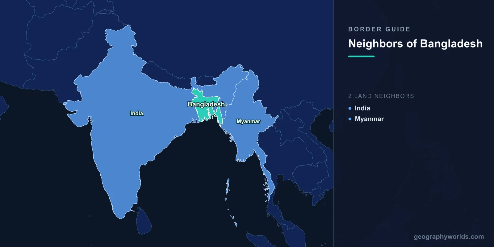
Bangladesh has only two land neighbours, India and Myanmar, and the split between them is almost comically lopsided. India accounts for 4,142 km of a 4,413 km total, wrapping around the country on the west, the north and most of the east. Myanmar supplies the remaining 271 km in the far south-eastern corner. The only other edge is the Bay of Bengal. Two neighbours makes for a very short list — but the Indian half of it is the fifth-longest land border on Earth, after Canada–United States, Kazakhstan–Russia, Argentina–Chile and China–Mongolia.
It is also the most heavily engineered border in South Asia, and it took sixty-eight years to finish drawing.
Five Weeks, One Barrister, and a Line He Never Saw
Cyril Radcliffe, a London barrister who had never travelled east of Europe, arrived in India on 8 July 1947 and was handed the chairmanship of both Boundary Commissions. He had roughly five weeks. His award was signed on 12 August and published on 17 August, two days after independence.
He worked from out-of-date survey maps and 1941 census returns showing religious majorities at district level, in a delta where the population is mixed village by village and the rivers move every monsoon. The line he drew around East Bengal cut jute-growing districts away from the Calcutta mills that processed their crop, severed railways in the middle of nowhere, and crossed dozens of rivers at angles no hydrologist would have chosen. It created a country in two pieces separated by 1,600 km of India, an arrangement that lasted until the 1971 war produced Bangladesh.
Even the length of the thing is disputed. India’s Ministry of Home Affairs puts the border at 4,096.7 km; the CIA World Factbook says 4,142 km. The forty-five kilometre difference is not carelessness. It is what happens when you try to measure a boundary that follows river channels which physically relocate.
The Enclaves, and the Field Inside a Field Inside a Field
Radcliffe did not invent the strangest part. In the Cooch Behar and Rangpur districts he inherited a scatter of parcels left over from an early eighteenth-century settlement between the Mughal Empire and the Kingdom of Cooch Behar — the story that they were wagered in chess games is charming and almost certainly false. When Cooch Behar acceded to India in 1949, those parcels became Indian territory sitting inside East Pakistan, and vice versa.
By 2015 there were 162 of them: 111 Indian enclaves inside Bangladesh covering 17,160 acres, and 51 Bangladeshi enclaves inside India covering 7,110 acres, with a combined population of about 51,000. Nobody governed them in any practical sense: no schools, no clinics, no police, no electricity, and no legal way to leave home, since reaching a hospital meant crossing an international border illegally in both directions.
The extreme case had a name and a plot number. Dahala Khagrabari #51 was a jute field of roughly 7,000 square metres: a piece of India inside the Bangladeshi enclave of Upanchowki Bhajni, which sat inside the Indian enclave of Balapara Khagrabari, which sat inside Bangladesh. It was the only third-order enclave that has ever existed anywhere in the world, and it was farmed by a Bangladeshi man who, on the strictest reading of the law, had to leave his own country three times to reach his crop.
The largest Bangladeshi enclave, Dahagram–Angarpota, was about 18 km² and was separated from Bangladesh proper by a mere 178 m of Indian ground. A 1974 agreement promised a corridor. The Tin Bigha Corridor finally opened on 26 June 1992 — and even then only for a few hours a day, on a published timetable, so that fifteen thousand people could visit their own country during business hours. Round-the-clock access was granted only in 2011.
What Actually Changed at Midnight on 31 July 2015
The Land Boundary Agreement that fixed all this was signed by Indira Gandhi and Sheikh Mujibur Rahman on 16 May 1974. Bangladesh ratified it the same year. India took forty-one more, because handing over territory required a constitutional amendment. The 100th Amendment passed the Rajya Sabha on 6 May and the Lok Sabha on 7 May 2015, both unanimously, and instruments of ratification were exchanged in Dhaka on 6 June during Narendra Modi’s visit.
At midnight on 31 July 2015 the enclaves ceased to exist. Residents had been surveyed and offered a choice of citizenship; 979 people in the former Indian enclaves opted to move to India, and everyone else simply woke up as a citizen of the country that had always surrounded them. The same package settled 6.1 km of previously undemarcated boundary in three sectors, in West Bengal, Tripura and Assam, and exchanged roughly 2,700 acres of adverse possessions. It remains one of the very few cases in modern history of two states peacefully swapping inhabited territory to make a border make sense.
The Fence, and the People Living on the Wrong Side of It
India began fencing the border in the 1980s and accelerated sharply after 2000. Well over three-quarters of the line now carries barbed wire, floodlighting and patrol roads, guarded by the Border Security Force. Because Indian regulations require the fence to stand 150 yards inside Indian territory, many Indian villages and fields ended up on the Bangladeshi side of their own barrier, reachable through gates that open on a schedule — a smaller echo of the Tin Bigha problem the two governments had just spent decades solving.
Geography works against enforcement: the line runs through paddy fields, market towns, villages where houses on opposite sides share a wall, and rivers that shift their banks annually. Cattle moving into Bangladesh was for years the dominant informal trade. Enforcement has been lethal: Human Rights Watch documented a pattern of shootings in its 2010 report on the BSF, and in January 2011 a fifteen-year-old girl, Felani Khatun, was shot climbing the wire at Anantapur in Kurigram district and left hanging on the fence for hours. The photograph became the defining image of the border, and the annual death toll has never reached zero.
Not everything about the line is adversarial. Since 2011 the two governments have opened border haats, small managed markets built directly on the boundary in Meghalaya and Tripura — the first at Kalaichar in May 2011 — where residents trade small volumes without customs paperwork. Benapole and Petrapole, on the Kolkata–Dhaka road, form one of the busiest land ports in South Asia, and the Akhaura–Agartala rail link, opened in November 2023, cut the journey from Kolkata to Agartala from roughly 1,600 km the long way round to about 500 km straight through.
Fifty-Four Rivers That Do Not Recognise the Line
Bangladesh and India share fifty-four transboundary rivers, and almost every one of them is upstream in India. The Farakka Barrage, commissioned in 1975 about 18 km above the border, diverts Ganges water into the Hooghly to keep Kolkata’s port navigable, and has been the single most contentious structure between the two countries. The Ganges Water Sharing Treaty signed on 12 December 1996 set a thirty-year dry-season formula — and it expires in December 2026, which makes renewal a live diplomatic question. A parallel deal on the Teesta has been ready since 2011 and never signed, blocked by the West Bengal state government.
The delta also rearranges itself faster than treaties can be renegotiated. New Moore Island, called South Talpatti in Bangladesh, was a mudbank in the Hariabhanga estuary claimed by both states through the 1980s; it settled the argument itself by going under water around 2010.
Bangladesh’s shape also constrains its neighbour. The strip of Indian territory running north of Bangladesh, squeezed between it and Nepal, narrows to about 22 km at Siliguri — the Chicken’s Neck, through which every Indian road and railway to Assam, Tripura, Nagaland and the rest of the north-east must pass. Transit rights across Bangladesh are therefore among the most valuable things Dhaka can grant or withhold, which is a good deal of leverage for the smaller party. For the full picture from the other side, see our guide to the countries that border India and our look at how big India actually is.
271 Kilometres, and the River Between Them
The Myanmar border is short, mountainous and, in recent years, the more volatile of the two. It was fixed by a 1966 treaty between Pakistan and Burma that Bangladesh inherited in 1971. About 63 km of it is the Naf River, a tidal estuary several kilometres wide in places, separating Cox’s Bazar from Rakhine State; the rest climbs into the hills of Bandarban and Chin State. Myanmar began fencing its side in 2009.
Then came the displacement. After 25 August 2017 roughly 742,000 Rohingya crossed the Naf and the hill tracks within months, joining earlier arrivals. The Kutupalong and Balukhali settlement near Cox’s Bazar grew into the largest refugee camp in the world, holding close to a million people, and it is still there. From late 2020 Bangladesh began relocating tens of thousands to Bhasan Char, a silt island in the Meghna estuary that did not exist thirty years ago.
Control on the far side has since changed hands. The Arakan Army captured Maungdaw in December 2024 and announced that it held the entire border with Bangladesh, meaning Dhaka’s counterpart along those 271 km is now an armed group rather than a government. Mortar rounds and landmines have crossed into Bangladeshi villages near Tumbru. Myanmar’s other frontiers are covered in our piece on the countries bordering Myanmar.
Two Neighbours, Two Tribunals
Bangladesh’s sea boundaries were as tangled as its land ones, and it settled both in court. On 14 March 2012 the International Tribunal for the Law of the Sea drew the line with Myanmar, awarding Bangladesh most of the disputed water and a continental shelf beyond 200 nautical miles. On 7 July 2014 an arbitral tribunal at the Permanent Court of Arbitration settled the Indian boundary, giving Bangladesh some 19,467 km² of the 25,602 km² in dispute. Both losing states accepted the result.
| Neighbour | Length | Territory on the far side | What defines the line |
|---|---|---|---|
| India | 4,142 km | West Bengal, Assam, Meghalaya, Tripura, Mizoram | Radcliffe’s 1947 award, rewritten by the 2015 Land Boundary Agreement; largely fenced |
| Myanmar | 271 km | Rakhine State and Chin State | 1966 treaty; the Naf River for about 63 km, then hill country |
| Total | 4,413 km | — | — |
For a country with only two neighbours, Bangladesh has generated more boundary law than most continents, and the next chapter already has a date on it: the Ganges treaty runs out in December 2026. The most counterintuitive thing about its map remains how few countries are actually anywhere near it, which becomes obvious the first time you have to name the nearest one in a closest-country round.