
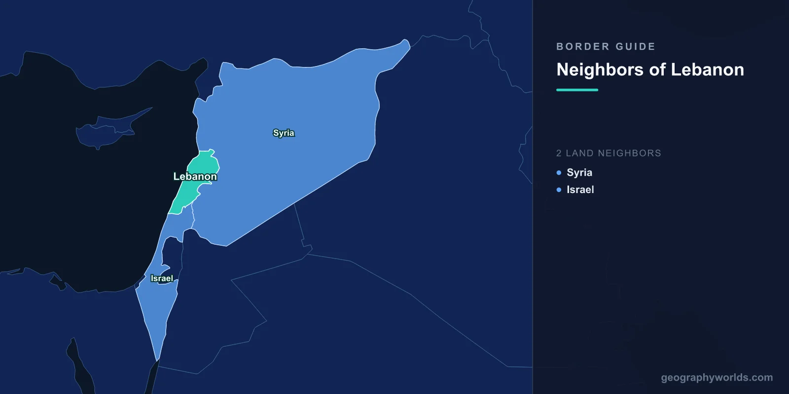
Lebanon has just two land neighbours: Syria, which wraps around it to the north and east across 403 km, and Israel, which meets it along 81 km in the south. That is the entire list — 484 km of land boundary, plus about 225 km of Mediterranean coast. Very few countries have so few neighbours without being an island or sitting on a peninsula.
The short list is misleading, though, because neither of those two lines is a normal border. The Syrian boundary has never been fully surveyed or marked on the ground in the century since it was invented, and Syria spent most of that century declining to treat it as an international frontier at all. The southern line is not a border in law: it is a withdrawal line that United Nations cartographers drew in 2000 so that a departure could be verified, and Lebanon and Israel have never negotiated, signed or ratified a land boundary between them. A country with two neighbours has, in a strict legal sense, zero agreed land borders.
| Neighbour | Length | What the line legally is | Official crossings |
|---|---|---|---|
| Syria | 403 km | A mandate-era administrative division, never demarcated on the ground | Four main ones — Masnaa, Abboudieh, Arida and Qaa |
| Israel | 81 km | The Blue Line: a UN-drawn withdrawal line, explicitly not a boundary | None open; a UN gate at Ras Naqoura used for liaison |
A Country Assembled in a Single Afternoon
Modern Lebanon was announced on 1 September 1920, when General Henri Gouraud, the French high commissioner, proclaimed the State of Greater Lebanon from the steps of the Pine Residence in Beirut. The word greater was the point. Under Ottoman rule there had been an autonomous province called the Mutasarrifate of Mount Lebanon, a mountain district with a Maronite Christian majority and no real economic base. France attached to it the coastal cities of Tripoli, Beirut, Sidon and Tyre, the Bekaa Valley and the Akkar plain — territory drawn from the Syrian hinterland, populated largely by Sunni and Shia Muslims.
Everything about the Lebanese–Syrian relationship since flows from that decision. The line was an internal French administrative division within a single mandate, drawn to make a viable state, not to separate two nations. When both countries became independent in the 1940s, Syria did not open an embassy in Beirut and did not exchange ambassadors, on the principle that relations between two parts of one people did not require diplomacy. Formal diplomatic relations were not established until October 2008, sixty-five years after independence.
403 Kilometres Nobody Has Ever Drawn on the Ground
The Syrian border begins at the Mediterranean just north of Tripoli, where the Nahr al-Kabir al-Janoubi — the Great Southern River — flows to the sea and gives the northern section its only clear physical marker. From there it runs inland and then south along the eastern flank of the country, past the Akkar highlands, down the length of the Bekaa Valley between the Lebanon and Anti-Lebanon ranges, and up onto the slopes of Mount Hermon.
Almost none of it is fenced, and the great majority has never been jointly demarcated with pillars and surveys. Villages sit astride it. Some Lebanese farmers hold land on the Syrian side and some Syrian farmers hold land on the Lebanese side, a legacy of a time when crossing between the two required nothing. Estimates of the number of informal crossing points — footpaths, riverbeds, unpaved tracks used by pickup trucks — run well into the dozens and by some counts past a hundred.
The four official crossings carry the legitimate traffic. Masnaa, on the Beirut–Damascus highway over the Anti-Lebanon range, is by far the busiest and is Lebanon's only functioning land route to the wider Arab world; everything exported by truck to Jordan and the Gulf goes through it. Abboudieh and Arida serve the north near Tripoli, and Qaa serves the north-eastern Bekaa near Hermel.
The unmarked stretches have carried other things. The northern Bekaa and the Wadi Khaled district have long-standing smuggling economies, historically in subsidised fuel, flour and medicine moving in whichever direction the price gap pointed, and more recently in captagon, an amphetamine trade that both governments have come under heavy regional pressure to shut down. Since 2011 the same terrain carried more than a million Syrians into Lebanon, one of the largest per-capita refugee burdens any country has taken on.
Syrian military forces were present in Lebanon from 1976 until April 2005, when they withdrew following the assassination of the former prime minister Rafik Hariri and the international pressure that followed under UN Security Council Resolution 1559. Demarcation of the border has been formally on the agenda ever since, and formally unfinished. The rest of Syria's tangled perimeter is set out in the piece on the countries that border Syria.
The Blue Line Is Not a Border
The southern line has a paper ancestry that is actually rather clear. The Paulet–Newcombe agreement of 1923 fixed the boundary between the French mandate over Syria and Lebanon and the British mandate over Palestine, and surveyors marked it on the ground at the time. When the 1949 armistice agreements were signed after the first Arab–Israeli war, the Israel–Lebanon armistice line followed that 1923 international boundary — the only one of Israel's four armistice lines that did so.
What has never happened is a treaty. Lebanon and Israel have no peace agreement and no negotiated land boundary. After Israeli forces withdrew from southern Lebanon in May 2000, the United Nations needed a line against which to certify that the withdrawal was complete, and UN cartographers produced one, publishing it in June 2000. It became known as the Blue Line, after the colour used to draw it, and it is marked on the ground by blue-painted barrels. It runs roughly 120 km as drawn, following the general course of the 1923 line but departing from it in places where the terrain or existing positions made strict adherence impractical.
The UN has been consistent on this point: the Blue Line is a line of withdrawal for the purpose of confirming Israeli compliance, and it is without prejudice to any future border agreement between the two countries.
Lebanon has registered reservations at some thirteen points along it. The line is patrolled by UNIFIL, the UN Interim Force in Lebanon, created by Security Council Resolutions 425 and 426 in March 1978 and substantially enlarged after the 2006 war under Resolution 1701. Its tripartite mechanism at Ras Naqoura, on the coast, is the one place where Lebanese and Israeli officers meet regularly in the same room, with UN officers chairing.
The village of Ghajar shows how awkward the drawing was. Its population is Syrian Druze from the Golan, and the Blue Line was cut straight through the built-up area, leaving the northern half on the Lebanese side and the southern half on the Israeli side of a village whose residents regard themselves as one community.
Twenty-Five Square Kilometres With Three Different Answers
The knottiest piece of the southern line is the Shebaa Farms, a strip of about 25 square kilometres of grazing land and terraced slopes at the western foot of Mount Hermon, where Lebanon, Syria and the Israeli-held Golan meet.
There are three positions on it. Lebanon says the land is Lebanese, pointing to property deeds held by families from the village of Shebaa and to long-standing local use. Syria has stated that it regards the land as Lebanese, though it has not provided the UN with the formal documentation and delimitation that would settle the matter between Damascus and Beirut. Israel captured the area in 1967 along with the Golan Heights and treats it as part of that territory, whose status is governed by the Israeli–Syrian track rather than the Lebanese one. When the UN examined the available maps and records in 2000 to certify the Israeli withdrawal, its cartographers concluded that the documentation placed Shebaa on the Syrian side of the line, and therefore that withdrawal from it was not required under Resolution 425.
That finding did not close the argument; it relocated it. Hezbollah has cited continued Israeli presence in Shebaa as grounds for continued armed operations, which is precisely why the cartography of a small patch of hillside has mattered far beyond its size. The area's neighbour to the south, and its own boundary arithmetic, are examined in how big Israel is.
What Two Unfinished Borders Do to a Country
Lebanon is about 10,450 square kilometres, smaller than Northern Ireland or the US state of Connecticut, and its geography leaves it with almost no room for manoeuvre. With the southern crossings shut, the only land route out of the country runs through Syria — so a closed or dangerous Syrian road means Lebanese exports move by air freight or by sea from Beirut and Tripoli, at multiples of the cost. When the Nassib crossing between Syria and Jordan shut during the Syrian war, Lebanese growers lost their overland market to the Gulf for years.
One boundary has actually been agreed, and it is offshore. In October 2022, after years of indirect talks mediated by the United States, Lebanon and Israel signed off on a maritime delimitation in the eastern Mediterranean, resolving a disputed wedge of seabed containing the Karish and Qana gas prospects. Two countries with no peace treaty, no diplomatic relations and no agreed land border managed to draw a line through open water. Whether that ever becomes a precedent for the 81 km on land is one of the more consequential open questions in the region.
Lebanon is a useful reminder that a border count tells you almost nothing on its own — two neighbours can be more complicated than fourteen. If you want to test how confidently you can place it, along with the rest of the eastern Mediterranean, on a map without labels, try the location guessing game and see how close your first click lands.