
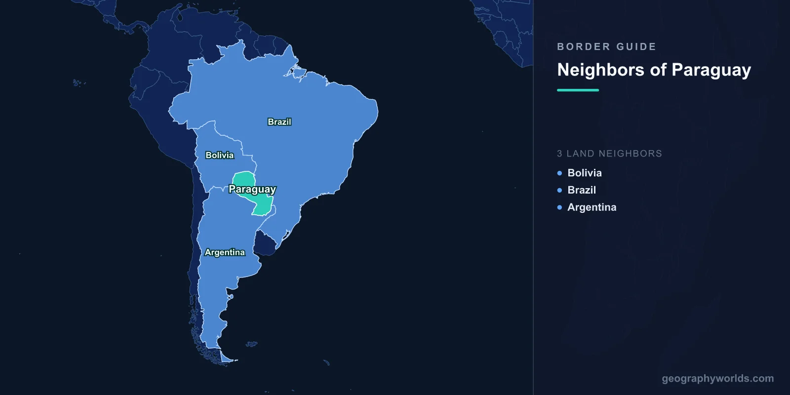
Three countries border Paraguay: Argentina to the south and southwest, Brazil to the east and northeast, and Bolivia to the northwest. The boundary runs 4,655 km in total, split 2,531 km with Argentina, 1,371 km with Brazil and 753 km with Bolivia. There is no fourth neighbour and no coast: Paraguay and Bolivia are the only two landlocked states in the Americas, and they happen to be landlocked against each other.
What makes Paraguay worth studying is not the count but the division of labour. Each of the three borders does a distinct job. The Brazilian line generates the country's electricity. The Argentine line is its road to the ocean. The Bolivian line exists in its current position because of a war fought in the 1930s over land almost nobody lived on.
Two Rivers Do Most of the Work
Paraguay is cut in half by the river it is named after. The Rio Paraguay flows north to south through the middle of the country, separating the humid, populated east from the Chaco, a flat scrub and thornforest plain that covers about 60 per cent of the national territory and holds under 3 per cent of its people. That split shapes every border.
Water carries most of the line. Working clockwise from the northeast, the boundary with Brazil follows the Apa river, climbs onto the Cordillera de Amambay for a long dry stretch, then drops onto the Parana and rides it south. The Parana then becomes the Argentine border, hands over to the Rio Paraguay, and finally to the Pilcomayo, which runs northwest into the Chaco. Only the Bolivian section has no river at all. It is a set of straight surveyed segments through open scrub, drawn by treaty and marked by concrete pillars.
The Pilcomayo deserves its own note. It is one of the most unstable rivers in the world, dumping so much sediment that it repeatedly chokes its own channel and jumps course across the flats. A boundary defined by a river that moves has needed constant technical management, and both governments run joint commissions whose entire purpose is to keep agreeing on where the water currently is.
Brazil: A Border You Can Measure in Megawatts
The eastern border was for a long time the tense one. In 1965 Brazilian troops occupied the area around the Guaira Falls, a colossal series of rapids on the Parana that both countries claimed. The crisis was defused by the Act of Iguacu in June 1966, which put the disputed reach under joint study, and it was resolved permanently in the most literal way available: the reservoir of the Itaipu dam drowned the falls in 1982. The argument disappeared under 100 metres of water.
The Itaipu Treaty was signed on 26 April 1973. The dam came online in 1984, and at around 14,000 MW of installed capacity it is one of the two largest power stations on earth by output. Paraguay owns half of it. That single fact does more to define the country's relationship with Brazil than any other.
The terms, though, have always rankled. Paraguay is entitled to half the energy but consumes only a fraction of it, and under Annex C of the treaty it was obliged to sell the surplus to Brazil at a price tied to construction costs rather than market value. Annex C was written to be reviewed once the construction debt was cleared, which finally happened in 2023. The renegotiation that followed set a revised capacity charge for 2024 and left the deeper questions open. For a country whose electricity is essentially all hydroelectric and whose treasury depends heavily on those payments, this is not a technical footnote.
Where the Line Runs Down a Street
On the dry section of the Brazilian border, Pedro Juan Caballero and Ponta Pora form a single built-up area divided by an avenue with no fence down the middle. The pattern of open twin towns is common along Brazil's southern frontiers, and anyone tracing Brazil's full list of neighbours will run into several more of them.
Argentina: The Longest Line, and the Only Way Out to Sea
At 2,531 km, Argentina accounts for more than half of Paraguay's total boundary. It was fixed by the Machain-Irigoyen Treaty of 3 February 1876, in the wreckage of the War of the Triple Alliance, which had cost Paraguay a devastating share of its population and a large share of its claimed territory. What Argentina did not get was decided by arbitration: on 12 November 1878, United States President Rutherford B. Hayes ruled the Chaco between the Verde and Pilcomayo rivers to be Paraguayan. The department of Presidente Hayes still carries his name, which is a rare tribute for an American president few Americans can place.
The southern border also carries the country's economy. Paraguay has no port on the ocean, so almost everything it exports, above all soy and beef, travels down the Paraguay-Parana waterway through Argentine river channels to the Rio de la Plata. The country maintains one of the largest river barge fleets in the world, an odd distinction for a landlocked state. That dependence is a permanent point of leverage. When Argentina imposed a toll on a stretch of the waterway in 2023, Paraguay objected hard and briefly withheld its share of power from the jointly owned Yacyreta dam; the charge was suspended.
Yacyreta is the mirror image of Itaipu. Agreed with Argentina in a treaty signed in December 1973, it began generating in 1994 and produces around 3,100 MW. Raising its reservoir to full height flooded low-lying parts of Encarnacion, whose old riverside district was demolished and rebuilt on higher ground with compensation money. Paraguay is the only country on earth that co-owns two dams of this scale, one with each of its large neighbours.
Bolivia: Taken in the Chaco, Signed Off in 2009
The northwestern border is the youngest and the most expensive. Between 1932 and 1935, Paraguay and Bolivia fought the Chaco War over the Chaco Boreal, a waterless plain rumoured to hold oil and, more importantly for Bolivia, a possible route to the Atlantic through the Rio Paraguay. Bolivia had lost its Pacific coast to Chile half a century earlier and was looking for another way out.
It was the deadliest interstate war in twentieth-century South America. Roughly 90,000 to 100,000 men died between the two armies, many of them from thirst and disease rather than combat. Paraguay, smaller and poorer, ended up holding most of the ground. The Peace Treaty of Buenos Aires of 21 July 1938 and the arbitral award that followed gave Paraguay about three quarters of the disputed zone, while Bolivia received access to the Paraguay river at Puerto Busch.
Even then, a final segment stayed undefined for another seventy years. Presidents Fernando Lugo and Evo Morales signed the definitive demarcation in Buenos Aires on 27 April 2009, closing the last open stretch. The border today is quiet almost to the point of emptiness, with the main formal crossing at Infante Rivarola on the Trans-Chaco road. That is beginning to change: a bioceanic road corridor now under construction is intended to run freight from Brazilian ports on the Atlantic across the Chaco to Chilean ports on the Pacific, which would put traffic on a line that has carried almost none. If you want the other side of that story, Bolivia's borders are largely a record of what it lost.
The Corner Where Three Countries Meet
The best place to see all of this at once is the Triple Frontier, where the Iguazu river joins the Parana and Paraguay, Brazil and Argentina come within sight of each other. Three obelisks, painted in the three national colours, face across the water from Ciudad del Este, Foz do Iguacu and Puerto Iguazu.
Ciudad del Este did not exist before 1957. It grew up around the Friendship Bridge, a 552 m span over the Parana opened in 1965, into one of the largest duty-free retail markets in the world, with tens of thousands of Brazilian shoppers crossing on a busy day. Congestion on that single bridge became severe enough that a second cable-stayed crossing was built downstream at Presidente Franco to take freight off it.
| Neighbour | Border length | Defined by | What it gives Paraguay |
|---|---|---|---|
| Argentina | 2,531 km | Parana, Paraguay and Pilcomayo rivers; Machain-Irigoyen Treaty 1876 and the Hayes Award 1878 | River access to the Atlantic; the Yacyreta dam |
| Brazil | 1,371 km | Apa river, Cordillera de Amambay, Parana river | Half of the Itaipu dam; its largest trading partner |
| Bolivia | 753 km | Dry surveyed line across the Chaco; 1938 peace treaty, demarcation completed 2009 | Territory won in the Chaco War; a future bioceanic road |
Add it up and Paraguay's position is less isolated than the word landlocked suggests. It sells power to Brazil, ships grain through Argentina, and is about to become a transit route between two oceans. The borders are not walls around it so much as the terms of its business. Placing a country like this accurately on a blank map is harder than it sounds, and clicking the right spot on a world map is a quick way to find out whether you actually know where the middle of South America is.