
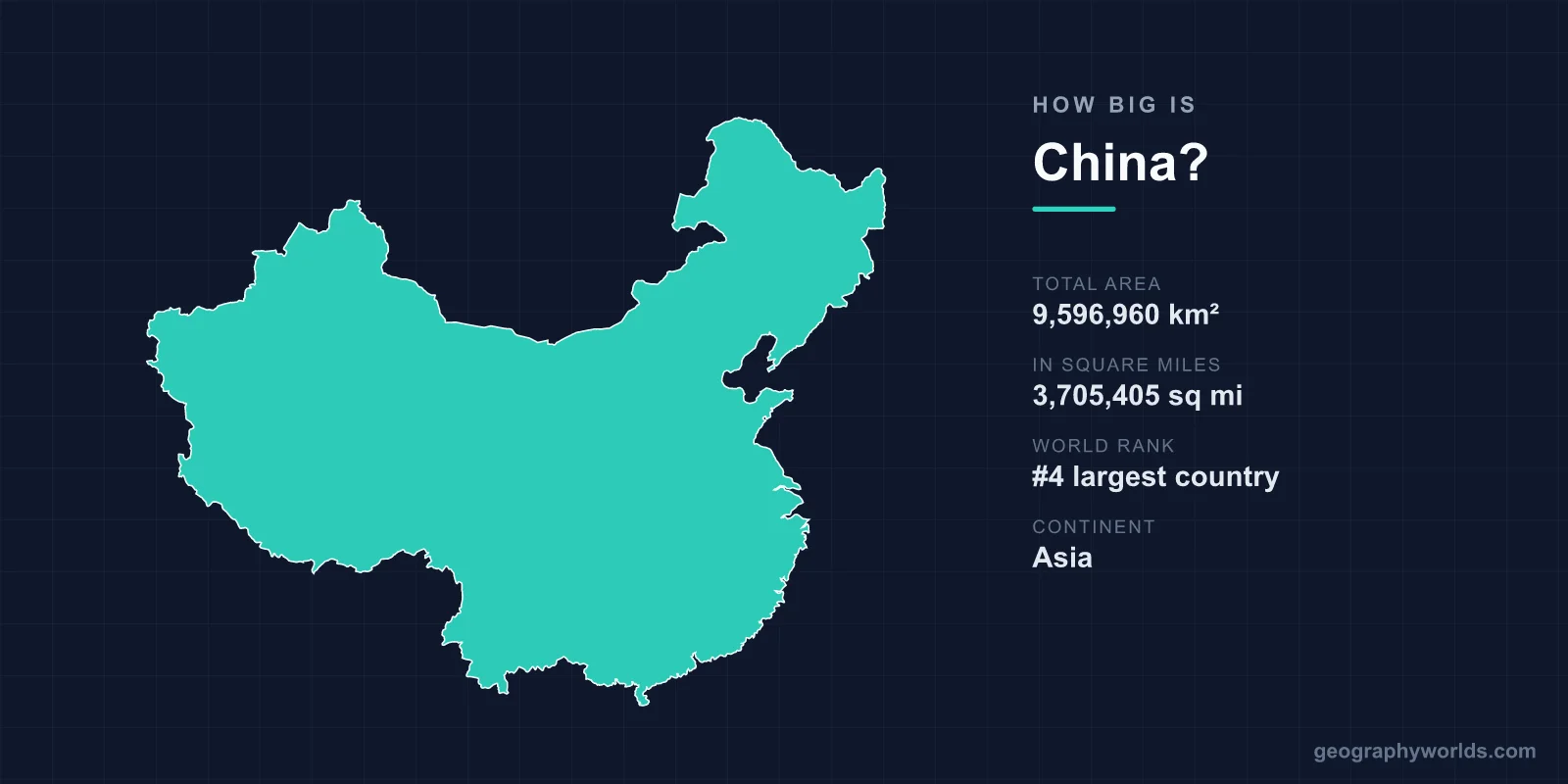
China covers about 9,596,960 km² (3,705,407 sq mi), the figure used by the CIA World Factbook and the United Nations, which makes it the third- or fourth-largest country in the world, behind Russia and Canada and neck and neck with the United States. It is the second-largest country by land area alone, after Russia. To put that in familiar terms, China is about 2.3 times the size of the European Union, almost three times the size of India, roughly 39 times the size of the United Kingdom, and only slightly smaller than the whole continent of Europe.
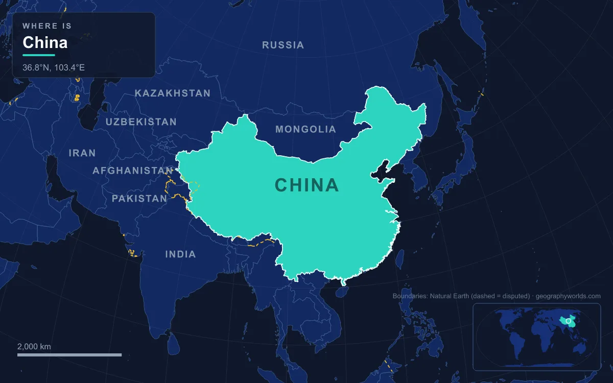
China’s Area in Figures: 9,596,960 km² and What It Leaves Out
The headline number breaks down into 9,326,410 km² of land and 270,550 km² of inland water, so lakes, reservoirs and rivers make up about 2.8% of the total. Poyang Lake in Jiangxi is the largest of the country’s freshwater lakes, and Qinghai Lake, the largest lake of any kind, gave its name to Qinghai province.
The Factbook total covers the territory the People’s Republic of China administers. It does not include Taiwan, which Beijing claims but which is governed by the Republic of China; it does not include Arunachal Pradesh, which India administers and China claims as South Tibet; and it leaves out the disputed islands of the South China Sea and all coastal and territorial waters. Aksai Chin and the Trans-Karakoram Tract, which China administers and India claims, are a separate source of disagreement between published figures. A map printed in Beijing and one printed in New Delhi will therefore not shade exactly the same area, and the total you see quoted can drift by tens of thousands of square kilometres depending on whose border line is used.
The outline is just as large in linear terms. China’s northernmost point lies in Mohe County, Heilongjiang, at 53°33′N, close to the Amur River. The undisputed southern tip is the coast of Hainan island south-east of Sanya at 18°09′N, so the country spans more than 35 degrees of latitude. From west to east it runs from Akto County in Xinjiang, on the Tajikistan border at 73°30′E, to Fuyuan in Heilongjiang, on the west bank of the Ussuri near its meeting with the Amur, at 134°46′E, a spread of more than 61 degrees of longitude. Along the way China borders 14 countries over 22,117 km of land frontier, and its coastline on the Bohai, Yellow, East China and South China seas is put at about 14,500 km by one measure and about 18,000 km by another, depending on how finely the shore is traced.

Third or Fourth? The China–United States Area Tie
Ask which is bigger, China or the United States, and the honest answer is that it depends on what you count. The US total has been redefined several times. From 1989 to 1996 it was listed as 9,372,610 km² of land and inland water; the Great Lakes and coastal waters were added in 1997, and territorial waters in 2007. Today the CIA World Factbook gives the United States 9,833,517 km², the UN Statistics Division gives 9,629,091 km², and Encyclopaedia Britannica gives 9,525,067 km², which includes the Great Lakes but not coastal or territorial waters.
China’s 9,596,960 km² sits inside that range. On the CIA and UN figures the United States comes out ahead and China ranks fourth; on the Britannica figure, the one that treats both countries the same way by leaving out coastal water, China is larger and ranks third. Because Beijing has never published an area for its own coastal and territorial waters, there is no like-for-like number that settles it. What is not in doubt is land: China has about 9.33 million km² of land against roughly 9.15 million km² for the United States, so on dry ground alone China is second in the world. Our United States vs China comparison sets the two side by side on population and economy as well.
Measured Against Europe, India and Australia
The European Union’s 27 members together cover 4,233,255 km², so China is about 2.27 times larger. The continent of Europe, from Portugal to the Urals, covers roughly 10,186,000 km²; China is about 94% of that, which means it would cover nearly all of Europe if laid over it. Against single countries the gaps widen quickly:
- India (3,287,263 km²): China is about 2.9 times larger.
- Australia (7,741,220 km²): China is about 1.24 times larger.
- The contiguous United States, the 48 states without Alaska and Hawaii (8,080,464 km²): China is about 1.19 times larger.
- Germany (357,581 km²): about 27 Germanys would fit inside China.
- Japan (377,915 km²): about 25 times over.
- Metropolitan France (551,500 km²): about 17 times over.
- The United Kingdom (244,376 km²): about 39 times over.
Xinjiang, Tibet and Inner Mongolia: Regions the Size of Countries
China is divided into 33 province-level divisions, and the three largest are each bigger than most nations. Xinjiang, in the far north-west, spans more than 1.6 million km², making it the eighth-largest country subdivision in the world and larger than the whole of Mongolia (1,564,116 km²). It borders eight countries, from Russia and Mongolia to Pakistan and India, and holds the Tarim Basin, whose Taklamakan Desert alone covers about 337,000 km², and the Dzungarian Basin to the north. Only about 9.7% of Xinjiang’s land is considered fit for habitation.
The Tibet Autonomous Region is the second-largest division at more than 1.2 million km², more than twice the area of metropolitan France. Inner Mongolia, stretching along two-thirds of the border with the country of Mongolia, comes third at roughly 1.2 million km². Together these three autonomous regions cover more than 4 million km², over two-fifths of China, and next in line is Qinghai, the largest unit that is a province rather than an autonomous region.
Much of that land sits on the Tibetan Plateau, the world’s largest and highest plateau. It covers about 2.5 million km² across Tibet, most of Qinghai, western Sichuan and parts of neighbouring countries, with an average elevation above 4,500 m (14,800 ft). The plateau gives China its vertical range as well as its horizontal one. Mount Everest, on the border with Nepal, was measured at 8,848.86 m (29,032 ft) in the joint Chinese–Nepalese survey of 2020. Ayding Lake in the Turpan Depression of Xinjiang lies 154 m (505 ft) below sea level, so the land surface of China spans more than 9,000 m from top to bottom.

One Clock From Kashgar to Fuyuan
A country 61 degrees of longitude wide would naturally straddle about five time zones, and China once planned for exactly that. In 1918 the Central Observatory of the Beiyang government proposed five zones, from Kunlun time (UTC+5:30) in the far west to Changpai time (UTC+8:30) in the north-east, and a 1939 conference in Chongqing adopted a version of the scheme. After the civil war ended in 1949–1950, regional governments outside Xinjiang and Tibet switched to the time used in Beijing, and the whole country now officially runs on Beijing Time, UTC+8. China is the largest sovereign state in the world with a single official time zone, and it has not used daylight saving since 1991.
The cost of that choice falls on the west. In Kashgar and the rest of Xinjiang the sun rises and sets far later by the clock than it does in Shanghai, and many residents keep a parallel Xinjiang Time, or Ürümqi Time (UTC+6), two hours behind Beijing and shared with neighbouring Kyrgyzstan. Shops and offices in Xinjiang commonly open from 10:00 to 19:00 Beijing Time, which is 08:00 to 17:00 by the local clock, and Xinjiang Television runs its Chinese channel on Beijing Time and its Uyghur and Kazakh channels on Xinjiang Time, so arranging a meeting often means saying which clock you mean. The story of how one clock came to cover the whole country is told in our piece on China’s single time zone.
Where 1.4 Billion People Fit: The Hu Line
China’s population stood at about 1.404 billion in 2025, according to official figures, which gives an average density of about 146 people per km². That average hides one of the most lopsided distributions on Earth. In 1935 the demographer Hu Huanyong drew a diagonal line across the map from Heihe on the Amur in Heilongjiang to Tengchong in Yunnan near the Myanmar border. As of 2015, the land east of the Heihe–Tengchong Line made up 43% of China’s territory but held 94% of its people; the 57% to the west held just 6%.
The line roughly follows the 400 mm annual rainfall boundary, which separates land wet enough for large-scale farming from semi-arid country suited mainly to herding. The terrain explains the rest. Mountains cover about 33% of China, plateaus 26% and hills 10%, leaving plains at only 12% and basins at 19%, and some of the largest basins, the Tarim among them, are filled with desert. Most of the population and farmland is packed into the North China Plain between Beijing, Shanghai and Yichang, the Northeast China Plain, the Yangtze valley and the Sichuan Basin, whose floor averages about 500 m above sea level.
So China’s size works in two ways at once. In the east it is a crowded country of plains and river deltas, with the Yangtze basin alone covering a fifth of China’s land and home to nearly a third of its people. In the west it is a thinly settled land of plateaus and deserts, where Xinjiang alone is more than twice the size of France. For a tour of the 22,117 km land frontier, neighbour by neighbour from North Korea to Afghanistan, see which countries border China.