
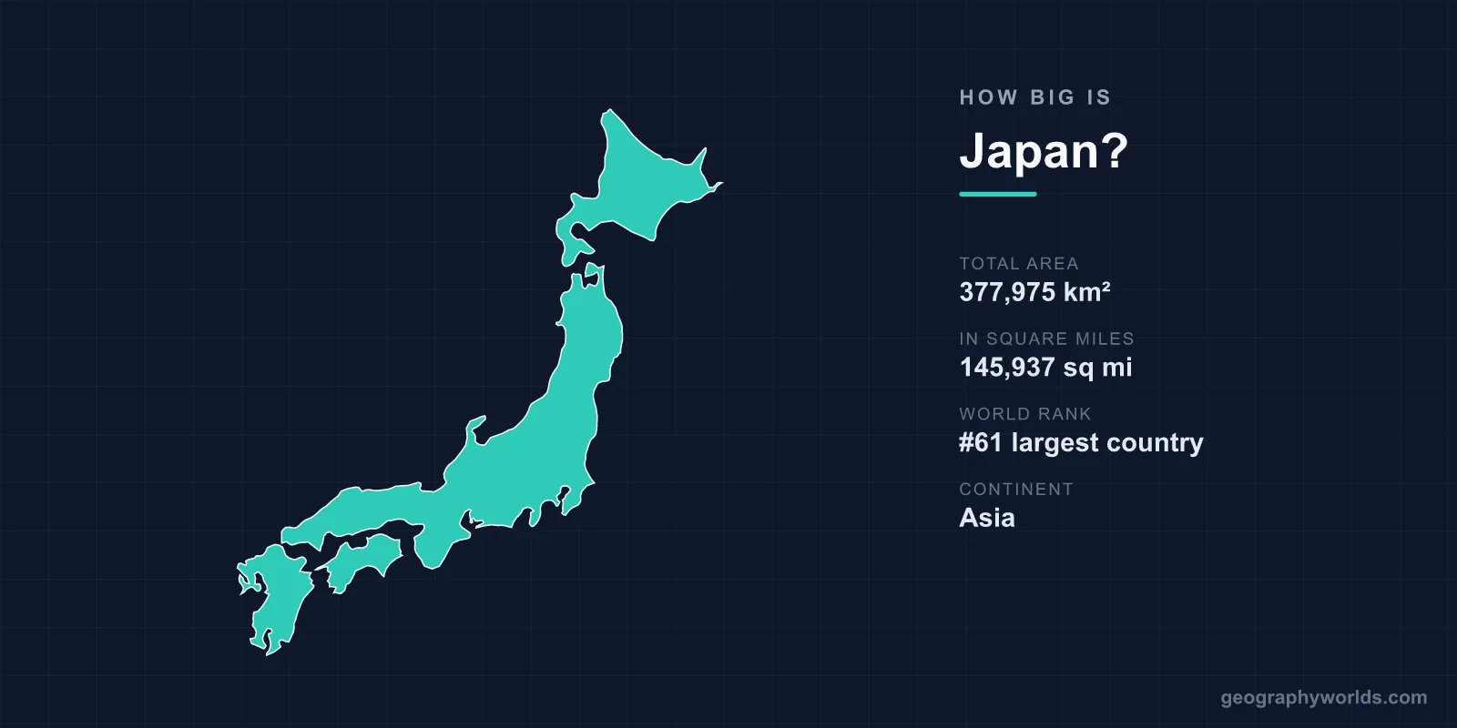
Japan covers about 377,975 km² (145,937 sq mi), according to the Geospatial Information Authority of Japan, which places it 62nd among the world's countries by total area on the list Wikipedia compiles from UN and CIA World Factbook data. That makes Japan slightly larger than Germany (357,581 km²), almost exactly the size of the US state of Montana (380,831 km²) and about 89% the size of California (423,967 km²). What the single figure hides is shape: the territory is split across 14,125 islands and stretches more than 3,000 km from the Sea of Okhotsk to the Philippine Sea, so a country of middling area spans a range of latitudes closer to that of a continent.
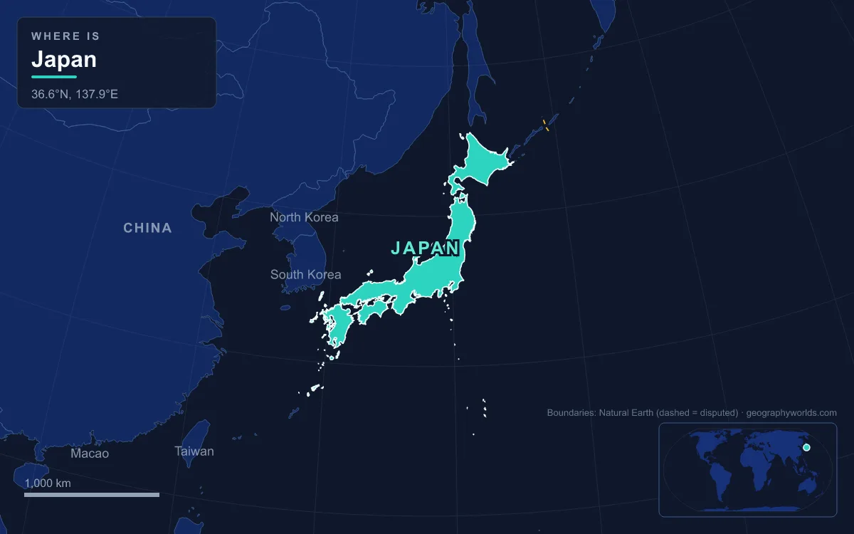
377,975 km²: How Japan Measures Its Own Territory
Japan's official area changes slightly from year to year, and the government publishes each new total. The Geospatial Information Authority of Japan (GSI) re-measures the national territory annually, and its figure grows slowly because of land reclamation, natural coastal uplift and volcanic eruptions such as those that have repeatedly enlarged Nishinoshima, a volcanic island about 940 km south of Tokyo. The GSI gave 377,975.24 km² in 2019 and 377,973.89 km² as of 1 July 2021. Of the 2021 total, about 364,546 km² is land and roughly 13,430 km² is inland water such as lakes and rivers. The CIA World Factbook, which most international rankings use, gives a slightly lower 377,915 km², and that is the number behind Japan's 62nd place.
Reclaimed ground, known in Japanese as umetatechi, accounted for about 0.5% of Japan's area as of 2014. That is close to 1,900 km², an area about the size of Kagawa, the smallest prefecture, built out over what used to be sea.
The island count also moved recently. For decades Japan was said to consist of 6,852 islands. In 2023 the GSI recounted using digital maps and arrived at 14,125, more than doubling the total without adding any meaningful area; the change came from counting on detailed digital maps rather than from new land. About 430 of the outlying islands are inhabited.
Honshu, Hokkaido, Kyushu and Shikoku by Size
Four islands hold almost all of Japan's land. Honshu, the "main province", covers about 228,300 km², roughly 60% of the country, and is the seventh-largest island on Earth, a little larger than Great Britain. It runs about 1,300 km from the Tsugaru Strait in the north to the Kanmon Straits opposite Kyushu and is only 50 to 230 km wide. Tokyo, Osaka, Nagoya, Kyoto and Hiroshima are all on Honshu, and 81% of Japan's people live there.
Hokkaido, north of the Tsugaru Strait, is the second-largest at about 77,700 km² and the 21st-largest island in the world. Hokkaido Prefecture is listed at 83,424 km² because, by Japanese reckoning, it also includes several smaller islands and the four southernmost Kuril Islands, which Russia administers and Japan claims. Kyushu, the most southerly of the four, covers about 36,800 km², and Shikoku, the smallest, about 18,400 km², a single island 225 km long that is divided into four prefectures.
Together the big four make up about 95% of Japan. Okinawa Island, the largest of the Ryukyu chain, adds only 1,207 km², about 106 km long and on average 11 km wide. The remaining few per cent is scattered across thousands of small islands, some of them very far from Tokyo. At prefecture level the gap between largest and smallest is huge: Hokkaido is more than 40 times the size of Kagawa, on Shikoku, which is the smallest of the 47 prefectures at 1,877 km².
Japan Next to Germany, Norway, Finland and the United Kingdom
Japan's nearest neighbours on the area table are a mixed group. Norway, counted with Svalbard and Jan Mayen, sits one place above at 386,224 km², and Zimbabwe (390,757 km²) and Paraguay (406,752 km²) are just above that. Directly below Japan comes Germany, which Japan exceeds by about 20,000 km², roughly 6%. Further down are the Republic of the Congo (342,000 km²), Finland (338,145 km²), Vietnam (331,340 km²) and Malaysia (330,621 km²), all within about 13% of Japan.
Against Western Europe, Japan is larger than it tends to look on a world map. It is about 25% bigger than Italy (302,068 km²) and about 55% bigger than the United Kingdom (244,376 km²); Honshu on its own is larger than the whole island of Great Britain. Within East Asia, Japan is the largest island country and roughly 3.8 times the size of South Korea (about 100,000 km²), while China is about 25 times larger. Among island countries worldwide, Japan ranks fourth by area.
Japan Against California, Montana and Texas
For a reader in the United States, Montana is the closest match. The two are within about 2,900 km² of each other, Montana being the slightly larger; the gap is less than 1% of either. California is about 46,000 km² bigger than Japan, so Japan is close to nine-tenths of California. Texas, at 695,662 km², is roughly 1.8 times the size of Japan, and the contiguous United States (8,081,869 km²) could hold Japan more than 21 times over.
The comparison changes completely once people are counted. Montana had 1,084,225 residents at the 2020 census; Japan had almost 123 million in 2025, more than a hundred times as many people on a slightly smaller area. Montana's plains and ranges are mostly open country, while Japan's population is packed into a thin band of coastal lowland. The two places are the same size on paper and nothing alike on the ground.
3,000 km From Benten-jima to Okinotorishima
Japan's extreme points explain why it feels bigger than its area. The territory extends from about 20° to 45° north and from 122° to 153° east. In the north, Cape Sōya on Hokkaido carries the monument to the northernmost point of Japan, although the true northern tip under Japanese control is Benten-jima, a small uninhabited island about 1 km to the northwest. Sakhalin in Russia is about 43 km away across La Pérouse Strait.

The southern extreme is Okinotorishima, a coral reef 1,740 km south of Tokyo and the only Japanese territory south of the Tropic of Cancer. Its dry land is under 10 m², protected by concrete casings, and China, South Korea and Taiwan dispute that it can support a 200-nautical-mile exclusive economic zone. To the west, Yonaguni in Okinawa Prefecture lies only about 107 km from Taiwan, and to the east Minamitorishima, a 151-hectare coral atoll, is the most isolated Japanese territory and the only one on the Pacific Plate.
Even the four main islands alone cover a wide span. Cape Sata, at the tip of Kyushu's Ōsumi Peninsula, lies just south of 31° north, roughly 14 degrees of latitude from Cape Sōya. That range is why Hokkaido has a humid continental climate with heavy winter snow while Okinawa and the Ogasawara Islands are subtropical, and it is why a train trip down the country, via the 53.85 km Seikan Tunnel under the Tsugaru Strait, crosses several climate zones.
Why 123 Million People Feel Crowded in 378,000 km²
Divide the population by the area and Japan has roughly 325 people per square kilometre, high but not extreme by world standards. The figure understates how crowded much of Japan is, because so little of the land is usable. About 73% of the country is mountainous, with ranges running down the spine of each main island, and 68.55% is forest, a share matched among developed countries only by Finland and Sweden. Only 11.2% of the land is suitable for cultivation.
The mountains rise to Mount Fuji, a stratovolcano of 3,776 m on Honshu, and include the Japanese Alps of central Honshu, formed by the Hida, Kiso and Akaishi ranges, several of whose peaks exceed 3,000 m. Japan has 108 active volcanoes, about a tenth of the world's total. Rivers are short and steep: the longest, the Shinano, runs only 367 km, and the largest freshwater lake, Lake Biwa in Shiga Prefecture, covers about 670 km².
The people therefore crowd onto coastal plains. Honshu had about 450 people per km² in 2010, while Hokkaido had just 64.5 per km² in 2016. Around 30% of the national population lives in the Greater Tokyo Area on the Kantō Plain, which at about 17,000 km² is the largest plain in Japan and still smaller than Shikoku. About 80 million city dwellers are concentrated on the Pacific coast of Honshu, and no point in Japan is more than 150 km from the sea.
A Sea Area Eleven Times the Land: Japan's Exclusive Economic Zone
Measured by the ocean it controls rather than by land, Japan is far larger. Its many far-flung islands give it a coastline of 29,751 km, the sixth-longest in the world, and an exclusive economic zone of about 4.47 million km², the eighth-largest anywhere and more than 11 times the land area. Minamitorishima alone supports an EEZ of 428,875 km², larger than all of Japan's land put together. The zone takes in the Sea of Japan coast facing the Korean Peninsula, which lies 190 km from Kyushu, the East China Sea, and a broad stretch of the Pacific beyond the Ogasawara Islands.
So the honest answer to how big Japan is depends on what is measured: a 62nd-place area the size of Montana, laid out along an arc more than 3,000 km long, with an ocean zone larger than the whole of India. The forty-seven units that divide it up are explained in our guide to how many prefectures Japan has, its highest summit has its own profile in Mount Fuji, Japan's tallest peak, and the closest European comparison is set out in the United Kingdom vs Japan comparison.