
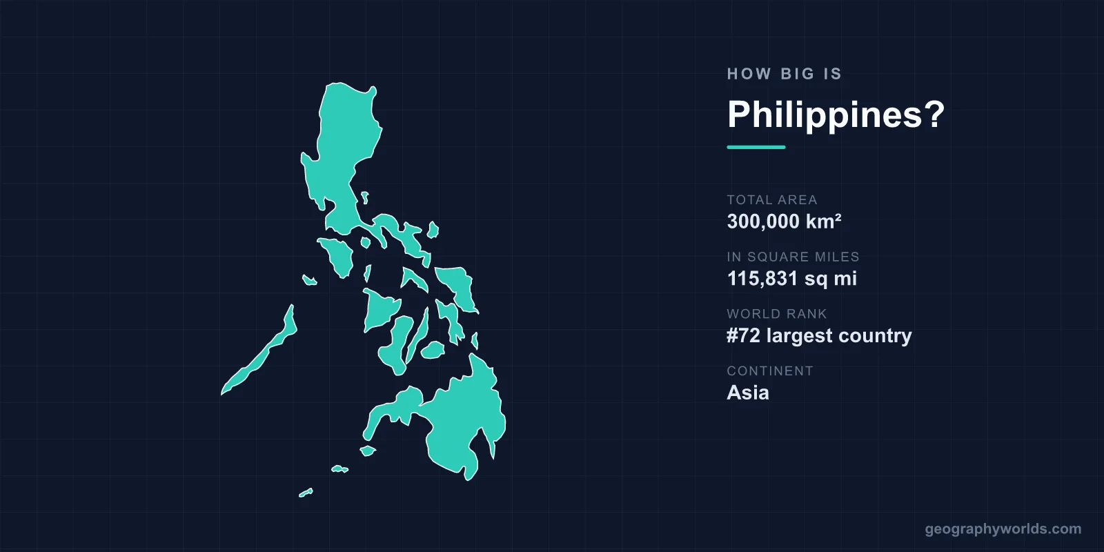
The Philippines covers about 300,000 km² (115,800 sq mi) of land, making it roughly the 72nd-largest country in the world. That is almost exactly the size of Italy, which is marginally larger, and slightly larger than Arizona or Ecuador. It is about 1.2 times the size of the United Kingdom. But the land is split among 7,641 islands spread across about 1,850 km of ocean from north to south, so the Philippines covers far more of the map than its land area suggests. Its exclusive economic zone at sea, about 2.2 million km², is more than seven times its land area.
The Philippines Next to Places You Know
| Place | Area | Compared with the Philippines |
|---|---|---|
| United Kingdom | ~243,600 km² | About 19% smaller |
| New Zealand | ~268,000 km² | About 11% smaller |
| Ecuador | ~283,600 km² | About 5% smaller |
| Arizona | ~295,200 km² | About 2% smaller |
| Italy | ~301,300 km² | Almost identical, marginally larger |
| Poland | ~312,700 km² | About 4% larger |
| Vietnam | ~331,200 km² | About 10% larger |
| Japan | ~378,000 km² | About 26% larger |
Japan is the most natural comparison, another long archipelago on the western Pacific Ring of Fire. Japan has about a quarter more land and a population only slightly larger, but its islands are fewer and much more tightly grouped, as our guide to how big Japan is shows.
7,641 Islands, and Counting
For decades schoolchildren learned that the Philippines had 7,107 islands. In 2016 the national mapping agency, NAMRIA, completed a new survey using satellite imagery and higher-resolution charts, and raised the count to 7,641. Most of the new ones are tiny islets and rocks. Only around 2,000 of the islands are inhabited, and many of the rest have no name.
Almost all the land is concentrated in a few large islands. Luzon, in the north, covers about 110,000 km², making it the fifteenth-largest island in the world, and it holds Manila and about half the population. Mindanao, in the south, covers about 97,500 km². Between them lie the Visayas, a cluster of mid-sized islands including Samar, Negros, Panay, Leyte, Cebu and Bohol, while the long, narrow island of Palawan reaches south-west towards Borneo. Luzon and Mindanao alone make up about two-thirds of the country's land. At the far northern end, the small Batanes islands lie closer to Taiwan than to Manila.
Treaty Lines and the Sabah Claim
The country's outline was fixed by colonial treaties. The islands were named Las Islas Filipinas after the future King Philip II of Spain by the explorer Ruy López de Villalobos in 1543, and Spain ruled them from Manila after 1571. In the 1898 Treaty of Paris, which ended the Spanish–American War, Spain ceded them to the United States for 20 million dollars. The treaty drew a large rectangle of lines around the archipelago, and those "treaty limits" still shape how the Philippines describes its territory at sea. Two small island groups outside the lines, Cagayan de Sulu and Sibutu, were added by a further treaty in 1900, and a 1930 agreement between the United States and Britain fixed the boundary with British North Borneo, leaving the Turtle Islands to the Philippines.
One old claim was never settled. Since 1962 the Philippines has maintained a dormant claim to Sabah, in northern Borneo, based on the historic rights of the Sultanate of Sulu. Sabah has been part of Malaysia since 1963, and the claim remains a periodic irritant between the two countries.
Much Bigger at Sea
Because the islands are so scattered, the Philippines stretches about 1,850 km from Y'ami Island, near Taiwan, to the islands of Tawi-Tawi near Borneo, and about 1,100 km from east to west. Its coastline, about 36,300 km, is one of the longest in the world, longer than that of the United States. Its exclusive economic zone covers roughly 2.2 million km². In 2012 the United Nations commission on the continental shelf also confirmed its claim to an additional area of seabed of about 135,000 km² east of Luzon, the Philippine Rise, formerly called Benham Rise.
To the west, its maritime claims are contested. In the South China Sea, which the Philippines calls the West Philippine Sea within its own zone, China claims most of the area inside its "nine-dash line". In July 2016 an international arbitration tribunal ruled that China's line had no basis in international law and that Chinese activities had violated the Philippines' sovereign rights within its zone. China rejected the ruling, and confrontations between Chinese and Philippine vessels around Scarborough Shoal and Second Thomas Shoal, where the Philippines keeps a handful of marines aboard a deliberately grounded warship, have continued since. In the Spratly Islands, the Philippines occupies around nine features, the largest of which, Pag-asa, has a small civilian community and an airstrip, and administers them as the municipality of Kalayaan, part of Palawan province. The wider dispute is explained in our guide to where the South China Sea is.
Built by Volcanoes, Hit by Typhoons
The Philippines sits on the Pacific Ring of Fire, where the Philippine Sea Plate is pushed beneath the islands. Just off the east coast, the Philippine Trench plunges to about 10,540 m, one of the deepest points in the world's oceans. On land, the country has around two dozen active volcanoes. Mount Mayon, with its near-perfect cone, rises 2,463 m above Albay province. Taal sits in a lake inside a larger flooded caldera south of Manila. Mount Pinatubo, on Luzon, produced the second-largest volcanic eruption of the twentieth century in June 1991. It threw so much sulphur into the stratosphere that average global temperatures fell by about half a degree Celsius for the next two years, and its ash forced the United States to abandon nearby Clark Air Base. The highest peak, Mount Apo on Mindanao, reaches 2,954 m.
The islands also lie in the path of the western Pacific's typhoons. About twenty tropical storms enter the country's area of responsibility in a typical year, and several make landfall. Typhoon Haiyan, known locally as Yolanda, struck the central Visayas in November 2013 with some of the strongest winds ever recorded at landfall and killed more than 6,000 people, most of them in the city of Tacloban.
Crossing the Country
The scattered map makes distances long. Manila to Davao, the largest city on Mindanao, is almost 1,000 km in a straight line, a journey that usually means a flight of under two hours or a day or more by road and ferry. Since 2003, a network of roll-on, roll-off ferry routes linked to the national highways has allowed trucks and buses to cross from island to island. The San Juanico Bridge, 2.2 km long and opened in 1973, links Samar and Leyte and was for decades the country's longest bridge.
The climate is tropical everywhere, with a wet season from about June to November and a drier season through the rest of the year, but it changes with height and exposure. The Pacific-facing east coasts get the most rain. Baguio, in the Cordillera at about 1,500 m, is cool enough that the American colonial government built it as a "summer capital" in the early 1900s, and Filipinos still go there to escape the lowland heat.
112 Million People on a Crowded Map
The 2024 census counted about 112.7 million Filipinos, an average density of about 375 people per km², higher than Japan's or Vietnam's. As with its land, the population is unevenly spread. Metro Manila, a region of sixteen cities and one municipality covering about 620 km², is home to about 14 million people, and the city of Manila proper, at under 43 km², is one of the most densely populated cities on Earth. Metro Cebu in the Visayas and Davao on Mindanao are the next largest urban areas. About 10 million more Filipinos live or work abroad. The country is divided into 18 regions, after the Negros Island Region was re-created in 2024, and 82 provinces.
Its size is often underestimated because maps drawn on the Mercator projection, and the country's position at the edge of Asia, make it look smaller than it is. With more than 110 million people, the Philippines has a larger population than any European country except Russia, and one of the largest in Asia.
Landscapes on a Small Scale
The number of islands packs a remarkable range of landscapes into a small total area. On Bohol, more than a thousand symmetrical limestone mounds form the Chocolate Hills, named for the brown colour they turn in the dry season. In the Cordillera of northern Luzon, the Ifugao people carved rice terraces into the mountainsides. They are traditionally said to be 2,000 years old, though recent archaeology suggests many were built only a few centuries ago, and they are now a World Heritage Site. Palawan has the Puerto Princesa Subterranean River, which flows for more than 8 km through a cave to the sea, and the Tubbataha Reefs, an atoll far out in the Sulu Sea, both of them World Heritage Sites. Those islands are home to one of the most distinctive religious landscapes in Asia too, as our guide to religion in the Philippines describes.