
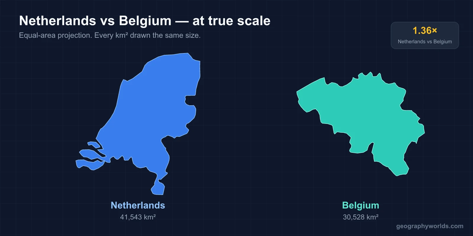
The Netherlands is roughly 41,500 km² and home to about 18 million people; Belgium is roughly 30,700 km² with about 11.8 million. The Netherlands is therefore about a third larger and holds around half again as many people, but Belgium is the denser of the two only marginally — both rank among the most crowded countries in Europe. The differences that actually matter are not size but water, language and the way each state is put together.
Two Countries That Were One, Twice
Belgium and the Netherlands are not neighbours that drifted together; they are fragments of the same historical unit. The Low Countries were assembled under the Dukes of Burgundy in the fifteenth century and passed to the Habsburgs. The Dutch Revolt of the late sixteenth century split them: the seven northern provinces became the Protestant Dutch Republic, while the south stayed Catholic and Spanish, later Austrian.
The Congress of Vienna stitched them back together in 1815 as the United Kingdom of the Netherlands, a buffer state against France. It lasted fifteen years. The Belgian Revolution of 1830 broke it apart again, largely over religion, language and the northern king's handling of both, and Belgian independence was recognised in 1839. Luxembourg detached in the same settlement.
That shared-then-severed history explains a lot of what follows. The two share a language across the border — Dutch is spoken in the Netherlands and in Flanders — but almost nothing about how the two states organise themselves.
Where the Land Is, and How Much of It Was Made
The single largest physical difference is elevation. The Netherlands is extraordinarily flat: roughly a quarter of its land area lies below sea level, and the lowest point, near Nieuwerkerk aan den IJssel, is about seven metres below it. The highest point, the Vaalserberg where the Dutch, Belgian and German borders meet, reaches only about 322 metres — and even that is on the southern tip of Limburg, well away from the core of the country.
Belgium climbs. The coastal plain and the Flemish lowlands in the north resemble the Netherlands closely, but south of the Sambre–Meuse valley the land rises into the Ardennes, a forested upland of old, worn rock. The Signal de Botrange in the High Fens reaches about 694 metres — more than double the Dutch maximum, and the terrain around it is genuinely hilly, with deep river valleys and winter snow.
The Dutch flatness is not entirely natural. Centuries of drainage, dyking and pumping have added a large amount of land: the Zuiderzee Works closed off an inland sea and created the province of Flevoland out of the seabed, and the Delta Works in the southwest sealed the estuaries after the catastrophic North Sea flood of February 1953, which killed over 1,800 people in the Netherlands alone. Belgium has coastal defences too, but it has nothing on that scale — its coastline is only about 67 kilometres long, against roughly 450 kilometres of Dutch coast.
One Language Border, Two Very Different Politics
Belgium is divided by a language frontier that runs roughly west to east across the country. North of it, Flanders speaks Dutch; south of it, Wallonia speaks French; a small German-speaking community sits in the east near the border. Brussels, geographically inside Flanders, is officially bilingual and in practice majority French-speaking.
This is not a cultural footnote — it is the architecture of the Belgian state. Successive reforms from 1970 onward converted Belgium from a unitary kingdom into a federation of Regions (Flanders, Wallonia, Brussels-Capital) and Communities (Flemish, French, German-speaking), with overlapping competences. Belgian government formation is correspondingly slow; the country holds the world record for time without an elected federal government, 541 days between 2010 and 2011, and went through a second long stretch in 2019–20.
The Netherlands has a language minority too — West Frisian is an official language in the province of Friesland — but it has no comparable territorial cleavage. It is a decentralised unitary state with twelve provinces, and its coalition politics, while famously protracted, do not run on linguistic lines.
The border between the two produces one genuine curiosity: the town of Baarle-Hertog and Baarle-Nassau, where Belgian and Dutch parcels are interleaved so finely that the frontier runs through houses and front doors are labelled with the country they open into.
Capitals, Ports and Where the Money Sits
Both countries separate their capital from their largest commercial engine, but in opposite directions. Amsterdam is the constitutional capital of the Netherlands while the government, parliament and royal residence sit in The Hague — which also hosts the International Court of Justice and the International Criminal Court. Rotterdam, meanwhile, is the working port: for decades the busiest in the world, and still by a wide margin the busiest in Europe, handling well over 400 million tonnes a year.
Brussels is both Belgium's capital and its institutional centre of gravity, hosting the European Commission, the Council of the European Union and NATO headquarters. Antwerp is the port, second in Europe after Rotterdam and historically the great trading city of the Low Countries before the Dutch closed the Scheldt to it in the seventeenth century.
- Area: Netherlands ~41,500 km² · Belgium ~30,700 km²
- Population: Netherlands ~18 million · Belgium ~11.8 million
- Highest point: Vaalserberg ~322 m · Signal de Botrange ~694 m
- Coastline: ~450 km · ~67 km
- Official languages: Dutch (plus Frisian regionally) · Dutch, French, German
- Currency: euro in both; both are founding EU members and part of Benelux
Climate, Rivers and the Delta They Share
Both have a temperate maritime climate — mild, damp, heavily influenced by the North Sea, with rainfall spread across the year rather than concentrated in a wet season. Neither gets reliably hot summers or hard winters near the coast. The Ardennes are the exception: high enough to be several degrees colder, wetter and snowier than anywhere in the Netherlands.
The two share a river system. The Meuse rises in France, crosses Wallonia through Namur and Liège, and then forms part of the Dutch–Belgian border before joining the Rhine–Meuse–Scheldt delta. The Scheldt rises in France, runs through Belgium past Antwerp, and reaches the sea through Dutch territory — an arrangement that has been a source of friction between the two for four centuries and is still governed by negotiated treaties on dredging and flood management.
Population distribution differs too. The Dutch Randstad — the ring of Amsterdam, Rotterdam, The Hague and Utrecht around a green interior called the Green Heart — concentrates roughly half the national population in one conurbation, deliberately kept from merging into a single sprawl. Belgium instead has the Flemish Diamond, a looser quadrilateral of Brussels, Antwerp, Ghent and Leuven, plus a separate post-industrial belt along the Sambre-Meuse where Wallonia's coal and steel economy once sat. Wallonia's slower recovery from that industrial decline is the main reason Flemish GDP per head has run meaningfully ahead of Walloon for decades, and it feeds directly back into the federal politics described above.
How the Pair Compares to Denmark and Switzerland
Set the Netherlands and Belgium beside two other small, wealthy European states and the pattern sharpens. Denmark is close to Belgium in area (~43,000 km², so nearer the Dutch figure) but has only about 6 million people, so its density is roughly a third of either. It shares the Dutch maritime flatness — its highest point is under 200 metres — but not the reclaimed-land engineering or the population pressure.
Switzerland is the mirror image: similar population to Belgium at around 9 million, comparable prosperity, and like Belgium it is multilingual and federal. But Switzerland manages four languages across 26 cantons without Belgium's bipolar deadlock, largely because no single language group can dominate and because direct democracy distributes decisions differently. Switzerland is also landlocked and mountainous, with the Dufourspitze at 4,634 metres — fifteen times the Dutch maximum.
What the Netherlands and Belgium have that Denmark and Switzerland do not is the delta: two of Europe's three busiest ports within 100 kilometres of each other, at the mouth of a river system draining much of the continent's industrial core. That geography, more than area or population, is what both countries are actually built around.
Choosing Between Them as a Visitor
They are easy to combine — Amsterdam to Brussels is under two hours by high-speed train, and Antwerp sits roughly between them. If the draw is water, windmills, cycling infrastructure and the engineered landscape, the Netherlands delivers it more completely; the Kinderdijk mills and the Delta Works are legible from a bicycle. If it is medieval urban fabric, the Netherlands has Delft and Utrecht but Belgium has Bruges, Ghent and Leuven at a density that is hard to match.
For food and drink the gap is wider than the distance suggests: Belgium's brewing tradition, with Trappist abbey beers and lambics that exist nowhere else, has no Dutch counterpart. For a closer look at the physical make-up of the northern half of the pair, the Netherlands geography overview goes further into the provinces, polders and flood defences.