

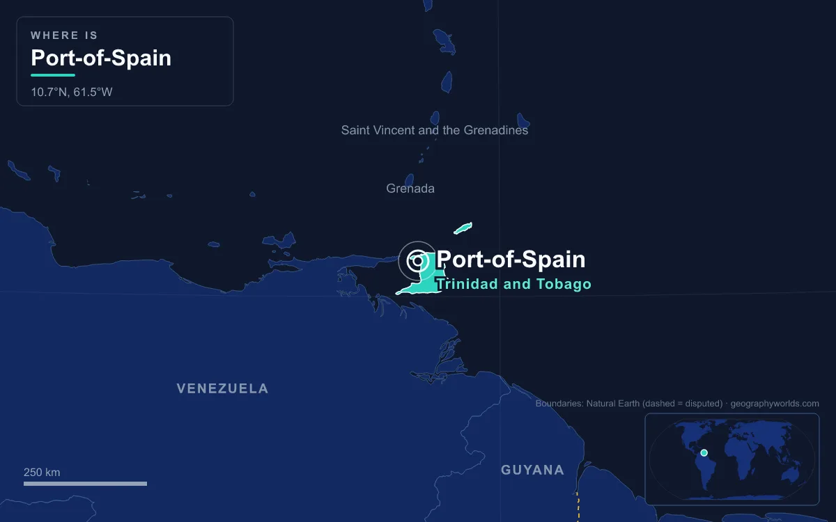
Just 37,074 people lived inside the boundaries of Port of Spain at the 2011 census, yet it is the capital and chief port of Trinidad and Tobago. The city sits on the Gulf of Paria on the northwest coast of Trinidad, an island only about 11 kilometres off the coast of Venezuela, and by resident count it is merely the country’s third-largest municipality, after Chaguanas and San Fernando. Yet roughly 250,000 people pour into it on a working day, and it anchors a built-up corridor of around 600,000 people that runs east to Arima. That gap between a modest resident count and an outsized role is what defines Port of Spain, and it shows up in almost every number you can put beside it.
Ten Square Kilometres Against Trinidad’s 4,768
Port of Spain covers roughly 10.4 square kilometres, wedged between three hard edges: the Gulf of Paria to the south and west, the forested slopes of the Northern Range to the north, and the Caroni Swamp to the south. The country as a whole measures about 5,128 square kilometres, of which the island of Trinidad accounts for 4,768. The capital therefore occupies around one five-hundredth of the national territory while holding its parliament, its central bank, its stock exchange and most of its ministries.
Much of the downtown grid is not even original land. The first Spanish buildings in the 16th and 17th centuries stood among mangroves and tidal mudflats. From 1803 onward the town grew southwards by filling the foreshore with earth carted from the Laventille Hills, with further rounds of reclamation in the 1840s, the 1870s and 1906. In 1935 the Deep Water Harbour Scheme dredged the waters off the western neighbourhoods and created the reclaimed strip known as Docksite, which housed United States forces during the Second World War. Wrightson Road, linking downtown to the western suburbs, was built at the same time.
The Northern Range, whose highest summits, El Cerro del Aripo and El Tucuche, rise above 900 metres, forms the city’s northern wall. The protected Caroni Swamp, 3,278 hectares of mangrove and the island’s second-largest wetland after the Nariva Swamp, has blocked growth to the south. With the sea on one side, mountains on another and swamp on a third, the city could only spill east, which is exactly what it did.
37,074 Residents and a Quarter of a Million Commuters
The census count has been falling. Between the censuses of 2000 and 2011 it dropped at an average rate of 2.3 percent a year, and the 2011 count broke down as 18,008 men and 19,066 women in 12,333 households. At its peak in the 1960s the city held about 100,000 people. Since then, offices, banks and shopping arcades have pushed housing out of the centre, and families have moved to the suburbs and to the towns along the Eastern Main Road.
Those towns now form the East–West Corridor, a continuous urban strip stretching 24 kilometres from the capital to Arima. It takes in Barataria, San Juan, St. Joseph, Curepe, St. Augustine, Tunapuna, Tacarigua and Arouca, once separate settlements and now districts of a single conurbation of around 600,000 people. Congestion is the price: the corridor runs between the Churchill–Roosevelt Highway and the foothills of the Northern Range, and at peak hours downtown is hard to reach, which is why large shopping centres such as Trincity Mall and Grand Bazaar grew up at highway junctions instead.
Port of Spain Versus San Fernando and Chaguanas
Trinidad and Tobago is one of a group of countries whose capital is not its biggest place, a pattern explored in our list of capital cities that are not the largest city. Chaguanas, in west-central Trinidad, counted 83,489 people in 2011, more than twice the capital’s total. It stayed a minor sugar town near the Woodford Lodge refinery until the 1980s, when cheaper housing and bargain shopping drew people in; it became a borough only in 1990 and is now the fastest-growing municipality in the country and a centre of Indo-Trinidadian culture.
San Fernando, known locally as Sando, is the real rival in character. It covers about 19 square kilometres on the flanks of San Fernando Hill in the southwest, had 48,838 residents in 2011, and became a city corporation on 18 November 1988. It is called the country’s industrial capital because of its closeness to the Pointe-à-Pierre oil refinery and to the petrochemical, LNG, iron and steel plants of Point Lisas and Point Fortin. Its tallest building is the 18-storey San Fernando Teaching Hospital. Port of Spain, by contrast, has no heavy industry at all, yet it has the skyline: the Nicholas Tower and the other downtown towers are among the tallest in the Caribbean.
The split is almost a division of labour. Oil and gas are extracted and processed in the south, but the companies that run them, including BPTT, Atlantic LNG, EOG Resources and Repsol, keep headquarters in the capital to be near the ministries. Two of the largest banks in the region, Republic Bank and RBTT, are based in Port of Spain, and the Trinidad and Tobago Stock Exchange trades there. The Port of Port of Spain is the country’s main port for containerised shipping, followed by the Port of Point Lisas.

Gulf of Paria Heat, Northern Range Rain
Port of Spain lies about 10.7 degrees north of the equator and has a tropical monsoon climate. Monthly mean temperatures at Piarco International Airport, the reference station for the capital, vary by less than two degrees across the year, from 26.6°C in January to 28.5°C in May and September. Temperatures usually sit between 19°C and 34°C and rarely go beyond 35°C or below 17°C. Because the Northern Range shelters the city, it is somewhat cooler than Chaguanas and San Fernando, and temperature inversions are common in the valleys on its northern edge.
Rain is where the contrast lies. The dry season runs from January to April, when March averages just 40.6 millimetres. The wet season follows from May to December, and August brings 255.3 millimetres, more than six times the March figure. Of the roughly 1,801 millimetres that fall in an average year, more than 80 percent arrives in those eight wet months. Trinidad’s southerly position also keeps it outside the main hurricane track, so the country sees fewer hurricanes than most of the Caribbean.
From 3,000 People in 1786 to a 1960s Peak
The capital was not always here. The Spanish seat of government was San José de Oruña, today’s Saint Joseph, about 11 kilometres inland. By 1757 it had fallen into disrepair, and Governor Pedro de la Moneda moved his residence to the port, which became the de facto capital. The last Spanish governor, José María Chacón, forced the island’s governing council, the Cabildo, to follow. The 1783 Cedula of Population, which invited French Catholic settlers, set off rapid growth: eleven streets were laid out westward from the foot of the Laventille Hills to the St. Ann’s River, the grid that still shapes downtown, and by 1786 the town had about 3,000 inhabitants. In 1787 Chacón diverted the flood-prone St. Ann’s River to the east so the town could expand north and west over the cane fields.
Ten years later, in 1797, a British force under General Sir Ralph Abercromby landed at what is still called Invaders Bay, and Chacón, outgunned, surrendered on negotiated terms. A fire in 1808 destroyed the wooden town, after which government buildings were rebuilt in brick. In 1817 the town council bought the former Peschier sugar estate that became the Queen’s Park Savannah. Port of Spain was formally proclaimed a city in 1914, served as the temporary capital of the West Indies Federation from 1958 to 1962, and remained the capital when Trinidad and Tobago became independent in 1962 and a republic in 1976.

The Savannah is the other big number in the city. It covers about 110 hectares of level ground, and the road around its perimeter runs roughly 3.5 kilometres, which is why it is often described as the largest roundabout in the world. Along its western edge on Maraval Road stand the Magnificent Seven, a row of late Victorian and Edwardian mansions that includes Queen’s Royal College, Whitehall and Stollmeyer’s Castle. On its southern side the Grand Stand becomes the centre of Carnival, hosting the Parade of Bands and the Panorama steelpan finals.
Scarborough, Laventille and the Rest of Trinidad and Tobago
In and around the capital, the contrasts are sharp over short distances. St. Clair, between the Savannah and the Maraval River, holds grand mansions and Federation Park. East of the Savannah, at the foot of the Laventille Hills, Belmont, the city’s first suburb, with 9,035 residents, was partly settled in the 1840s and 1850s by Africans freed by the Royal Navy from illegal slave ships and later became known as the Black St. Clair. Beyond the St. Ann’s River, the working-class hillsides of Laventille are widely credited as the birthplace of the steelpan. St. James, the last district incorporated into the city, has been the centre of Port of Spain’s Indian community since the late 19th century and is its main nightlife strip. Woodbrook, a former Siegert family sugar estate sold to the Town Board in 1911, is known for its gingerbread houses.
Across the sea, Tobago runs on a different scale. Its main town, Scarborough, had an estimated 17,537 people in 2011 and became Tobago’s capital in 1769, long before the two islands were joined under British rule in 1889. Fort King George overlooks its harbour, a deepwater port only since 1991, and a ferry service operated through the Port of Port of Spain links the two islands. For the country as a whole, with an estimated 1.4 to 1.5 million people in the mid-2020s, about 35 percent of them of Indian descent, 34 percent of African descent and 23 percent of mixed heritage, Port of Spain remains the place where government, money and Carnival meet.
Those numbers explain why a city of fewer than 40,000 registered residents hosted the Fifth Summit of the Americas in 2009 and matches in the 2007 Cricket World Cup at the Queen’s Park Oval, a ground with around 20,000 seats that has staged more Test matches than any other in the Caribbean. For more on the islands beyond the capital, from Tobago’s reefs to Trinidad’s oil fields, read our Trinidad and Tobago country guide, or settle the long-running question of whether Trinidad and Tobago belongs to North or South America.
Quick Facts About Port Of Spain
- Country: Trinidad And Tobago
- Continent: North America (Caribbean)
- Country population: approximately 1.5 million
- Capital city status: Port Of Spain is the capital of Trinidad And Tobago, the seat of national government, and the location of foreign embassies, parliament, and the head of state's official residence.
Frequently Asked Questions
What is the capital of Trinidad And Tobago?
The capital of Trinidad And Tobago is Port Of Spain. Port Of Spain is the seat of national government, hosts most foreign embassies and consulates, and is typically where the head of state and parliament are located.
What continent is Port Of Spain in?
Port Of Spain, the capital of Trinidad And Tobago, is located in North America, in the Caribbean region. As Trinidad And Tobago's capital, Port Of Spain serves as the country's primary connection to the broader North American political, economic, and cultural sphere.
Why is Port Of Spain the capital of Trinidad And Tobago?
Port Of Spain was chosen as the capital of Trinidad And Tobago for reasons that typically combine geography, history, and politics. Capital city selections often reflect a desire for centrality (being accessible from across the country), historical importance (being a longstanding seat of government or culture), or neutrality (being acceptable to multiple regions or ethnic groups within the country). The specific reasons for Port Of Spain's designation are detailed in the city's history above.
What is Port Of Spain known for?
As the capital of Trinidad And Tobago, Port Of Spain is best known for housing the country's central government institutions — parliament, presidential or royal residences, supreme court, and key ministries. It is also typically a major cultural and economic center within Trinidad And Tobago, hosting national museums, embassies, and signature monuments. The introduction and history sections above provide detailed coverage of the city's specific notable institutions and landmarks.
Related Pages
- Trinidad and Tobago Country Guide — full geography, climate, economy, and culture overview
- Flag of Trinidad and Tobago — meaning, history, and design of Trinidad and Tobago's national flag