
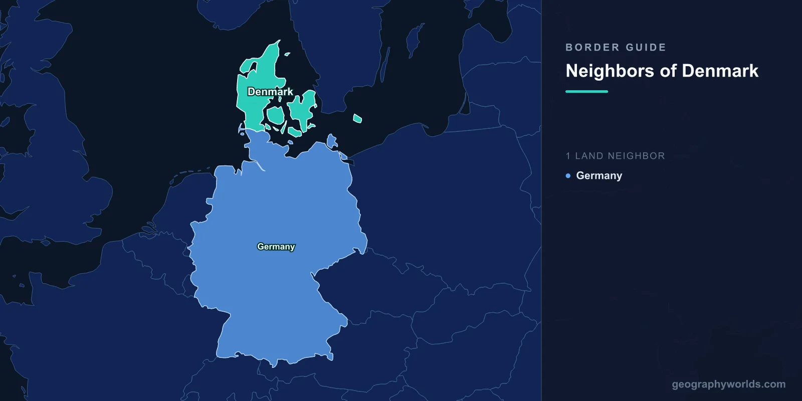
Denmark has a single land neighbour: Germany. The two states meet across the neck of the Jutland peninsula, on a frontier the CIA World Factbook lists at 140 km, though only about 68 km of it is dry land — the rest runs through the tidal waters of the Wadden Sea in the west and Flensburg Firth in the east. Sweden and Norway are close enough to see on a clear day, but neither touches Denmark by land. Sweden is reached over the Øresund Bridge, a fixed link rather than a border you can walk across, and Norway lies beyond the Skagerrak.
One neighbour, then, and a short one. What makes it worth knowing is that this may be the only international boundary in Europe that was drawn by counting votes rather than casualties — and that the Kingdom of Denmark quietly acquired a second land border in 2022, roughly 3,000 kilometres from Copenhagen.
Artillery Drew It First, and Got It Wrong
People have been fortifying this neck of land for well over a thousand years. The Danevirke, an earthwork rampart begun in the eighth century and extended repeatedly through the Viking age, runs east–west across southern Jutland some 40 km south of the modern boundary, near the trading town of Hedeby. It was built precisely because the peninsula narrows here to a width an army could defend, and for centuries the Eider river a little further south marked the northern limit of the Holy Roman Empire. Danish troops were still digging into the Danevirke's line in the winter of 1864, which gives some sense of how persistently this corner of Europe has been treated as a frontier.
Until 1864 the Danish crown ruled the duchies of Schleswig, Holstein and Lauenburg, stretching Danish authority deep into what is now Germany. The Second Schleswig War ended that. Prussian and Austrian forces broke the Danish line at Dybbøl on 18 April 1864 — a defeat still taught in Danish schools as a national trauma — and the Treaty of Vienna of 30 October 1864 stripped Denmark of all three duchies. The country lost around two-fifths of its territory and roughly a third of its population in a single season.
The problem was that the new line was purely military. It cut straight across a region where Danish and German speakers lived interleaved, village by village, with no clean linguistic frontier to follow. Article V of the 1866 Treaty of Prague even promised the people of North Schleswig a vote on returning to Denmark; Prussia and Austria formally cancelled the promise in 1878 without ever holding it.
Then the Voters Redrew It
Germany's defeat in 1918 reopened the file. Articles 109 to 114 of the Treaty of Versailles — the same settlement that returned Alsace-Lorraine to France — required plebiscites in Schleswig, this time actually held. The territory was divided into zones, and the rules differed between them in a way that decided the outcome before a single ballot was cast.
| Zone | Date of vote | How votes were counted | Result |
|---|---|---|---|
| Zone I (North Schleswig, Tønder to Haderslev) | 10 February 1920 | As a single bloc | About 75% for Denmark — transferred in full |
| Zone II (Flensburg and central Schleswig) | 14 March 1920 | Parish by parish | About 80% for Germany — no parish voted Danish |
| Zone III (south of Flensburg) | Never held | — | Abandoned as pointless; remained German |
The bloc-versus-parish distinction mattered enormously. Zone I contained German-majority towns that would have stayed German under parish counting; Zone II contained a real Danish minority in Flensburg that was outvoted locally. The line that emerged was a compromise nobody had drawn on a map beforehand — it fell out of the arithmetic.
North Schleswig formally transferred to Denmark on 15 June 1920, a date Danes call Genforeningen, the Reunification. On 10 July, King Christian X rode a white horse across the old frontier at Frederikshøj, an image reproduced on everything from postage stamps to butter tins ever since. The border established that summer has not moved by a metre in more than a century, which is an unusual record for this part of Europe.
Two Minorities, and a Party That Ignores the 5 Percent Rule
Drawing a line through mixed settlement leaves people on the wrong side of it, and both countries decided, eventually, to stop treating that as a problem to be solved. The Bonn–Copenhagen Declarations of 29 March 1955 are the reason. Signed as West Germany joined NATO, the parallel statements guaranteed each minority the right to its own language, schools, press and political organisation, and — critically — established that declaring your identity was a private matter that no authority could verify or challenge.
The results are still visible. Around 15,000 people in the Danish border region identify as German, supported by the newspaper Der Nordschleswiger and represented politically by the Schleswig Party. On the German side, a Danish minority estimated at 50,000 runs its own school network, its own daily paper in Flensborg Avis, and its own party: the Südschleswigscher Wählerverband, or SSW. Because German electoral law exempts recognised national minority parties from the 5 per cent threshold, the SSW can win representation on a share of the vote that would eliminate anyone else. It took a Bundestag seat in the 2021 federal election — its first since 1953 — with a national vote share well under one per cent.
Sixty-Eight Kilometres of Fence, Built for Pigs
In 2019 Denmark did something no one had done to that frontier since 1920: it built a fence across the whole of it. Not for people. For wild boar.
African swine fever had been advancing westward through central Europe, and Denmark's pork industry is not a minor sector — the country raises well over 30 million pigs a year against a human population under six million, and exports the overwhelming majority. A single confirmed case in a Danish herd would have closed non-EU export markets overnight, with losses estimated in the billions of kroner. Wild boar are the classic vector, and Denmark's own boar population was small enough to keep at zero if nothing wandered in from Schleswig-Holstein.
So the Danish state fenced the entire land boundary: about 68 km of galvanised mesh, 1.5 metres high, sunk half a metre into the ground, completed in December 2019, with roughly twenty openings where roads and railways cross. Ecologists objected that it obstructed deer, otters and other wildlife along a corridor that had been open for a century; veterinarians countered that the calculation was insurance, not biology. African swine fever never reached Denmark. Whether the fence deserves the credit is a question the two professions still answer differently.
What Actually Crosses at Padborg and Kruså
For a border this short, the traffic across it is disproportionate. Padborg, immediately north of the line, is one of northern Europe's largest road-freight hubs, a town essentially built around customs clearance, logistics yards and truck parking. The E45 motorway crossing at Frøslev–Ellund carries the main artery between Scandinavia and the continent, which means Denmark's only land border is also the funnel through which a large share of Norwegian and Swedish overland trade reaches Germany and its nine neighbours.
Alongside the freight runs one of Europe's most enthusiastic border-shopping cultures. Danes drive to Flensburg and the Grenzhandel shops just south of Kruså for beer, soft drinks, sweets and anything else carrying heavy Danish duty; Germans come north for Danish groceries and holiday houses on the west coast. Denmark also reintroduced temporary identity checks at the German border on 4 January 2016 during the migration crisis and has renewed them repeatedly since, making this one of the longest-running suspensions of Schengen's open-border rule anywhere in the bloc.
The Second Border, Three Thousand Kilometres North
Here is the fact that spoils every neat answer. The Kingdom of Denmark includes Greenland, and in the Nares Strait between Greenland and Canada's Ellesmere Island sits Hans Island — Tartupaluk in Greenlandic — a barren rock of about 1.3 square kilometres claimed by both states since 1973. For decades the dispute was conducted by leaving bottles of spirits and national flags for the other side's visiting patrol to find, which is how it acquired the name the Whisky War.
On 14 June 2022 Denmark and Canada settled it by dividing the island along a natural fissure. That agreement created a land boundary roughly 1.3 km long between the two countries — Canada's second land border after the United States, and Denmark's second after Germany. On the standard reference lists Denmark still shows one neighbour, because those lists count metropolitan Denmark rather than the Realm. On the ground, in the Arctic, there is now a second.
A Short Line With a Long Memory
Denmark's frontier is worth knowing not for its length but for its method. Almost every European border of its generation was set by treaty negotiators, occupying armies or exhausted diplomats working from maps. This one was set by two rounds of voting in February and March 1920, has not shifted since, and is policed today mainly against a pig disease. If you want to test how well you can place Denmark's actual neighbours against the ones that merely look close on a map, the Closest Country game will show you quickly how misleading a glance at Scandinavia can be.