
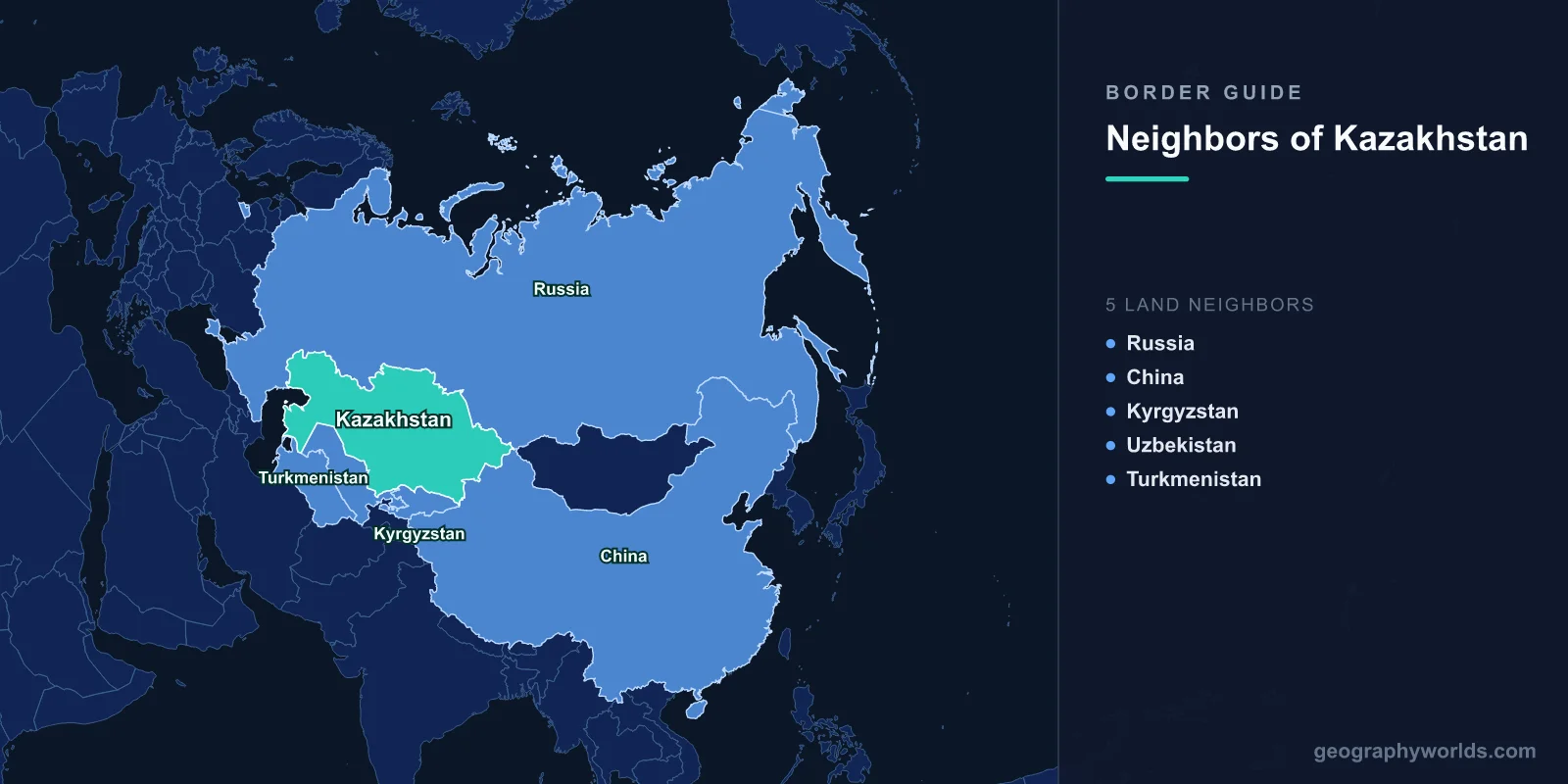
Kazakhstan borders five countries: Russia, China, Kyrgyzstan, Uzbekistan and Turkmenistan. Together those lines run 13,364 km, the fifth-longest set of land boundaries any state possesses, behind only China, Russia, Brazil and India. Every kilometre carries more weight than it would elsewhere, because Kazakhstan has no coast at all. At roughly 2.7 million km² it is the largest landlocked country on the planet, and nothing it sells leaves the country without crossing somebody else’s customs post.
Five Neighbours, Ranked
| Neighbour | Length | Share of total | When the boundary was legally fixed |
|---|---|---|---|
| Russia | 7,644 km | 57% | Treaty signed in Moscow, 18 January 2005 |
| Uzbekistan | 2,330 km | 17% | Treaty of 2002, final segments settled in 2017 |
| China | 1,765 km | 13% | 1994 agreement, supplemented 1997 and 1998 |
| Kyrgyzstan | 1,212 km | 9% | Delimitation agreed 2001 |
| Turkmenistan | 413 km | 3% | Delimitation agreed 2001 |
| Total | 13,364 km | — | — |
Look at the right-hand column. Every one of these boundaries was settled by treaty within about fifteen years of independence, most of them in a rush between 1994 and 2005. That is unusually fast, and it was deliberate: a new state surrounded by two nuclear powers and three unstable neighbours decided that unresolved lines were the last thing it needed.
Seven Thousand Kilometres and Almost No Landmarks
The Russian border is the headline figure. At 7,644 km it is the longest continuous land boundary between any two countries in the world. The Canada–United States frontier is longer in total, at roughly 8,890 km, but Alaska splits it into two separate segments; the Kazakh–Russian line runs unbroken from the north-east shore of the Caspian near Atyrau all the way east to the Altai mountains where Mongolia begins.
For most of that distance there is almost nothing to look at. The line crosses open steppe, wheat country and semi-desert, with very few rivers and hardly any relief to anchor it. That is because it was never designed as a border. It began as an internal administrative boundary of the Kirghiz (later Kazakh) Autonomous Soviet Socialist Republic created in 1920, adjusted repeatedly through the 1920s, and confirmed when the Kazakh SSR was established in 1936. Surveyors drew it for bureaucratic convenience, not defence.
One feature does stand out. The Ural river crosses the border and is conventionally taken as the divide between Europe and Asia, which makes Kazakhstan a transcontinental country and gives Oral and Atyrau a foot on each continent. Otherwise the significance of the line is demographic: several million ethnic Russians live in the northern provinces immediately along it. That is a large part of why Nursultan Nazarbayev moved the capital in December 1997 from Almaty, tucked into the far south-east corner, to Akmola on the northern steppe — a city later renamed Astana. Since the Eurasian Economic Union took effect on 1 January 2015, citizens of both states cross without visas, and the border is busier than the emptiness of the landscape suggests. The rest of Russia’s remarkable neighbour list appears in our guide to the countries that border Russia.
A Russian City With a Kazakh Address
One consequence of that border is not on the border at all. Baikonur Cosmodrome, the launch site that sent up Sputnik in 1957 and Yuri Gagarin in 1961, sits deep inside Kazakhstan’s Kyzylorda region. When the Soviet Union dissolved, the facility became Kazakh property overnight and Russia’s entire crewed space programme was suddenly abroad.
The fix was a lease. Under a 1994 agreement, extended in 2004 to run until 2050, Russia rents the cosmodrome and the adjoining town of Baikonur, formerly Leninsk, for about $115 million a year. The town is administered by Russia with a Russian-appointed head, Russian police and the rouble in the shops, while remaining Kazakh sovereign territory. It is not an exclave, because there is no marked border around it, but it functions like one. The arrangement produces regular friction: spent rocket stages fall on the steppe, and Kazakhstan grounded Proton launches after a crash in 2013 spread hypergolic propellant across farmland.
How Kazakhstan Settled With China
The 1,765 km eastern border was once shooting ground. During the Sino-Soviet split the two armies clashed at Zhalanashkol in what is now Kazakhstan in August 1969, four months after the better-known fighting on the Ussuri. Independence in 1991 left Kazakhstan holding roughly 944 km² of contested ground and a neighbour with fifty times its population.
Astana negotiated rather than posturing. An agreement on 26 April 1994 fixed most of the line; supplementary accords on 24 September 1997 and 4 July 1998 divided the disputed sections, with China taking a little over half; demarcation was completed in 2002. The border has been calm ever since, and the crossings have become some of the most consequential pieces of infrastructure in inner Asia.
At Dostyk and Alashankou, the old Turkestan–Siberia railway meets the Chinese network through the Dzungarian Gate, a natural pass between Lake Alakol and Lake Ebinur that funnelled nomadic invasions for two thousand years and is now one of the windiest inhabited places in Asia. Trains cannot simply roll through: Kazakhstan uses 1,520 mm gauge track and China 1,435 mm, so every container is either transshipped or the wagons are lifted onto new bogies. A second rail crossing opened at Khorgos in December 2012, alongside the Khorgos Gateway dry port and the International Centre for Boundary Cooperation — a duty-free trade zone that physically straddles the boundary line, where citizens of both countries can walk in without visas. And when Xi Jinping wanted somewhere to announce the Silk Road Economic Belt, the land half of the Belt and Road Initiative, he chose a lecture hall at Nazarbayev University in Astana on 7 September 2013. China’s fourteen land neighbours are listed in our piece on the countries that border China.
The Sea That Is Legally Not a Sea
Kazakhstan’s western edge is water, and for twenty-seven years nobody could agree what kind. If the Caspian is a sea, the UN Convention on the Law of the Sea applies: territorial waters, exclusive economic zones, and the right of any littoral state to run a pipeline across the seabed without asking the others. If it is a lake, it can only be divided by unanimous agreement among all five countries on its shore, giving each of them a veto. Russia and Iran preferred the lake reading, largely because it blocked a trans-Caspian gas pipeline that would carry Turkmen and Kazakh gas west to Azerbaijan and on to Europe.
The Convention on the Legal Status of the Caspian Sea, signed at Aktau on 12 August 2018 by Kazakhstan, Russia, Azerbaijan, Iran and Turkmenistan, invented a third answer: a special legal status belonging to neither category, with 15 nautical miles of territorial water plus 10 more of exclusive fishing rights, seabed sectors divided by bilateral agreement, and a ban on any non-littoral state basing military vessels there. Kazakhstan had already carved up its own seabed with Russia in 1998 and Azerbaijan in 2001, which is how the giant Kashagan field got developed. The remaining problem is export routes: most Kazakh crude still leaves through the Caspian Pipeline Consortium line to Novorossiysk on the Russian Black Sea coast, a chokepoint the country has been trying to hedge against since 2022 by shipping barrels across to Baku.
The Aral Line
The 2,330 km Uzbek border is the second-longest and the most complicated on the ground. A treaty signed in September 2002 fixed most of it, leaving about a hundred kilometres unresolved until a further agreement in 2017. It crosses the Kyzylkum desert, follows irrigation infrastructure in places, and passes within about fifteen kilometres of Tashkent — the crossing near Saryagash and Shymkent is the busiest in Central Asia.
Its most instructive stretch runs through the bed of the Aral Sea. The Aral was a single lake shared between two Soviet republics until decades of cotton irrigation on the Amu Darya and Syr Darya drained it; in 1987 it split into a northern basin, on the Kazakh side, and a much larger southern one, mostly Uzbek. Kazakhstan then did something its neighbour could not: with World Bank funding it built the 13 km Kokaral Dam across the connecting channel, completed in 2005, and simply kept the Syr Darya water in the north. The North Aral rose several metres within a year, salinity fell, and commercial fishing returned to Aralsk. The southern basin has largely become a salt desert called the Aralkum. One dam, one border, two entirely different outcomes for the same lake.
Bishkek Is Twenty Kilometres From Another Country
The 1,212 km Kyrgyz border, delimited in 2001, has a geographical quirk at its heart: Bishkek sits so close to it that the Kyrgyz capital’s northern suburbs run almost to the line. The Korday crossing on the Chu river carries the bulk of the traffic and a large share of Kyrgyzstan’s imports.
Both states belong to the Eurasian Economic Union, Kyrgyzstan since 2015, so goods should move freely. In practice Kazakhstan has repeatedly used the crossing as leverage — hundreds of lorries were held up in October 2017 after the Kyrgyz president criticised his neighbour, and again during customs disputes in the early 2020s. Further east the line climbs the Tien Shan foothills, and water rather than trade dominates: agreements dating from 2000 have Kazakhstan help pay for Soviet-era reservoirs that sit in Kyrgyzstan but irrigate Kazakh fields in the Chu and Talas valleys.
Four Hundred Kilometres of Ustyurt
The shortest border, 413 km with Turkmenistan, runs across the Ustyurt Plateau: a flat chalk and clay tableland with sheer escarpments, almost no water and almost no people. Its significance is a railway. The Uzen–Bereket–Gorgan line, built jointly by Kazakhstan, Turkmenistan and Iran, opened its Bolashak to Serhetyaka section in December 2012 and reached Iran in December 2014. For a landlocked exporter it was a genuine strategic gain: the shortest overland route from the Kazakh steppe to the Persian Gulf, and the first serious alternative to sending everything north through Russia.
For a country with no sea, the map is really a list of questions about whose territory the oil, wheat and containers have to cross — and the answers have changed more since 2022 than in the previous twenty years. If you want to see how much of Asia that 7,644 km line actually spans, try dropping a pin on Kazakhstan and its neighbours in the map location game.