
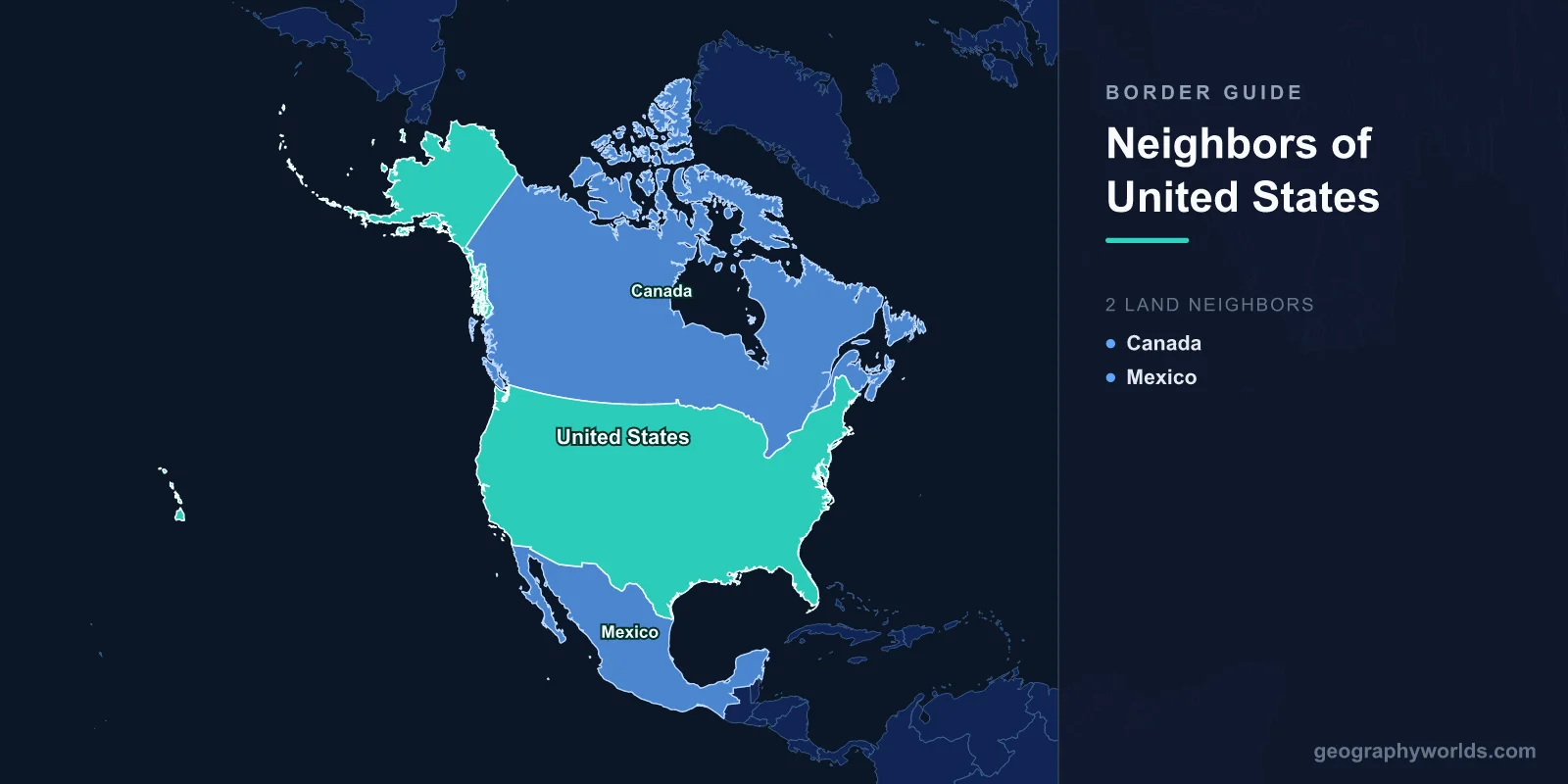
The United States shares land borders with just two countries: Canada to the north and Mexico to the south. Together those boundaries run roughly 12,000 kilometres, and the US–Canada border is the longest international land border in the world.

Two land neighbours is a strikingly small number for a country of the United States' size. Russia has 14, China has 14, Brazil has 10. The explanation is partly geography — the US spans a continent's midsection with oceans on both sides — and partly history, since nineteenth-century expansion absorbed the territory that might otherwise have become additional neighbours. This guide covers both land borders in detail, the maritime neighbours people usually forget, and why the US ended up with so few.
The Two Land Neighbours at a Glance
- Canada (north) — approximately 8,890 km, including the Alaska–Canada section. The longest international border on Earth.
- Mexico (south) — approximately 3,145 km, from the Pacific Ocean to the Gulf of Mexico.
The combined total of roughly 12,000 km is itself substantial — but it is split across only two countries, each of which meets the US along a single continuous frontier (Canada does so in two separate segments, thanks to Alaska).
The United States–Canada Border
The US–Canada boundary is the longest border between any two nations, and it has been demilitarised since the Rush–Bagot Agreement of 1817 — one of the oldest such arrangements anywhere.
It falls into three broad sections:
- The western section follows the 49th parallel almost exactly, from the Strait of Georgia near Vancouver east to Lake of the Woods in Minnesota. This straight-line arrangement came out of the 1818 Anglo-American Convention and the 1846 Oregon Treaty.
- The eastern section abandons straight lines for water and terrain, running through four of the five Great Lakes and along the St. Lawrence River before turning through Vermont, New Hampshire and Maine.
- The Alaska section adds roughly 2,475 km, separating Alaska from Yukon and British Columbia — much of it along the 141st meridian.
The border's straightness has produced some genuine oddities. The Northwest Angle in Minnesota is a fragment of US territory reachable by land only by driving through Manitoba, the product of a surveying error about the source of the Mississippi. Point Roberts, Washington, sits below the 49th parallel on a peninsula attached to British Columbia, so its residents cross two international borders to reach the rest of their own state. Derby Line, Vermont, and Stanstead, Quebec, share a library and opera house that the boundary runs straight through.
For the view from the other side, see our guide to the countries that border Canada — which, unlike the US, has only one land neighbour.
The United States–Mexico Border
The southern border runs roughly 3,145 km from San Diego–Tijuana on the Pacific to the mouth of the Rio Grande at Brownsville–Matamoros on the Gulf of Mexico. Four US states touch it — California, Arizona, New Mexico and Texas — as do six Mexican states.
Its shape reflects a specific historical rupture. The Treaty of Guadalupe Hidalgo, which ended the Mexican–American War in 1848, transferred a vast block of territory to the United States. The Gadsden Purchase of 1853–54 added a further strip across southern Arizona and New Mexico to secure a southern railway route. Between them, these agreements set the line that stands today.
The border divides into two very different halves:
- The Rio Grande section — about two-thirds of the total length follows the river from El Paso to the Gulf. Because rivers move, the channel's shifts have caused genuine territorial disputes; the Chamizal dispute over land near El Paso ran from the 1860s until a settlement in 1963.
- The western land section — from El Paso to the Pacific the line is a surveyed straight-line boundary across the Sonoran and Chihuahuan deserts, marked by monuments rather than any natural feature.
The terrain along the way is far more varied than the flat desert of popular imagination. The line crosses the Chihuahuan Desert, climbs through the sky-island mountain ranges of south-eastern Arizona, drops into the Sonoran Desert — some of the hottest and driest country in North America — and finishes in the coastal hills above the Pacific. In the Big Bend region of Texas the Rio Grande has carved canyons more than 400 metres deep, and the border runs along the river at their floor.
This is also one of the most heavily trafficked borders anywhere. The San Ysidro crossing between San Diego and Tijuana handles tens of millions of northbound crossings a year, and paired cities — El Paso and Ciudad Juárez, Laredo and Nuevo Laredo — function as closely linked economic units. Our guide to the countries that border Mexico covers the picture from the southern side, where Mexico meets Guatemala and Belize.
Maritime Neighbours: The Ones People Forget
Land borders are only part of the answer. The United States also has maritime boundaries with several countries it never touches on land — and in one case, the gap is small enough that the two countries are visible from one another on a clear day.
- Russia — separated from Alaska by the Bering Strait, about 82 km wide. In the middle sit Big Diomede (Russia) and Little Diomede (US), roughly 3.8 km apart with the International Date Line between them, so the two islands are nearly a full calendar day apart.
- Cuba — around 150 km south of Key West across the Straits of Florida.
- The Bahamas — the nearest islands lie under 100 km off the Florida coast.
- Others — through its territories the US also holds maritime boundaries with countries in the Caribbean and the Pacific, including Japan and several Pacific island states near Guam and American Samoa.
Why Only Two? A Comparison With Russia and China
Set against the world's other territorial giants, the United States is unusually isolated — and the contrast is instructive.
Russia and China each border 14 countries. Both sit within the Eurasian landmass, where multiple long-established states press against each other across mountain ranges, steppe and river valleys. Neither has an ocean on more than one or two flanks, so their frontiers are overwhelmingly terrestrial.
The United States is differently placed for three reasons:
- Ocean flanks. The Atlantic, Pacific and Arctic bound the country on three sides. Only the north and south are land frontiers at all.
- Continental scale absorbed by two states. North America has only three large countries. Where Europe fits dozens of states into a comparable area, Canada, the US and Mexico divide the continent between them.
- Nineteenth-century expansion. The Louisiana Purchase, the annexation of Texas, the Oregon settlement, the Mexican Cession and the purchase of Alaska each removed a potential boundary by absorbing the territory behind it. The Republic of Texas, for example, was briefly an independent neighbour before annexation in 1845.
The strategic consequences are considerable. Two stable, friendly land neighbours and two oceans have given the US what historians sometimes call "free security" — a degree of insulation from invasion that Russia and China, with their long and often contested frontiers, have never enjoyed.
Border Facts Worth Knowing
- The US–Canada border is the longest international land border in the world, ahead of Kazakhstan–Russia.
- The International Boundary Commission maintains a 6-metre-wide cleared strip — the "Slash" — along much of the forested US–Canada line.
- The International Boundary and Water Commission, established in its modern form in 1889, manages the Rio Grande and Colorado River boundary questions jointly with Mexico.
- Thirteen US states touch Canada; four touch Mexico. Of the 50 states, the large majority touch no international border at all.
- Alaska borders only Canada, despite lying closer to Russia than any other part of the US.
- The US–Canada border predates the modern shape of both countries: the 49th parallel was agreed in 1818, when British North America had not yet federated and the US reached nowhere near the Pacific.
- Neither land border is entirely straight or entirely natural. Both mix surveyed parallels and meridians with rivers, lakes and watersheds — which is why both have needed permanent joint commissions to administer them.
It is also worth noting what the United States does not border. Despite their prominence in American life, Cuba, the Bahamas and Russia are all maritime neighbours only. And although the US administers territories scattered across the Caribbean and Pacific, none of them creates an additional land border — Puerto Rico, Guam and American Samoa are all islands.
The short answer, then, stays short — Canada and Mexico — but it conceals a great deal. Those two boundaries include the longest border on Earth, one of the busiest, a border that follows a moving river, enclaves reachable only through foreign territory, and a pair of islands a day apart across four kilometres of water. Two neighbours has never meant a simple frontier.