
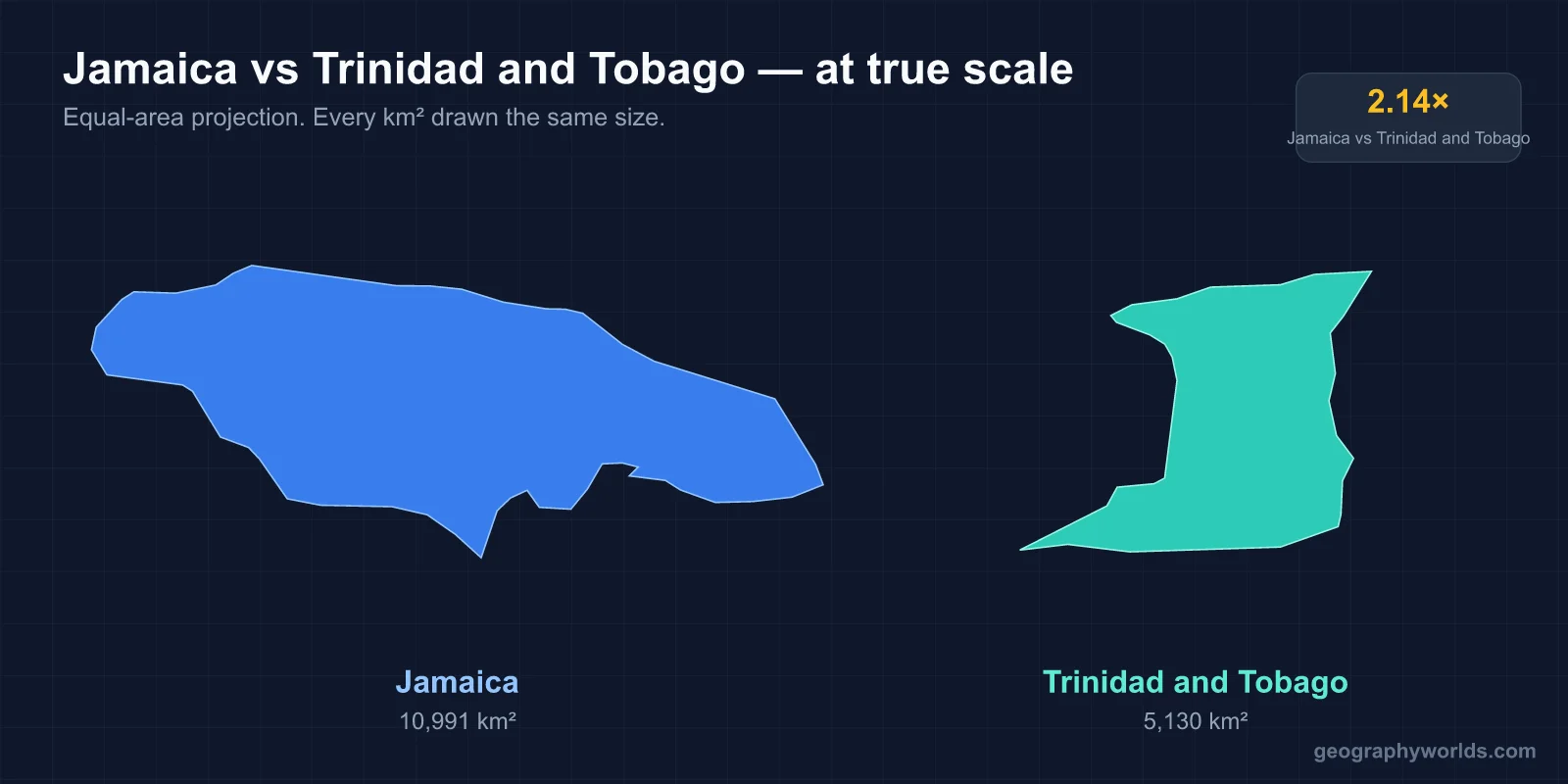
Jamaica is about twice the size of Trinidad and Tobago (10,991 square kilometres against 5,128) and has roughly twice the population (about 2.7 to 2.8 million against about 1.4 to 1.5 million), but Trinidad and Tobago is more than twice as rich per person, because it sits on oil and natural gas while Jamaica lives on tourism, bauxite and money sent home from abroad. The gap goes back to geology: Jamaica is an uplifted limestone island in the open Caribbean, and Trinidad is a piece of South America that rising seas cut off from Venezuela.
A Limestone Island and a Broken-Off Piece of South America
Jamaica began as part of a volcanic island arc in the Cretaceous period, more than 65 million years ago. The arc sank, and for tens of millions of years the seabed above it collected the shells of marine organisms, building the thick White Limestone that now covers about two-thirds of the island. Tectonic movement along the boundary between the Caribbean and North American plates later pushed the whole block up out of the sea. The result is a high, rugged island 235 kilometres long with almost no flat land except narrow coastal plains. In the east the old volcanic and metamorphic core shows through as the Blue Mountains, where Blue Mountain Peak reaches 2,256 metres. In the west, rain has dissolved the limestone into Cockpit Country, a maze of steep cone-shaped hills and sinkholes so impassable that escaped slaves, the Maroons, held it against British troops in the 18th century.

Trinidad has a completely different origin. It stands on the South American continental shelf, and until sea levels rose at the end of the last ice age, roughly 10,000 years ago, it was joined to what is now Venezuela. The Gulf of Paria separates them today, and at the Serpent's Mouth in the south the Venezuelan coast is only about 11 kilometres away. Trinidad's Northern Range is the eastern end of Venezuela's Coastal Cordillera, rising to 940 metres at El Cerro del Aripo; south of it lie the Caroni plains, the Central Range and a southern lowland of soft young sediments full of oil, gas and mud volcanoes. Because it was once mainland, Trinidad has South American wildlife that Jamaica never received: red howler monkeys, ocelots, armadillos and more than 450 bird species, including the oilbirds of the Northern Range caves and the scarlet ibis of Caroni Swamp. Jamaica's native land mammals are limited to bats and one hutia. Tobago, 30 kilometres to the northeast, has its own spine, the Main Ridge, whose forest was protected by law in 1776, one of the oldest such reserves in the Americas.
Latitude matters too. Jamaica sits at about 18 degrees north, squarely in the hurricane belt; Trinidad, at about 10 degrees north, lies south of the usual storm tracks. On 28 October 2025 Hurricane Melissa made landfall on Jamaica's southwest coast as a Category 5 storm with winds near 185 miles per hour, the strongest on record for the island, devastating St Elizabeth and Westmoreland. Trinidad's last serious hit was Hurricane Flora, which struck Tobago in 1963. A broader look at the island's terrain is in our guide to the geography of Jamaica.
Bauxite, Beaches and Remittances: How Jamaica Pays Its Way
Jamaica's limestone gave it one mineral in quantity: bauxite, the red ore of aluminium, which formed in the soils that weathered on top of the limestone. Deposits were identified in 1942, North American companies such as Reynolds and Alcan began exporting in 1952, and by 1957 Jamaica was the largest bauxite producer in the world. Prices and plant closures since the 1970s have shrunk the industry's weight, but bauxite and alumina remain Jamaica's main goods exports.
The economy's centre of gravity moved to the coast. Montego Bay, Negril and Ocho Rios grew into resort towns from the 1960s, and before Hurricane Melissa the island was receiving more than 4 million visitors a year, counting cruise passengers. The other pillar is the diaspora: by common estimates there are nearly as many people of Jamaican birth or descent in the United States, Britain and Canada as in Jamaica itself, and their remittances, a little over US$3 billion a year, are worth around 15 per cent of GDP.
Pitch, Oil and Gas: Trinidad's Underground Fortune
Trinidad's sediments trapped hydrocarbons, and at La Brea on the southwest coast they come to the surface. Pitch Lake is the largest natural deposit of asphalt in the world, about 40 hectares across and some 75 metres deep, fed from below by oil that loses its lighter fractions as it rises. Sir Walter Raleigh used its pitch to caulk his ships in 1595, and from the late 19th century asphalt dug from it paved streets in London, New York and Washington.

One of the first oil wells anywhere was drilled close to the lake in 1857, and commercial production began at Guayaguayare in 1908. Oil dominated the 20th century; as it declined, offshore natural gas took over. Atlantic LNG at Point Fortin shipped its first cargo in 1999, and the Point Lisas industrial estate turned gas into ammonia and methanol, making the country one of the world's largest exporters of both. The Central Bank of Trinidad and Tobago reports that energy made up about 80 per cent of exports in the first nine months of 2024 and roughly 22 per cent of GDP. The state refinery at Pointe-à-Pierre closed in 2018, and falling gas output since a 2010 peak is the economy's main worry.
Africa, India and the Making of Two Populations
Both islands were sugar colonies worked by enslaved Africans, but their histories diverge after emancipation in 1834 to 1838. Jamaica, Spanish from 1494 and British from 1655, already had a large African-descended majority and an established plantation society. In the 2011 census about 92 per cent of Jamaicans identified as Black, around 6 per cent as mixed and less than 1 per cent as East Indian, even though some 36,000 indentured Indian labourers arrived between 1845 and 1917.
Trinidad was a thinly settled Spanish outpost until the 1783 Cedula of Population invited French Catholic planters and their slaves, which is why village names such as Sans Souci and Blanchisseuse dot the map and why French Creole was once widely spoken. Britain took the island in 1797. When freed workers left the estates, planters turned to India: the Fatel Razack landed the first indentured labourers on 30 May 1845, and about 144,000 had come by 1917, most from what is now Uttar Pradesh and Bihar. The 2011 census counted 35.4 per cent of the population as East Indian, 34.2 per cent as African and 22.8 per cent as mixed. Diwali and Eid are public holidays, Hindu temples stand beside churches in the Caroni plains, and the two largest groups have broadly anchored the country's two main political parties. Port of Spain's cosmopolitan mix is described in our profile of Port of Spain.
The two countries took parallel routes out of empire. Both joined the West Indies Federation in 1958, with its capital at Port of Spain; Jamaicans voted to leave it in a September 1961 referendum, and the federation collapsed. Jamaica became independent on 6 August 1962, and Trinidad and Tobago followed on 31 August. Trinidad and Tobago became a republic in 1976; Jamaica still has King Charles III as head of state, though its government has begun the process of becoming a republic.
Carnival and Steelpan Against Reggae and Sound Systems
Trinidad's Carnival grew out of the masquerade balls of French planters, which freed Africans took over after emancipation with canboulay processions and stick-fighting. Today it peaks on the Monday and Tuesday before Ash Wednesday, with masquerade bands of thousands in costume, calypso and soca competitions, and Panorama, the national steelband contest held since 1963. The steelpan itself was invented in Laventille and other districts of Port of Spain in the 1930s and 1940s, after colonial authorities banned skin drums; players found that hammered oil drums, abundant on an oil island, could be tuned to play melodies. The government named it the national instrument in 1992, and in 2023 the United Nations General Assembly declared 11 August World Steelpan Day.

Jamaica's musical export came from Kingston's yards and dancehalls rather than a festival. Mobile sound systems in the 1950s played American rhythm and blues; local producers answered with ska around 1960, slowed it to rocksteady by 1966 and to reggae by about 1968. Bob Marley and the Wailers, Toots and the Maytals and Jimmy Cliff took it worldwide in the 1970s, carrying with them the Rastafari faith that arose in Jamaica in the 1930s. UNESCO added reggae to its list of the intangible cultural heritage of humanity in 2018.
Barbados: The Third Corner of the Triangle
Barbados shows that neither model is the only way an English-speaking Caribbean island can live. It has neither Jamaica's mountains nor Trinidad's oil: it is a low island of 430 square kilometres capped by coral limestone, its highest point Mount Hillaby at 340 metres, east of the main island chain. Its 2021 census counted about 270,000 people, so it is far more crowded than either. With no bauxite and almost no hydrocarbons, Barbados built its economy on tourism and offshore financial services, and it reaches an income per person roughly three times Jamaica's and at or above Trinidad's. It also moved first on the constitutional question, becoming a republic on 30 November 2021. The pairing of Barbados with its southern neighbour is set out in Trinidad and Tobago vs Barbados, and Jamaica's own northern contrast, with the much larger island across the Cayman Trench, is the subject of our comparison of Cuba and Jamaica.