
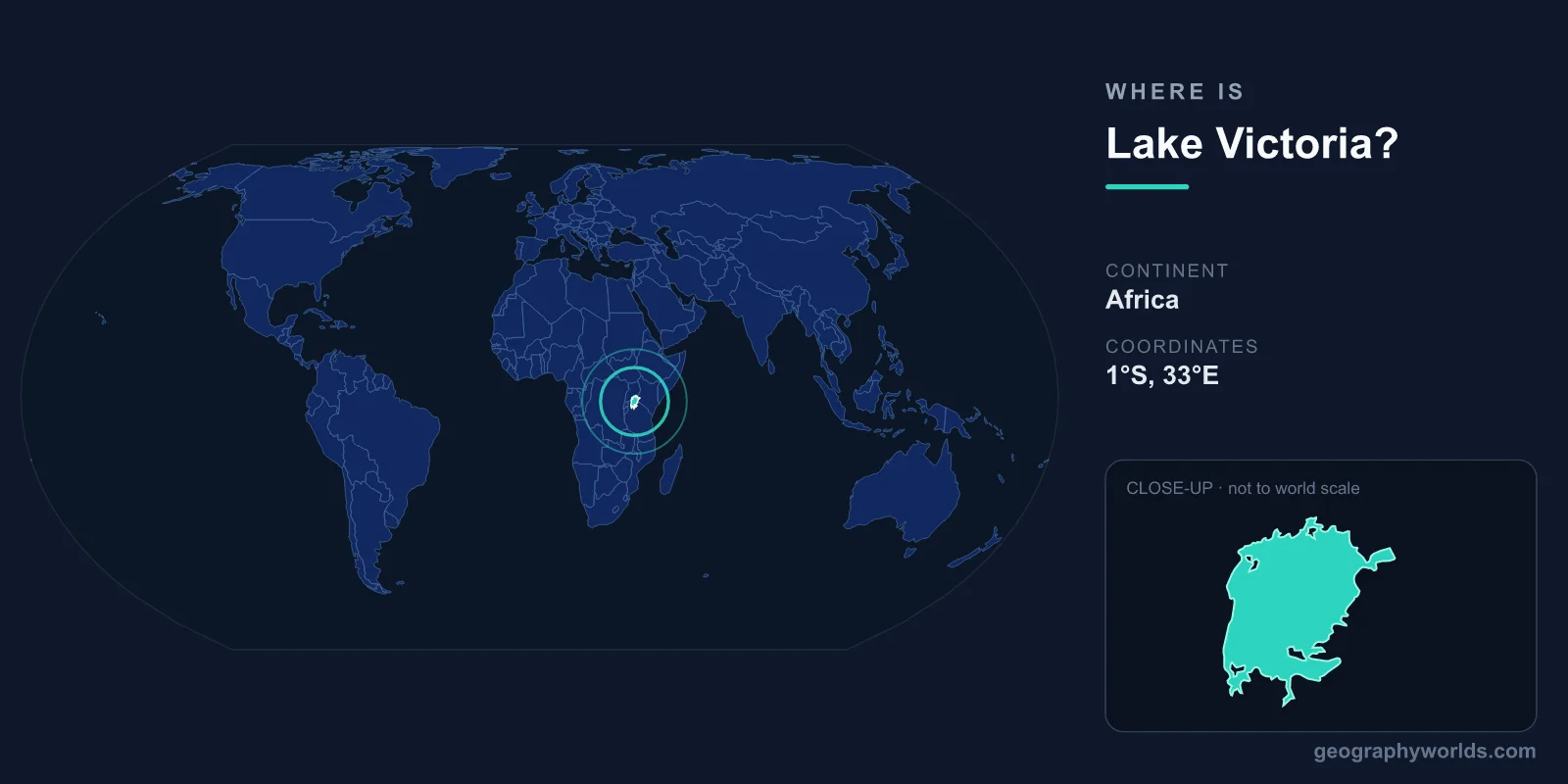
Lake Victoria is located in East Africa, straddling the equator at approximately 1°S latitude and 33°E longitude. It is shared by three countries: Tanzania (which holds about 49% of the lake), Uganda (about 45%), and Kenya (about 6%). Covering roughly 68,800 square kilometers, it is Africa's largest lake, the world's largest tropical lake, and the primary source of the White Nile.
If you scan a map of Africa, Lake Victoria is impossible to miss: it is the enormous, roughly circular body of water sitting in the eastern half of the continent, between the Indian Ocean coast and the Congo Basin. The lake was named by British explorer John Hanning Speke in 1858 after Queen Victoria, but the communities living along its shores had known, fished, and traded across its waters for thousands of years before any European arrived.

Where Exactly Is Lake Victoria?
Lake Victoria sits in a broad, shallow depression in the East African plateau, at an elevation of about 1,135 meters above sea level. Its center lies at roughly 1°S, 33°E, which means the equator runs directly through the northern part of the lake, placing it in both the Northern and Southern Hemispheres at once.
To find it on a map, locate Kenya and Tanzania in East Africa, then trace their shared border. The lake sits just west of this border, with Uganda wrapping around its northern shore. The single most important geographic landmark on the lake is its outlet: the Victoria Nile, which begins at Jinja in southern Uganda and carries the lake's water northward toward the Mediterranean Sea.
The Three Countries That Share Lake Victoria
Lake Victoria is one of the great shared waters of the world, divided among three East African nations whose economies and populations all lean on it heavily.
- Tanzania controls the largest share, roughly 49%, along the southern and eastern shores. The port city of Mwanza, with a population of around 1.1 million, is the lake's largest city and a major hub for trade and the fishing industry.
- Uganda holds about 45% along the northern shore. The capital, Kampala, lies just inland from the lake, while Jinja, Uganda's second-largest city, marks the point where the Nile begins its 6,650-kilometer journey to the sea.
- Kenya has the smallest portion at about 6%, on the northeastern shore. Despite its modest share, Kenya's lakeside city of Kisumu is the country's third-largest urban center and an important regional port.
The lake also acts as a natural highway. Ferries and cargo vessels connect Mwanza, Kisumu, and the Ugandan ports, linking communities that would otherwise be separated by hundreds of kilometers of road.
How Lake Victoria Formed
Lake Victoria is surprisingly young in geological terms, having taken its modern shape only about 400,000 years ago. Unlike the deep, narrow lakes of the Great Rift Valley, Victoria did not form inside a rift trench. Instead, it sits in a shallow basin created when the land between the eastern and western branches of the East African Rift System gently warped and sagged, trapping water from rivers that once drained westward.
This origin explains the lake's unusual shape and shallowness. It also explains its turbulent past: geological evidence shows that Lake Victoria dried up completely at least three times during the ice ages, most recently around 17,000 years ago. When it refilled, it was repopulated by fish and other life, which helps explain the astonishing diversity of species that later evolved in its waters.
Physical Characteristics
For all its vastness, Lake Victoria is remarkably shallow. Its average depth is only about 40 meters, with a maximum depth of roughly 84 meters near the deeper western side. By comparison, the rift lakes Tanganyika and Malawi plunge to depths of over 700 and 1,400 meters respectively.
That shallowness makes the lake sensitive to climate swings. During a regional drought in the early 2000s, the water level dropped by roughly two meters, visibly pulling back the shoreline and exposing wide mudflats. The lake is dotted with islands, including the Ssese archipelago in Uganda and Ukerewe Island in Tanzania, which is the largest lake island in Africa.
- Surface area: 68,800 km²
- Maximum depth: 84 m
- Average depth: 40 m
- Shoreline length: ~3,440 km
- Main inflow: Kagera River and numerous smaller tributaries
- Outflow: Victoria Nile at Jinja, Uganda
Why Lake Victoria Matters
Lake Victoria is the source of the White Nile, the longer of the two main branches of the Nile River. Water leaving the lake at Jinja flows north through Uganda, into South Sudan, and on to join the Blue Nile at Khartoum, ultimately reaching Egypt and the Mediterranean. In this sense, the lake feeds one of the most historically important rivers on Earth.
The lake also supports the world's largest inland fishery, producing roughly one million tons of fish each year, dominated by Nile perch and tilapia. More than 30 million people live in the Lake Victoria basin, relying on it for food, drinking water, transport, and income, and the population continues to grow rapidly.
This dependence comes with serious environmental strain. The introduction of the predatory Nile perch in the 1950s triggered the extinction of hundreds of endemic cichlid fish species, one of the most dramatic examples of an invasive species reshaping an ecosystem. Today, overfishing, pollution, invasive water hyacinth, and the destruction of shoreline wetlands threaten the lake's long-term health. At the same time, dams at the Nile outlet near Jinja generate hydroelectric power that supplies Uganda and neighboring countries.
Key Facts
- Location: East Africa, centered near 1°S, 33°E, straddling the equator
- Bordering countries: Tanzania (~49%), Uganda (~45%), Kenya (~6%)
- Surface area: 68,800 km² — Africa's largest lake and the world's largest tropical lake
- Outlet: Victoria Nile at Jinja, Uganda — source of the White Nile
- Maximum depth: 84 m (very shallow for its size)
- Age: Roughly 400,000 years; has dried up completely at least three times
- People supported: Over 30 million in the lake basin
Frequently Asked Questions
Which countries border Lake Victoria?
Lake Victoria is shared by three East African countries: Tanzania, which holds about 49% of the lake along its southern and eastern shores; Uganda, with about 45% to the north; and Kenya, with about 6% on the northeastern shore.
Is Lake Victoria the largest lake in the world?
No. Lake Victoria is the largest lake in Africa and the largest tropical lake on Earth, but by surface area it ranks second among freshwater lakes worldwide, behind Lake Superior in North America. By total water volume it is much smaller than deeper lakes such as Tanganyika or Baikal because it is so shallow.
Is Lake Victoria the source of the Nile?
Lake Victoria is the source of the White Nile, the longer headstream of the Nile River. The water exits the lake at Jinja, Uganda, as the Victoria Nile and flows north before joining the Blue Nile in Sudan and continuing to the Mediterranean.
Why is Lake Victoria so important to East Africa?
The lake supports more than 30 million people through fishing, transport, drinking water, and hydroelectric power. It hosts the world's largest inland fishery and feeds the Nile, making it central to the economy, food supply, and daily life of the region.
Test Your Knowledge!
Think you know where things are on the map? Test your skills!
Play Geography Games →