
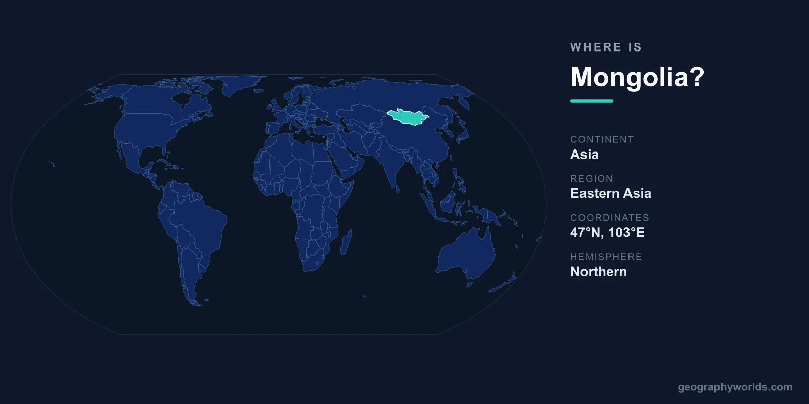
Mongolia is a large landlocked country in East and Central Asia, sandwiched between Russia to the north and China to the south, with its capital at Ulaanbaatar. It covers roughly 1,564,116 km², making it the second-largest landlocked country on Earth and a defining feature of the Asian interior, far from any ocean coastline. Sitting on a high plateau north of Beijing and south of Siberia, Mongolia is famous for its endless steppes, the Gobi Desert, and a living tradition of nomadic herding found almost nowhere else at this scale.
Where Exactly Is Mongolia on the Map?
Mongolia sits in the Northern and Eastern Hemispheres, occupying the high plateau region of Central Asia. The country stretches across roughly latitudes 41°N to 52°N and longitudes 87°E to 120°E, giving it a broad east-west span of more than 2,400 kilometres. Its position deep in the Asian landmass means the nearest sea, the Yellow Sea, lies hundreds of kilometres beyond its southern neighbour, China.
Because it is wedged entirely between just two enormous countries, Mongolia is one of only a handful of nations on Earth that borders no other state. This landlocked, double-neighbour geography has shaped its trade routes, foreign policy, and even its self-described status as a buffer between two great powers. To picture its place in the region, imagine a country that fills much of the space north of Beijing and south of Siberia, roughly on the same latitude band as central France and the northern United States.
Geographers usually classify Mongolia as part of East Asia, though its interior, high-altitude character also gives it a strong Central Asian identity. It belongs to neither a coastal monsoon zone nor a Mediterranean belt; instead it is a textbook example of a continental interior far removed from any maritime influence.
Who Are Mongolia's Neighbours?
Mongolia shares land borders with exactly two countries, and no others:
- Russia to the north, along a border running roughly 3,450 kilometres through Siberian forest and mountain terrain.
- China to the south, east, and west, along an even longer frontier of around 4,600 kilometres that includes the Gobi Desert region.
This positioning between Russia and China has dominated Mongolian history. The country was the heartland of the vast Mongol Empire under Genghis Khan in the 13th century, the largest contiguous land empire the world has ever seen. It later fell under Qing Chinese influence, declared independence in 1911, and in the 20th century became closely aligned with the Soviet Union before transitioning to a democratic, multi-party republic in 1990. Today Mongolia balances relations with both giant neighbours while cultivating ties to so-called "third neighbours" such as the United States, Japan, South Korea, and the European Union.
It is worth noting that the long southern border faces the Chinese autonomous region of Inner Mongolia, not the Mongolian state itself. The two share deep cultural and linguistic roots but are politically separate, a distinction that causes frequent confusion for newcomers to the region.
What Is the Landscape Like?
Mongolia is famous for its open, sparsely populated terrain. The defining features of its geography include:
- The steppe – vast rolling grasslands that cover much of the central and eastern country and sustain the herding lifestyle of nomadic families.
- The Gobi Desert – a cold desert spanning the south, shared with northern China, known for dinosaur fossils and dramatic temperature swings.
- Mountain ranges – the Altai in the west rise above 4,000 metres, with Khüiten Peak the country's highest point at about 4,374 metres.
- Lakes and forests – the northern fringe blends into Siberian taiga, and Lake Khövsgöl holds a large share of the nation's fresh water.
The whole country sits on an elevated plateau, averaging around 1,580 metres above sea level. This altitude, combined with its distance from any moderating ocean, gives Mongolia one of the most extreme continental climates in the world, with bitterly cold winters and short, warm summers. Temperatures can swing from below −40 °C in January to above 30 °C in July, and the country enjoys some of the clearest skies on the planet, earning it the nickname "Land of the Eternal Blue Sky."
The terrain rises gradually from the lower Gobi basins in the south to the rugged Altai and Khangai mountains in the west and north. Rivers are sparse and many drain into closed inland basins or evaporate before reaching any ocean, a hallmark of arid continental geography.
How Big and How Populated Is Mongolia?
At about 1,564,116 km², Mongolia is larger than the combined area of Britain, France, Germany, Italy, and Spain. Yet it is home to only around 3.4 million people, making it the most sparsely populated sovereign country in the world by population density, with fewer than two people per square kilometre. Roughly half of all Mongolians live in or around the capital, Ulaanbaatar, widely regarded as the coldest national capital on the planet.
Outside the city, much of the population still follows a semi-nomadic herding tradition, moving with livestock such as horses, sheep, goats, cattle, yaks, and camels across the steppe. Mongolian is the official language, written today primarily in Cyrillic script, and Tibetan Buddhism is the dominant religion. The national currency is the tögrög (MNT), and the country operates as a semi-presidential republic. The economy increasingly leans on mining of copper, gold, and coal, much of which is exported south to China.
Why Mongolia's Location Matters
Mongolia's geography is not just trivia; it shapes daily life and the wider region. Being landlocked between two superpowers means every export must cross either Russia or China, giving those neighbours enormous leverage over trade. The country's vast mineral wealth, paired with this dependence, makes its transport corridors and diplomatic balancing act a frequent subject of international interest.
Its interior position also explains the harsh winters known as the dzud, when deep cold and snow can wipe out millions of livestock and push herders toward the cities. At the same time, the sheer emptiness of the steppe has preserved one of the last great mobile pastoral cultures on Earth, a heritage tied directly to the land's openness and low rainfall. For a fuller look at the nation's culture, history, and travel highlights, see our Mongolia country guide.
Key Facts
- Continent: Asia (East and Central Asia)
- Capital: Ulaanbaatar
- Area: approximately 1,564,116 km² (second-largest landlocked country)
- Population: around 3.4 million (lowest population density of any sovereign nation)
- Bordering countries: Russia (north) and China (south, east, west) only
- Highest point: Khüiten Peak, about 4,374 metres
- Official language & currency: Mongolian; tögrög (MNT)
Frequently Asked Questions
Is Mongolia in Asia or Europe?
Mongolia is firmly in Asia, specifically the East and Central Asian region. It lies entirely on the Asian landmass and shares no border with any European country, though its northern neighbour Russia is partly European.
Is Mongolia part of China?
No. Mongolia is an independent sovereign nation with its own government, currency, and seat at the United Nations. It is sometimes confused with Inner Mongolia, which is a separate autonomous region within China to the south of the international border.
Is Mongolia landlocked?
Yes. Mongolia has no coastline and is surrounded entirely by Russia and China. It is the second-largest landlocked country in the world after Kazakhstan, and the sea lies far beyond its borders.
What is the capital of Mongolia?
The capital and largest city is Ulaanbaatar, located in the north-central part of the country. It is the political, economic, and cultural heart of Mongolia and home to roughly half the national population.
How many countries border Mongolia?
Just two: Russia to the north and China on the other three sides. This makes Mongolia one of the few nations in the world that borders only two neighbours, both of them far larger and more populous than itself.