
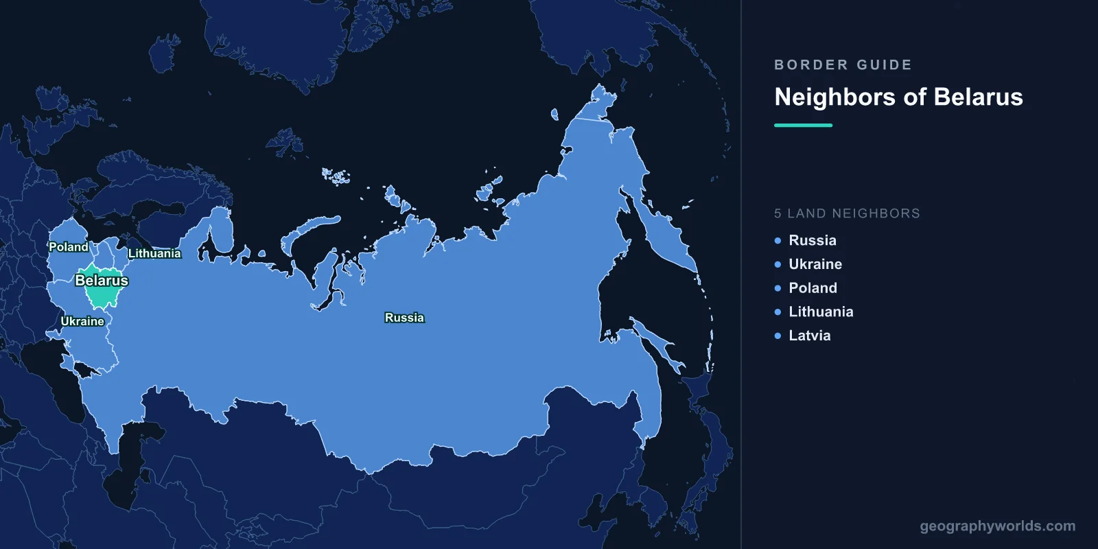
Five countries touch Belarus: Russia along the east, Ukraine across the south, Poland to the west, and Lithuania and Latvia in the north-west. That comes to 3,599 km of land boundary and not a single metre of coast — Belarus is the largest wholly landlocked country in Europe. What has happened to those five lines in the past decade is the more interesting story: three of them have been walled, mined or shut, and the other two have effectively been erased.
8 December 1991: An Empire Ends in a Belarusian Forest
Start where the modern borders start. At a state hunting lodge called Viskuli, deep inside the Belovezhskaya Pushcha and only a few kilometres from the Polish frontier, Boris Yeltsin of Russia, Leonid Kravchuk of Ukraine and Stanislau Shushkevich of Belarus signed a document stating that the Soviet Union had ceased to exist as a subject of international law. The Belovezha Accords created the Commonwealth of Independent States in its place. Mikhail Gorbachev resigned seventeen days later.
The consequence for the map was immediate. Four of Belarus’s five borders had been internal Soviet administrative divisions the previous morning — lines separating the Byelorussian SSR from the Russian, Ukrainian, Lithuanian and Latvian republics — and all four became international frontiers overnight without a single survey being redone. Only the Polish border had ever been a real one. It was fixed by the Soviet–Polish treaty of 16 August 1945, following the Curzon Line with local adjustments, after Stalin kept the territory the USSR had taken in September 1939.
The Forest Itself Is Cut in Two
The woodland where all this was signed is a border problem in its own right. Belovezhskaya Pushcha, called Białowieża on the Polish side, is the last substantial fragment of the primeval lowland forest that once covered the North European Plain. Roughly 1,500 km² of it survives, split between a Polish national park and a Belarusian one, and it holds a joint UNESCO World Heritage listing — Poland’s half inscribed in 1979, Belarus’s added in 1992, the boundaries revised again in 2014.
It is also the home of the European bison. The species was hunted out of the wild here by 1921 and rebuilt from a few dozen captive animals; well over a thousand now live in the forest. They cannot move through it freely. Soviet engineers strung a border fence along the line in the early 1980s, which already split the herd into two genetically separating populations, and the steel barrier built in 2022 sealed it much harder. Polish ecologists have documented lynx, wolf and elk movements collapsing along the boundary. It is a rare case of a political dispute leaving a measurable signature in the DNA of a wild animal.
2021: A Border Used as a Weapon
After the disputed election of August 2020 and the forced landing of Ryanair flight 4978 in Minsk in May 2021, the EU tightened sanctions. Belarus responded by turning its western borders into an instrument.
Minsk relaxed tourist visas and encouraged charter flights from Baghdad, Damascus, Istanbul and Dubai, then moved the arrivals by bus to the Polish, Lithuanian and Latvian lines. Lithuania recorded around 4,100 irregular crossings in 2021, against 81 the year before. In November a few thousand people, many of them Iraqi Kurds, camped in freezing weather at the Kuznica and Bruzgi crossing while Poland deployed something on the order of 15,000 soldiers, police and border guards. At least a dozen people died of exposure in the marshes on either side, and the true number is probably higher.
Poland declared a state of emergency in September 2021, sealing a three-kilometre strip to journalists and aid workers, then built a physical wall: 186 km of steel palisade five and a half metres high, finished in June 2022 for around 1.6 billion złoty, with an electronic barrier of cameras and motion sensors covering the river sections where a wall could not stand. Lithuania fenced roughly 550 km of its 679 km line by the end of 2022. Latvia built its own along all 161 km. Crossings closed one after another — Kuznica in 2021, Bobrowniki in 2023 — leaving Poland with essentially Terespol for people and Kukuryki for freight, and Lithuania with a bare handful that have been suspended and reopened repeatedly since. Our overview of Poland’s seven neighbours covers the other side of that wall.
The Gap Every NATO Planner Can Name
Look at the north-west corner and you find the most discussed sixty kilometres in European defence planning. The Suwałki Gap is the short stretch of Polish–Lithuanian border running from the point where Poland, Lithuania and Belarus meet to the edge of Russian Kaliningrad. It is the only land connection between the three Baltic states and the rest of NATO, and it is pinched between Belarusian territory on one flank and Russian territory on the other.
Two roads and one railway thread through it, the rail line being part of the Rail Baltica project. The corridor became a live topic again in mid-2023, when Wagner fighters relocated to camps in Belarus after their mutiny and Poland moved additional troops east. It is a reminder that Belarus’s borders matter far beyond Belarus: a country with no coastline and no NATO membership sits directly on the alliance’s most awkward piece of geography.
The Border With Russia That Nobody Polices
The longest line, 1,312 km, is also the one you would struggle to find. Belarus and Russia dismantled customs posts in 1995, and the Union State treaty signed on 8 December 1999 — deliberately on the eighth anniversary of the accords that ended the USSR — committed the two to a common economic and defence space.
For years the practical result was a legal curiosity. Because no international crossing points existed on the land border, citizens of the two countries moved freely, but a traveller from anywhere else had no lawful way to drive from Minsk to Smolensk: there was no post to issue an entry stamp. A mutual visa recognition agreement signed in 2020 gradually closed the loophole. The M1 highway, which runs from Brest through Minsk to Moscow, carries most of the traffic and is the physical spine of the relationship. In February 2022 the same absence of a controlled border let Russian forces stage the northern axis of the invasion of Ukraine from Belarusian soil, and in 2023 Moscow announced the deployment of tactical nuclear weapons to Belarus. The full ring around Russia is mapped in our guide to the countries that border Russia.
Ukraine’s Quietest and Most Watched Front
The 1,111 km southern border is now a fortified line that almost nobody crosses. Russian columns drove south from Belarus toward Chernihiv and Kyiv in February 2022 and withdrew by April; since then Ukraine has mined the approaches, destroyed bridges over the Pripyat and kept standing forces in the north that it would much rather use elsewhere.
The terrain does a lot of the work. This is Polesia, a belt of peat bog, floodplain and pine that historically funnelled armies around it rather than through it, and the Pripyat and its tributaries turn much of it to water each spring. Sitting astride the line is the Chernobyl fallout zone: Belarus’s Polesie State Radioecological Reserve covers about 2,160 km² on the northern side and is one of the least-visited landscapes in Europe. Russian troops dug positions in contaminated soil there in 2022. Ukraine’s other six neighbours are covered in our piece on the countries bordering Ukraine.
Where Each of the Five Lines Runs
| Neighbour | Length | Landscape it crosses | How it functions now |
|---|---|---|---|
| Russia | 1,312 km | Rolling farmland and forest toward Smolensk and Bryansk | No posts, no checks, Union State free movement |
| Ukraine | 1,111 km | Polesian marshes, Pripyat basin, Chernobyl zone | Closed and fortified since 2022 |
| Lithuania | 640 km | Lakes, pine forest and the Neman headwaters | Roughly 550 km fenced, crossings repeatedly suspended |
| Poland | 375 km | The Bug river and Białowieża Forest | 186 km steel wall, Terespol and Kukuryki only |
| Latvia | 161 km | Wooded lake country north of the Daugava | Fenced along its full length, tightly restricted |
| Total | 3,599 km | — | — |
Set those rows side by side and the shape of the last five years is obvious. Roughly two-thirds of the boundary faces east and south, toward states with which Belarus is either merged or at a standstill. The remaining 1,176 km faces the European Union, and essentially all of it has been fenced, walled or wired since 2021. For a country whose borders were mostly clerical lines in 1991, that is a fast hardening.
What the Numbers Do Not Show
Two things worth holding onto. The first is that Belarus is small in area but very well connected: it sits on the shortest road and rail routes between Moscow and Warsaw, between the Baltic ports and Ukraine, and between Kaliningrad and the rest of Russia. Transit is one of the few things it can meter, which is precisely why the crossings became bargaining chips.
The second is that the borders cut through a genuinely shared cultural landscape. Białystok in Poland, Vilnius in Lithuania and Hrodna in Belarus were parts of the same Grand Duchy for four hundred years. Polish, Belarusian, Lithuanian, Yiddish and Russian were spoken in the same market squares. The Bug and the Neman were highways rather than dividers. The lines drawn in 1945 and hardened in 2022 are recent things laid over something much older.
There is a small, blunt irony in all of it: the forest where three men signed away the Soviet Union now has a five-metre steel wall running through the middle of it, and the bison were not consulted. If you want to see how well you can place a landlocked country’s five neighbours from memory, Belarus is a good test in the neighbours game.