
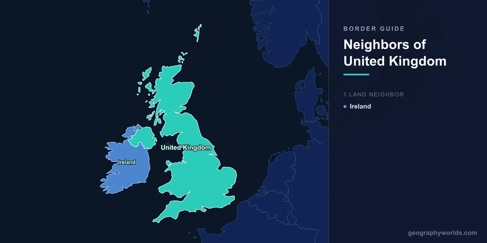
Exactly one country shares a land border with the United Kingdom, and it is Ireland. The frontier runs 499 kilometres — about 310 miles — from Lough Foyle in the north-west to Carlingford Lough on the Irish Sea, separating the six counties of Northern Ireland from the twenty-six of the Republic. Everything else that bounds Britain is water: the Channel, the North Sea, the Atlantic, the Irish Sea. For a state of 67 million people with a permanent seat on the UN Security Council, that is a strikingly short list of neighbours. Germany, by comparison, touches nine countries.
It is also, kilometre for kilometre, one of the most argued-over lines in modern Europe. A frontier you can drive across without noticing has consumed years of negotiation, helped collapse a devolved government twice, and produced an entire treaty framework that exists for no other purpose than to manage it.
Why an Island Country Has a Land Border at All
The border is barely a century old. The Government of Ireland Act 1920 split the island into two home-rule jurisdictions, and partition took formal effect on 3 May 1921. Northern Ireland was drawn as six of Ulster's nine counties — Antrim, Armagh, Down, Fermanagh, Londonderry and Tyrone — rather than the whole province. The arithmetic was deliberate. All nine counties would have delivered a unionist majority of roughly 56 per cent, thin enough to be lost within a generation. Six counties delivered something closer to two-thirds.
Because the drafters reached for existing county boundaries instead of commissioning a survey, the border inherited lines fixed during the seventeenth-century Plantation of Ulster, which in turn followed parishes, townlands, streams and field ditches. None of it was designed to carry customs law. The result wanders through farmyards, cuts parishes in half and, in a handful of well-documented cases, passes through buildings — the standard photograph being a house whose kitchen and bedroom sit in different states. At both ends the line reaches salt water in territory that has never been formally divided: sovereignty over Lough Foyle and Carlingford Lough remains unagreed between London and Dublin to this day.
The island itself is not large — roughly the size of Indiana — which is part of why the border feels so intimate. Nowhere in the border counties is more than about an hour's drive from the other jurisdiction.
More Road Crossings Than the EU's Entire Eastern Frontier
Counting the crossings is genuinely difficult, which tells you a great deal. A 2018 mapping exercise by The Irish Times identified 208 road crossings; counts that include farm lanes, bog tracks and private accesses run past 300. Either number comfortably exceeds the designated crossing points along the whole of the EU's eastern external border, from the Gulf of Finland to the Aegean — several thousand kilometres served by roughly 137 official crossings. The Irish border has more doors than a frontier fifteen times its length.
It was not always open. Customs posts operated from 1923 until the European single market abolished them on 1 January 1993. During the Troubles the British Army physically closed most minor roads by cratering, spiking or blockading them, leaving around twenty approved crossings and turning the rest into cul-de-sacs. Watchtowers stood on the hills of south Armagh until Operation Banner ended on 31 July 2007. What replaced all of that is nothing at all. The only reliable clue that you have crossed is that speed limit signs switch between miles per hour and kilometres per hour, and the road markings change colour.
That invisibility is a policy outcome rather than an accident. The Good Friday Agreement of 10 April 1998 rests on the principle that people in Northern Ireland may identify as Irish, British or both, and that daily life across the line should not force the choice. Tens of thousands commute across it for work; children cross it for school; a single ambulance service contract covers patients on both sides in the north-west. Milk crosses it repeatedly — a significant share of milk produced in Northern Ireland is processed in the Republic, sometimes returning north as cheese.
What Brexit Did to a Line Nobody Could See
On 1 January 2021, when the transition period ended, those 499 kilometres became the land frontier between the United Kingdom and the European Union's single market and customs union. In ordinary circumstances that implies infrastructure: inspection posts, cameras, declarations, number-plate recognition. In Northern Ireland it implied something politically impossible, because visible border installations had been targets for three decades and everyone at the table understood their return as a threat to the peace settlement.
The workaround was to relocate the checks. Under the Northern Ireland Protocol, Northern Ireland stayed aligned with EU rules on goods and the regulatory frontier moved to the Irish Sea, meaning inspection of goods arriving from Great Britain at Larne, Belfast and Warrenpoint. Unionist parties argued this had created a border within the United Kingdom, and the Stormont Assembly spent two years suspended over the point.
The Windsor Framework, agreed in February 2023, softened the arrangement rather than abolishing it. From 1 October 2023 trade was split into a green lane for goods staying in Northern Ireland, moving under the UK Internal Market Scheme with minimal paperwork, and a red lane for goods at risk of travelling onward into the EU, which face full customs process. It added "not for EU" labelling on certain retail food and created the Stormont Brake, a mechanism letting 30 Assembly members from at least two parties flag significant new EU goods rules for a UK government veto. In December 2024 the Assembly voted to keep the arrangements running for a further four years.
The Frontier That Runs Under the Sea
There is a second place where Britain behaves as though it had a land border, and it is not on British soil. Since the Channel Tunnel opened in 1994, UK immigration controls for tunnel and ferry traffic have been carried out in France, at Coquelles near Calais, at Calais port and at Dunkirk — with French controls reciprocally sited at Folkestone and Dover. The arrangement was set up by the Sangatte Protocol of 1991 and extended by the Le Touquet Treaty of 2003, and it means that a traveller boarding a train in Paris clears the British frontier before leaving the Gare du Nord.
Legally this is nothing like the Irish border; France's actual land neighbours are a different list entirely, and no British territory touches French soil. Practically, though, juxtaposed controls give the UK a functioning land frontier staffed by Border Force officers a hundred kilometres inside another country — an arrangement almost no other pair of states operates at this scale, and one that has made Calais a permanent fixture in British political argument.
Gibraltar, Cyprus and the Frontiers Britain Doesn't Count
Ask an atlas how many countries border the UK and the answer is one. Ask how many land frontiers the British state actually administers and the answer is four, because overseas territories and sovereign base areas are not part of the United Kingdom itself.
Gibraltar, ceded by Spain under the Treaty of Utrecht in 1713, holds a 1.2 km line with Spain at La Línea de la Concepción — a frontier that crosses an active airport runway. Franco sealed it in 1969 and it did not fully reopen until February 1985. Roughly 15,000 people, most of them residents of the Spanish Campo de Gibraltar, cross it to work each day, which is why the political agreement announced in June 2025 to remove routine checks there, pushing Schengen controls out to Gibraltar's port and airport instead, mattered locally far more than its 1.2 km would suggest.
Cyprus supplies the other two. Under the 1960 Treaty of Establishment Britain retained the Sovereign Base Areas of Akrotiri and Dhekelia, 254 square kilometres of the island held as military territory. Dhekelia runs 108 km against the Republic of Cyprus and encircles two Cypriot villages, Xylotymbou and Ormidhia, along with a power station; Akrotiri's boundary runs 48 km. Dhekelia also touches the UN buffer zone that divides the island, which makes it one of very few places where British-administered land faces a ceasefire line.
| British land frontier | Length | Opposite side | Constitutional status |
|---|---|---|---|
| Northern Ireland | 499 km | Ireland | Part of the UK — its only land border |
| Gibraltar | 1.2 km | Spain | British Overseas Territory |
| Dhekelia | 108 km | Cyprus | Sovereign Base Area |
| Akrotiri | 48 km | Cyprus | Sovereign Base Area |
Four Hundred and Ninety-Nine Kilometres of Consequence
The odd thing about Britain's single land border is how thoroughly it inverts expectations. Continental states with eight or nine neighbours generally treat borders as routine administration. The UK, with one, has built a good deal of its recent political history around it: an agreement to keep it invisible, a referendum that made invisibility legally awkward, and a framework of lanes, labels and brakes designed to preserve the appearance of a line that is not there.
None of which is visible on the ground. Drive the N54 out of Monaghan or the A3 towards Cavan and you will cross between two sovereign states several times in a few minutes, past hedges, a filling station and a sign advertising diesel in two currencies. If you want to see how unusual that single-neighbour arrangement really is, try naming the neighbours of a few continental countries from memory in the Neighbors game — most of them will beat Britain's tally without trying.